Burgstall Hattenberg
| Burgstall Hattenberg | ||
|---|---|---|
|
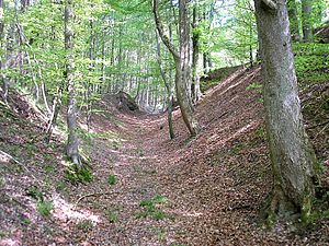
Burgstall Hattenberg - the approximately four meter high front wall of the outer bailey to the south |
||
| Creation time : | 12th Century | |
| Castle type : | Höhenburg, spur location | |
| Conservation status: | Burgstall | |
| Place: | Dinkelscherben -Ried | |
| Geographical location | 48 ° 17 '32.2 " N , 10 ° 37' 5" E | |
| Height: | 560 m above sea level NN | |
|
|
||
The Burgstall Hattenberg is located about 1300 meters south of the Dinkelscherbener district of Ried and 600 meters north of Wollmetshofen just beyond the border of the district on the connecting road between Ried and Wollmetshofen on the wooded Hartenberg in the Augsburg district in Swabia . The southern part of the high medieval castle complex was partially destroyed by a Nagelfluhbruch .
history
The castle was built in the 12th century by the Kemnat treasurers. The race was from the Swabians with the sub Bailiwick over possessions of the diocese of Augsburg in this area belehnt Service.
The Kemnater branch based on Hattenberg subsequently named itself after the fortress . In the 13th century, some namesake appear in contemporary documents .
However, the castle was devastated as early as 1297 during a feud between the lord of the castle Heinrich von Hattenberg and Bishop Wolfhard von Rohr. The Augsburg bishopric then acquired the associated rulership rights.
In 1304, the Hattenberger was appointed bailiff of Upper Swabia and town and bailiff of Augsburg . The nobleman , who was heavily indebted through his military service in the army of Albrecht I of Austria, tried to improve his economic situation through a few raids and robberies.
The citizens of Augsburg then sued the knight in 1305 together with the bishop and the cathedral chapter before King Albrecht. Shortly thereafter, the " robber baron " was deprived of the bailiwick over the episcopal property.
Around 1370 the family with Marquard von Hattenberg should have died out. The Burgstall was pledged by the bishopric in 1365.
In 1641 the cathedral chapter of Augsburg bought the rule of Hattenberg. Around 1780, the remains of the castle wall were removed for the construction of the brewery in Ustersbach . Later, the cone of the main castle was partially removed by dismantling the existing Nagelfluh stocks here.
In 1963 the castle area was topographically recorded by Otto Schneider, W. Dankerl and T. Nunner from the Augsburg Working Group for Prehistory and Early History. The site has not been significantly affected since this recording.
description
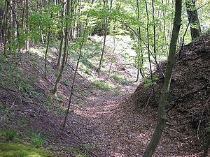
The two-part castle complex (approx. 80 × 220 meters) is about 40 meters above the valley on a ridge running from west to east. In the west of the mountain spur, a ring trench ran around the rectangular cone of the main castle (approx. 25 × 45 meters). The bottom of the trench is about ten meters below the plateau. The north and west edge dams accompany the ditch against the bailey to the east only weak Wall tracks are partially visible.
In the south, the earth cone and part of the outer bailey were largely destroyed by the Nagelfluhbruch. At the edge of the quarry , a circular pit marks the location of the former keep . On the western mountain slope, the trench was raised to form two bastion-like jutting trench heads, which were certainly secured by palisades or fences.
About 120 meters east of the main castle, the arched moat of the outer bailey seals off the castle area from the ridge of the hill. The inner wall is still around four meters high on the field side, the edge wall in front of the roughly two-meter deep ditch is largely flattened. The wall system continues on the south side as a slope protection.
The entire eastern fortification section is strongly reminiscent of early medieval fortification systems. However, the exact time can only be determined through a professional archaeological investigation.
The Bavarian State Office for Monument Preservation lists the ground monument as a medieval castle stable under monument number D 7-7729-0006.
About 400 meters southeast of the Burgstall, some funnel and material pits and burial mounds of unknown time can be seen on the southern slope of the Hartenberg . (BLfD: Monument number D 7-7729-0009).
literature
- Horst Gutmann: Burgstall Hattenberg north of Wollmetshofen . In: Hermann Endrös (Hrsg.): Guide to archaeological monuments in Swabia, Volume 1: Archaeological walks around Augsburg . Konrad Theiss Verlag, Stuttgart and Aalen 1977, ISBN 3-8062-0185-4 , pp. 64-66.
- Wilhelm Neu, Frank Otten: District of Augsburg (Bavarian art monuments XXX, short inventory). Munich 1970.
Topographical survey
- Horst Gutmann: Archaeological walks around Augsburg , p. 65.
Individual evidence
- ^ Bavarian State Office for Monument Preservation: Entry ( Memento from April 13, 2013 in the Internet Archive )
- ^ Bavarian State Office for Monument Preservation: Entry ( Memento from April 13, 2013 in the Internet Archive )


