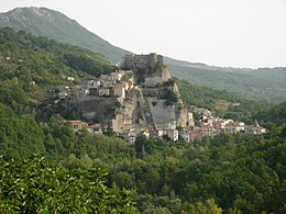
Cerro al Volturno
| Cerro al Volturno | ||
|---|---|---|

|
|
|
| Country | Italy | |
| region | Molise | |
| province | Isernia (IS) | |
| Coordinates | 41 ° 39 ' N , 14 ° 6' E | |
| height | 572 m slm | |
| surface | 23.7 km² | |
| Residents | 1,200 (Dec. 31, 2019) | |
| Population density | 51 inhabitants / km² | |
| Post Code | 86072 | |
| prefix | 0865 | |
| ISTAT number | 094014 | |
| Popular name | Cerresi | |
| Patron saint | Aemidius (January 12) | |
| Website | Cerro al Volturno | |
Cerro al Volturno is an Italian municipality ( comune ) with 1200 inhabitants (as of December 31, 2019) in the province of Isernia in Molise . The municipality is located about 12 kilometers west-northwest of Isernia . The Volturno flows along the south-eastern edge of the municipality.
traffic
The Strada Statale 158 della Valle del Volturno leads through the municipality from Alfedena to Caiazzo . From here the Strada Statale 652 di Fondo Valle Sangro branches off to Fossacesia .
Web links
Commons : Cerro al Volturno - Collection of images, videos and audio files
Individual evidence
- ↑ Statistiche demografiche ISTAT. Monthly population statistics of the Istituto Nazionale di Statistica , as of December 31 of 2019.


