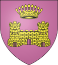
Châtillon-en-Michaille
| Châtillon-en-Michaille | ||
|---|---|---|

|
|
|
| local community | Valserhône | |
| region | Auvergne-Rhône-Alpes | |
| Department | Ain | |
| Arrondissement | Nantua | |
| Coordinates | 46 ° 9 ' N , 5 ° 48' E | |
| Post Code | 01200 | |
| Former INSEE code | 01091 | |
| Website | www.chatillonenmichaille.fr | |
Chatillon-en-Michaille is a former French community and today's commune Déléguée with 3694 inhabitants (at January 1, 2017) in the department of Ain in the region Auvergne Rhône-Alpes . It belonged to the canton of Bellegarde-sur-Valserine in the Arrondissement of Nantua and was a member of the community association Pays Bellegardien . With effect from January 1, 2019, it was merged with Bellegarde-sur-Valserine and Lancrans to form Commune nouvelle Valserhône .
geography
Châtillon-en-Michaille is located at 525 m , about five kilometers north-northwest of the town of Bellegarde-sur-Valserine (as the crow flies). The village extends in the French Jura in the valley of the Valserine , which opens here to the south to the Bellegarde basin, between the mountain ranges of Plateau de Retord in the west and Grand Crêt d'Eau in the east.
The area of the 37.63 km² former municipal area includes a section of the Upper Jura. The main settlement area is occupied by the Michaille plateau, a plateau at an average of around 550 m , which slopes slightly towards the east towards the Rhone Valley (Bellegarde basin) and the deeply cut valley of the Valserine. The eastern border forms the Valserine, the northern its right side stream Semine . Both waters flow in canyon-like valleys deepened into the area. To the west, the former municipal area extends up the Jura slope to the Plateau de Retord (an average of 1200 m ). The western boundary is formed by the Crêt de Beauregard (at 1249 m the highest point in Châtillon-en-Michaille) and the erosion valley of the Tacon (tributary of the Semine).
In addition to the actual locality, Châtillon-en-Michaille also includes various villages, hamlets and farms, including:
- Ochiaz ( 580 m ) on the Michaille plateau at the foot of the Retord
- Vouvray ( 590 m ) on the Michaille plateau at the foot of the Retord
- La Croix-Saint-Maurice ( 552 m ) on the Michaille plateau at the foot of the Retord
- Ardon ( 580 m ) above Châtillon
- Tacon ( 440 m ) in the narrow valley of the Semine
Neighboring municipalities of Châtillon-en-Michaille were
- Saint-Germain-de-Joux and Montanges in the north,
- Confort , Lancrans and Bellegarde-sur-Valserine to the east,
- Villes in the south,
- the Communes nouvelles Haut-Valromey and Le Poizat-Lalleyriat in the west, the former with the Commune déléguée Le Grand-Abergement .
history
Châtillon is first mentioned in a document in the 12th century. In today's district of Ardon, a priory was founded in the 12th century that was dependent on the Nantua monastery . Until 1973 the community was called Châtillon-de-Michaille . When the merger with the previously independent municipalities of Ochiaz and Vouvray took place at the end of 1973, the new municipality was renamed Châtillon- en- Michaille.
Attractions
The parish church of Châtillon-en-Michaille was built in the early 16th century. Various houses in traditional style from the 18th and 19th centuries have been preserved in the town center. In Gothic style forms the Church of Ochiaz was built, but rebuilt in the 17th and 19th centuries. The church of Vouvray dates from 1840, while Ardon today has a modern church.
population
| Population development | |
|---|---|
| year | Residents |
| 1962 | 1,240 |
| 1968 | 1,392 |
| 1975 | 1,765 |
| 1982 | 1.963 |
| 1990 | 2,189 |
| 1999 | 2,641 |
| 2006 | 2,948 |
| 2011 | 3.134 |
With 3,694 inhabitants (as of January 1, 2017), Châtillon-en-Michaille was one of the medium-sized communes in the Ain department. Thanks to the attractive residential area and good transport links, there has been a significant population growth since the mid-1960s. The local residents of Châtillon-en-Michaille are called Chatillonnais (es) in French .
Economy and Infrastructure
Until well into the 20th century, Châtillon-en-Michaille was a predominantly agricultural village. There are also some small and medium-sized businesses today. In the meantime the village has turned into a residential community. Many of the employed people are commuters who work in the larger towns in the area and mainly in neighboring Bellegarde-sur-Valserine.
The place is well developed in terms of traffic. It is located on the D1084 department road, which leads from Bellegarde-sur-Valserine via Nantua to Pont-d'Ain . Other regional road connections exist with Le Grand-Abergement and Seyssel (Ain) . The nearest connection to the A40 motorway , which crosses the municipality, is around five kilometers away. Châtillon-en-Michaille had a station on the railway line from Bellegarde via Nantua to Bourg-en-Bresse . The track is in December 2010 as the TGV - line skin-Bugey been reactivated (without stopping in Châtillon). The Bellegarde-Vouvray airfield is also located in the municipality.
There are two primary schools ( école élémentaire , both with pre-school classes) in Châtillon-en-Michaille .
Web links
Individual evidence
- ↑ É. Philipon: Dictionnaire Topographique du Département de l'Ain . Imprimerie Nationale, 1911, p. 104 (French, online [PDF; accessed January 4, 2014]).
- ↑ French Statistics Institute ( www.insee.fr )
- ↑ Châtillon-en-Michaille - notice communal. In: cassini.ehess.fr. Retrieved on June 3, 2015 (French, INSEE population from 1968 ).

