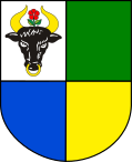
Chojnice (rural municipality)
| Gmina Chojnice | ||
|---|---|---|

|
|
|
| Basic data | ||
| State : | Poland | |
| Voivodeship : | Pomerania | |
| Powiat : | Chojnice | |
| Geographic location : | 53 ° 42 ' N , 17 ° 33' E | |
| Residents : | 39,890 (Jun. 30, 2019) |
|
| Telephone code : | (+48) 52 | |
| License plate : | GCH | |
| Economy and Transport | ||
| Next international airport : | Danzig | |
| Gmina | ||
| Gminatype: | Rural community | |
| Gmina structure: | 34 school authorities | |
| Surface: | 458.34 km² | |
| Residents: | 39,890 (Jun. 30, 2019) |
|
| Population density : | 87 inhabitants / km² | |
| Community number ( GUS ): | 2202011 | |
| administration | ||
| Wójt : | Zbigniew Tadeusz Szczepański | |
| Address: | ul. 31 Stycznia 56a 89-600 Chojnice |
|
| Website : | www.gminachojnice.com.pl | |
The Gmina wiejska Chojnice ([ xɔɪ̯ˈɲiʦɛ ]) is an independent rural municipality in Poland and is located in the powiat Chojnicki of the Pomeranian Voivodeship . The municipality has an area of 458.34 square kilometers with 18,104 inhabitants (as of 2015). The seat of the municipality and the district is located in the eponymous town of Chojnice ( German Konitz ), which is not part of the rural municipality.
geography
The rural municipality comprises the city of Chojnice to 95 percent.
The southern and southeastern municipal boundaries are at the same time the border to the Kuyavian-Pomeranian Voivodeship and the Powiat Sępoleński ( Zempelburg district ) and the Powiat Tucholski ( Tuchel district ). The western municipal boundary was the existing between 1919 and 1939 between the German Reich and Poland (“ Polish Corridor ”). In the northwest, the municipality extends into the landscape protection park Zaborskie Park Krajobrazowy with the Jezioro Charzykowskie ( Müskendorfer See ) and the National Park Park Narodowy Bory Tucholskie , while in the northeast it borders on the landscape protection park Tucholski Park Krajobrazowy .
Neighboring municipalities of Gmina Chojnice, in addition to the town of Chojnice, are the municipalities:
- Brusy ( Bruß ), Czersk ( Heiderode ) and Konarzyny ( Konarschin , 1942–1945 Kunertsfeld ) in the Powiat Chojnicki ,
- Człuchów ( Schlochau ) in the powiat Człuchowski ( Schluchow district ),
- Lipnica ( Liebnitz ) in the Powiat Bytowski ( Bütow district ),
- Kamień Krajeński ( Fireplace ) in the Powiat Sępoleński , as well as
- Kęsowo ( Klein Kensau ) and Tuchola ( Tuchel ) in the Tucholski powiat ( Tuchel district ), which - like the Sępoleński powiat - is already in the Kuyavian-Pomeranian Voivodeship .
structure
The Gmina Chojnice includes 81 localities, which are assigned to 34 districts (" Schulzenämtern ").
- Districts :
|
|
.
- Other localities :
|
|
traffic
Streets
Gmina Chojnice is crossed by two state roads (Droga krajowa) and four provincial roads (Droga wojewódzka), which is very important in terms of traffic:
- The national road 22 (former German national route 1 ) of Kostrzyn nad Odra ( Küstrin ) on the German-Polish border to Braniewo ( Braunsberg ) on the border with Russia crosses the town from the southwest to the northeast;
- The national road 25 from Bobolice ( Bublitz ) to Oleśnica ( Oels ) touches the municipality in the extreme south-west;
- The voivodship road 212 from Osowo Lęborskie meets the municipality in the west and ends in the south-west at DK 25 near Kamionka ( Steinberg );
- The provincial road 235 coming from beads ( beads ) to the north in the area of the Gmina and ends in the city Chojnice;
- The Voivodship Road 236 comes from Konarzyny ( Klein Konarczyn ) and touches the municipality near Swornegacie ( Schwornigatz ) and Drzewicz ( Drewitz ) in the far north and runs to Brusy ( Bruß );
- The provincial road 240 comes from Świecie ( Schwetz ). It meets the municipality from the east and ends in the town of Chojnice.
rails
Gmina Chojnice is also well connected to the region in terms of rail technology, with a total of five stations:
- Moszczenica ( Mosnitz ) and Krojanty ( Krojanten ) on the State Railways (PKP) line 203 Kostrzyn nad Odrą ( Küstrin ) –Tczew ( Dirschau ) , former Prussian Eastern Railway ,
- Silno ( Frankenhagen ) and Racławki ( Rakelwitz ) on the PKP line 208 ( Działdowo ( Soldau ) –Chojnice),
- Powałki ( Powalken ) on PKP line 211 ( Kościerzyna ( Berent ) –Chojnice).
The PKP line 210 from Runowo to Chojnice runs through the municipality without stopping, while the Ogorzeliny ( Görsdorf ) train station has been idle since the PKP line 281 from Oleśnica ( Oels ) to Chojnice was closed .
Web links
- Rural Municipality Website (Polish)
- ↑ a b population. Size and Structure by Territorial Division. As of June 30, 2019. Główny Urząd Statystyczny (GUS) (PDF files; 0.99 MiB), accessed December 24, 2019 .

