Demange-aux-Eaux
| Demange-aux-Eaux | ||
|---|---|---|

|
|
|
| local community | Demange-Baudignécourt | |
| region | Grand Est | |
| Department | Meuse | |
| Arrondissement | Commercy | |
| Coordinates | 48 ° 35 ' N , 5 ° 28' E | |
| Post Code | 55130 | |
| Former INSEE code | 55150 | |
| Incorporation | 1st January 2019 | |
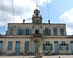
 Mairie Demange-aux-Eaux |
||
Demange-aux-Eaux is a village in the French commune of Demange-Baudignécourt and a former municipality with the last 505 inhabitants (as of January 1, 2016) in the Meuse department in the Grand Est region (until 2015 Lorraine ). The municipality belongs to the Arrondissement Commercy and the Haute Saulx et Perthois-Val d'Ornois municipal association founded in 2016 . The inhabitants are called Dominacoiriens .
The municipality of Demange-aux-Eaux merged with Baudignécourt on January 1, 2019 to form the Commune nouvelle Demange-Baudignécourt.
geography
Demange-aux-Eaux is located in the Barrois countryside on the Ornain River , about 35 kilometers southeast of Bar-le-Duc and 45 kilometers southwest of Toul . The former municipal area, which covers almost 25 square kilometers, is characterized by the approximately one kilometer wide Ornaintal and the partly wooded high plateaus rising to the left and right of the Ornain, which tower over the river valley by 100 meters . Parallel to Ornain extending Rhein-Marne-channel ( Marne-Rhine Canal ), which here apex attitude reached and in the 4880 m-long tunnel of Mauvages ( basement de Mauvages ) pivots, the connection to the Maastal manufactures. The hamlet of La Grangette, three kilometers northeast of the village of Demange-aux-Eaux, belonged to the municipality . The municipality of Demange-aux-Eaux was surrounded by the neighboring municipalities of Reffroy and Bovée-sur-Barboure in the north, Mauvages in the east, Delouze-Rosières in the southeast, Huilliécourt in the southwest, Baudignécourt in the south and Saint-Joire in the west.
Population development
| year | 1962 | 1968 | 1975 | 1982 | 1990 | 1999 | 2006 | 2016 |
| Residents | 624 | 605 | 536 | 502 | 537 | 543 | 555 | 505 |
| Sources: Cassini and INSEE | ||||||||
Attractions
- Saint-Remi church
- City hall by the architect Joseph-Théodore Oudet
- Lavoir
Economy and Infrastructure
In Demange-aux-Eaux there is a primary school, a post office and a small pleasure boat harbor. 15 farms are located in Demange-aux-Eaux (grain cultivation, horse breeding).
The western part of the former municipality belongs to the 30 square kilometer underground tunnel system of the underground laboratory operated by the French nuclear waste authority ANDRA (Agence Nationale pour la Gestion des Déchets Radioactifs) in Bure to research the local geological conditions for the construction of the Bure nuclear waste repository .
The D966 trunk road (former Route nationale 66 ) from Ligny-en-Barrois to Greux leads through Demange-aux-Eaux, which follows the Ornain . In Ligny-en-Barrois, 20 kilometers away, there is a connection to the motorway-like Route nationale 4 from Saint-Dizier to Toul . The community had a train station on the now disused railway line Nançois-Tronville-Neufchâteau on which only seasonal goods transports take place.
literature
- Le Patrimoine des Communes de la Meuse. Flohic Editions, Volume 1, Paris 1999, ISBN 2-84234-074-4 , pp. 490-491.
supporting documents
- ↑ Demange-aux-Eaux on cassini.ehess.fr (French)
- ↑ Demange-aux-Eaux on INSEE
- ↑ Farms on annuaire-mairie.fr (French)


