Barnet (Vermont)
| Barnet | ||
|---|---|---|
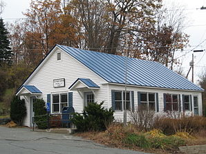
 Post Office Barnet |
||
| Location in Vermont | ||
|
|
||
| Basic data | ||
| Foundation : | December 16, 1763 | |
| State : | United States | |
| State : | Vermont | |
| County : | Caledonia County | |
| Coordinates : | 44 ° 19 ′ N , 72 ° 4 ′ W | |
| Time zone : | Eastern ( UTC − 5 / −4 ) | |
| Residents : | 1,708 (as of 2010) | |
| Population density : | 15.6 inhabitants per km 2 | |
| Area : | 112.9 km 2 (approx. 44 mi 2 ) of which 109.4 km 2 (approx. 42 mi 2 ) is land |
|
| Height : | 342 m | |
| Postal code : | 05821 | |
| Area code : | +1 802 | |
| FIPS : | 50-02875 | |
| GNIS ID : | 1462034 | |
| Website : | BarnetVT.org | |
Barnet is a town in Caledonia County of the state of Vermont in the United States with 1,708 inhabitants (according to the 2010 census).
geography
Geographical location
Barnet is on the border with the US state New Hampshire ; the main settlement of Barnet Village is located on the banks of the Connecticut River . Two other rivers cross the area and flow into the Connecticut River: the Passumpsic River and the Stevens River . They drain the local eastern foothills of Vermont's Green Mountains , which are separated from Connecticut by the rougher White Mountains of New Hampshire. The highest peaks are the Morrison Hill (429 m), Anderson Hill (375 m) and Barnet Mountain (368 m).
Neighboring communities
All distances are given as straight lines between the official coordinates of the places from the 2010 census.
- North: St. Johnsbury , 5.3 mi
- Northeast: Waterford , 9.2 mi
- East: Monroe, NH , 6 miles
- Southeast: Bath, NH , 6.1 mi
- South: Ryegate , 3.6 mi
- Southwest: Groton , 13.4 mi
- West: Peacham , 9.2 miles
- Northwest: Danville , 4.8 mi
City structure
There are several settlement areas in Barnet. These include West Barnet , East Barnet , McIndoe Falls, and Barnet Village .
climate
| Town of Barnet, Vermont | ||||||||||||||||||||||||||||||||||||||||||||||||
|---|---|---|---|---|---|---|---|---|---|---|---|---|---|---|---|---|---|---|---|---|---|---|---|---|---|---|---|---|---|---|---|---|---|---|---|---|---|---|---|---|---|---|---|---|---|---|---|---|
| Climate diagram | ||||||||||||||||||||||||||||||||||||||||||||||||
| ||||||||||||||||||||||||||||||||||||||||||||||||
|
Average monthly temperatures and rainfall for Town of Barnet, Vermont
Source:
|
|||||||||||||||||||||||||||||||||||||||||||||||||||||||||||||||||||||||||||||||||||||||||||||||||||||||||
On a long-term average, around 179 cm of snow fall per year, with peaks in February (46.5 cm) and January (43.9 cm). Only July and August are considered to be safely free of snow; in June, snowfall is recorded on one day on average every 10 years.
history
The Grant for Barnet was set by Bennet Wentworth under the New Hampshire Grants on September 15, 1763. Settlement did not begin until 1770 and the main features were completed in several phases by 1773. The Barnet area was given to 67 people; nine of them were members of the Stevens family who built a water mill. The main beneficiaries of the grant were Enos, Samuel, and Willard Stevens. Sons of Captain Phineas Stevens. The town's constituent assembly took place on March 18, 1783. The village was named after the Stevens' place of origin, Barnet in Hertfordshire, Great Britain, in 1807 when the post office opened in the main town of Stevens Village, now Barnet Village. The river on which the watermill was located became the Stevens River.
In the various localities of the area, the two parishes of the United Church of Christ are particularly worth mentioning; other communities are also present, but have only a small number of people.
Population development
| Census Results - Town of Barnet | ||||||||||
|---|---|---|---|---|---|---|---|---|---|---|
| year | 1700 | 1710 | 1720 | 1730 | 1740 | 1750 | 1760 | 1770 | 1780 | 1790 |
| Residents | 477 | |||||||||
| year | 1800 | 1810 | 1820 | 1830 | 1840 | 1850 | 1860 | 1870 | 1880 | 1890 |
| Residents | 858 | 1301 | 1488 | 1764 | 2030 | 2521 | 1994 | 1945 | 1907 | 1897 |
| year | 1900 | 1910 | 1920 | 1930 | 1940 | 1950 | 1960 | 1970 | 1980 | 1990 |
| Residents | 1763 | 1707 | 1685 | 2604 | 1596 | 1425 | 1445 | 1342 | 1338 | 1415 |
| year | 2000 | 2010 | 2020 | 2030 | 2040 | 2050 | 2060 | 2070 | 2080 | 2090 |
| Residents | 1690 | 1708 | ||||||||
Economy and Infrastructure
traffic
The Interstate 91 runs in a north-south direction by Barnet, along the Connecticut River. US Highway 5 runs parallel to the interstate in a north-south direction. They connect Barnet to the Canadian border in the north and New York City in the south.
Public facilities
There is no hospital in Barnet. The closest is Northeastern Vermont Regional Hospital in St. Johnsbury.
education
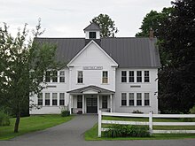
Barnet, along with Danville, Peacham, Walden and Waterford, is part of the Caledonia Central Supervisory Union . The Barnet School is located in Barnet . It offers classes from pre-kindergarten to eighth grade for 215 school children.
The Barnet Public Library is located on Church Street in Barnet.
Personalities
sons and daughters of the town
- Horace Fairbanks (1820–1888), politician and governor of Vermont
- John Gilfillan (1835–1924), politician and MP in the House of Representatives
- Henry Clay Ide (1844–1921), politician and governor of the Philippines
- Franklin D. Hale (1854–1940) American politician who was Vermont State Auditor
- David J. Foster (1857–1912), politician and member of the House of Representatives
- Ralph Flanders (1880–1970), entrepreneur and US Senator; Joseph McCarthy's critic
literature
- Zadock Thompson: History of Vermont, natural, civil and statistical, in three parts . tape III . Chauncey Goodrich, Burlington 1842, p. 8th f . ( limited preview in Google Book search).
- Abby Maria Hemenway: The Vermont historical Gazetteer, Volume 1 . Burlington 1867, p. 854 ff .
Web links
- Community website
- Profile of the community on the official portal www.Vermont.gov (English)
- Entry to VirtualVermont (English) ( Memento of 4 June 2016 Internet Archive )
Individual evidence
- ^ Barnet in the United States Geological Survey's Geographic Names Information System , accessed October 1, 2014
- ↑ Population data from the 2010 US Census in the American Factfinder
- ↑ Index of / geo. In: census.gov. Retrieved May 18, 2019 .
- ↑ http://www.weatherbase.com/weather/weather.php3?s=440534&cityname=Barnet-Vermont-United-States-of-America
- ↑ Population 1790–2010 according to the census results
- ↑ Caledonia Central Supervisory Union , accessed June 10, 2017
- ^ Barnet School , accessed June 10, 2017
- ^ Barnet Pubic Library , accessed June 10, 2017


