Erschwil
| Erschwil | |
|---|---|
| State : |
|
| Canton : |
|
| District : | Thierstein |
| BFS no. : | 2615 |
| Postal code : | 4228 |
| Coordinates : | 607888 / 246980 |
| Height : | 447 m above sea level M. |
| Height range : | 435–910 m above sea level M. |
| Area : | 7.43 km² |
| Residents: | 924 (December 31, 2018) |
| Population density : | 124 inhabitants per km² |
| Website: | www.erschwil.ch |
|
Erschwil, from the Neu-Thierstein Castle seen from |
|
| Location of the municipality | |
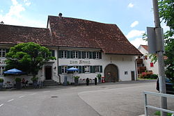
Erschwil is a municipality in the Thierstein district in the canton of Solothurn in Switzerland . The former French name of the municipality is Erginvelier . In the local dialect the community is called "erschbl ".
geography
Erschwil lies at 447 m above sea level. M. , 6.5 km south-southeast of the city of Laufen (linear distance). The former street and stream line village extends in a valley widening of the Lüssel , in the Jura south of the Laufen basin in the Schwarzbubenland .
The area of the 7.5 km² large municipal area includes a section of the folded Jura . The central part of the community is occupied by the Erschwil basin, through which the Lüssel flows from south to north and has a flat valley floor 200 to 500 m wide. In the north, the narrow point at the Sagi between Mülihabenfels and Chapf forms the natural demarcation. To the west, the widening of the valley is bounded by the partly rocky ridges of Moretchopf ( 862 m above sea level ) and Hoggen ( 875 m above sea level ) as well as the Welschgätterli , an 810 m high pass path from Erschwil into the Delsberg basin . The southern border runs over the summits of Schemel ( 906 m above sea level ) and Hörnli ( 816 m above sea level ). To the east, the municipality extends over the Riedberg to the Hochstelleli , on which at 907 m above sea level. M. the highest elevation of Erschwil is reached. The southern flank of the Chesselgraben , a right side valley of the Lüssel with the Ried and Hinterbüel farms, also belongs to Erschwil. In 2014, 8% of the municipal area was in settlements, 57% in forests and woodlands, 34% in agriculture and a little less than 1% in unproductive land.
Various individual farms belong to Erschwil. The neighboring communities of Erschwil are Grindel , Büsserach , Meltingen and Beinwil (SO) in the canton of Solothurn and Montsevelier in the canton of Jura .
population
With 924 inhabitants (as of December 31, 2018) Erschwil is one of the smaller communities in the canton of Solothurn. 96.0% of the residents are German-speaking, 1.3% French-speaking, and 0.8% speak Serbo-Croatian (as of 2000). The population of Erschwil was 594 in 1850 and 465 in 1900. In the course of the 20th century, the population rose continuously to 804 people by 1960. After a temporary phase of stagnation, the population has increased again since 1990 (820 inhabitants).
economy
Erschwil was a predominantly agricultural village until the second half of the 20th century . In the 18th and 19th centuries, embroidery and silk weaving were widespread, mostly done at home. Even today arable farming , fruit growing (especially cherry trees) as well as dairy farming and cattle breeding have an important place in the income structure of the population. Further jobs are available in local small businesses and in the service sector, including in companies in the construction industry and wood processing. In the last few decades the village has also developed into a residential community. Many employees are therefore commuters who work mainly in Laufen and the Basel agglomeration .
traffic
The community is very well developed in terms of transport. It is located on the main road from Zwingen over the Passwang to Balsthal . Erschwil is connected to the public transport network through a post bus course , which covers the route from Zwingen to Beinwil .
history
On the basis of various finds in the Chesselgraben it was possible to prove that the municipality of Erschwil was already inhabited during the Paleolithic and the Mesolithic . The first written mention of the place took place in 1147 under the name Hergiswilre . Later the names Helgiswilre (1194), Ergswile (1295), Verschweiler (1307) and Erschwilre (1364) appeared; the spelling Erswil was also used on various occasions afterwards . The place name goes back to the Old High German personal name Arginus and thus means court settlement of Arginus .
Since the Middle Ages , Erschwil was in the sphere of influence of the Beinwil monastery , which had the church set and rich land in the village. Secular rule was exercised by the Counts of Thierstein. After the Thierstein family had died out, Erschwil came to Solothurn in 1522 and was assigned to the Thierstein bailiwick. During the Reformation , the population of Erschwil converted to the new faith; however, since 1622 the Catholic mass has been held again.
Bohner ore has been mined in the area around Erschwil since the 15th century and processed in a blast furnace that has existed since 1512. The iron smelter ceased operations at the beginning of the 18th century. After the collapse of the Ancien Régime (1798), Erschwil belonged to the Dornach district during the Helvetic Republic and to the Thierstein district from 1803.
Attractions
- In the gorge of the Lüssel above Erschwil is the St. Josef chapel (from the 17th century) on the old Passwangstrasse.
- Some characteristic farmhouses from the 18th and 19th centuries have been preserved in the town center.
Catholic Church
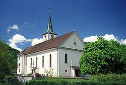
The Church of St. Peter and Paul, which originally dates back to the early 13th century, was rebuilt in 1847 in the classicism style.
organ
In 1834 the Brosy organ in Mulhouse was replaced by a new organ by Joseph Callinet (1795–1857). The Brosy organ was sold to Dornach near Mulhouse and installed in the Catholic Church of St. Bartholomew. She did not stay there for long, however; it was already offered for sale at the end of 1860. In December 1860, Michael Borer, the Ammann of the Erschwil community, asked the Higher Customs Directorate in Bern for a permit to import the organ from Alsace. The approval was granted on December 3, 1860. Nikolaus Verschneider dismantled the organ in Dornach and installed it in the church in Erschwil in 1861.
In 1954 the Erschwil Church was renovated. It was planned to remove the organ and to put it back in after the interior renovation of the church. But because the instrument was very damaged, it was decided in 1964 to build a completely new organ. The prospectus of the Brosy organ with the 47 prospectus pipes was purchased by the canton of Solothurn in 1966 at the request of the cantonal monument preservation authorities. On January 4, 1967, the old organ front was removed and brought to Solothurn, where it was stored for a long time in the orangery of Waldegg Castle near Feldbrunnen.
Old organ parts have come to light in the attic of the church in Erschwil, including original interior pipes from Brosy: wooden pipes made of oak from the Bourdon and flute registers and pewter pipes, probably from the doublette register. These pipes are dusty and partly damaged, but can be restored. In addition, one of the two original pipe sticks in the Cornet register was found, which provides a further clue for the internal arrangement of the instrument. The remaining parts of the Brosy organ from 1788 are of great historical and technical importance. It is the only authentic Brosy case that has survived. Apart from that, only the case of the former Basel cathedral organ, which Brosy built in 1787, has survived as an imitation of the previous case in Basel's Martinskirche. The organ was consecrated on May 15, 2011.
coat of arms
- Black, oblique blacksmith's hammer crossed in yellow over a black, oblique left (upward) pimple
The coat of arms alludes to the former ore mining in the municipality.
literature
- Gottlieb Loertscher: The art monuments of the canton of Solothurn, Volume III: The districts of Thal, Thierstein, Dorneck. (= Art Monuments of Switzerland. Volume 38). Edited by the Society for Swiss Art History GSK. Bern 1957, DNB 750089342 .
- Simon Lutz: Erschwil - Life on the Lüssel . Volume I and Volume II, 2012, p. 768 .
- Simon Lutz: Erschwil - Life on the Lüssel. Volume III, 2013, pages 120.
Web links
- Website of the municipality of Erschwil
- Lukas Schenker: Erschwil. In: Historical Lexicon of Switzerland .
Individual evidence
- ↑ Permanent and non-permanent resident population by year, canton, district, municipality, population type and gender (permanent resident population). In: bfs. admin.ch . Federal Statistical Office (FSO), August 31, 2019, accessed on December 22, 2019 .
- ↑ 000001992531_2012_1119.pdf (application / pdf Object). (PDF; 99 kB) (No longer available online.) In: rrb.so.ch. Archived from the original on April 2, 2015 ; Retrieved November 21, 2012 . Info: The archive link was inserted automatically and has not yet been checked. Please check the original and archive link according to the instructions and then remove this notice.


