
Nunningen
| Nunningen | |
|---|---|
 |
|
| State : |
|
| Canton : |
|
| District : | Thierstein |
| BFS no. : | 2621 |
| Postal code : | 4208 |
| Coordinates : | 613 652 / 249307 |
| Height : | 621 m above sea level M. |
| Height range : | 486-1021 m above sea level M. |
| Area : | 10.31 km² |
| Residents: | 1880 (December 31, 2018) |
| Population density : | 182 inhabitants per km² |
| Website: | www.nunningen.ch |
 Schwarzbubenbrunnen |
|
| Location of the municipality | |
  |
|
Nunningen is a municipality in the Thierstein district in the canton of Solothurn in northwestern Switzerland .
geography
Nunningen is 621 m above sea level. M. , 10 km east-southeast of the city of Laufen (linear distance). The village extends in a longitudinal hollow of the northern Solothurn Folded Jura , in the headwaters of the Chastelbach , which flows into the Birs , in the Schwarzbubenland . It forms the center of the Gilgenbergerland .
The area of the 10.3 km² municipal area comprises a strongly reliefed section of the northern Jura with a great variety of landscapes. The central part of the community is formed by the longitudinal hollow of Nunningen, which expands in a west-east direction and is approximately one kilometer wide in the area of the village. In the south, this hollow is flanked by the ridge of the Riedberg ( 935 m above sea level ) and the rugged Portiflue ( 876 m above sea level ). Also a small area around the Nunningenberg , the Hirnichopf and the Ämmenegg , already in the catchment area of the Lüssel , on which at 1020 m above sea level. M. the highest point of Nunningen is reached, still belongs to the community.
On its northern side, the longitudinal hollow is formed by the forest heights of Chilchberg ( 761 m above sea level ), Mühleberg ( 774 m above sea level ), Buechenberg ( 838 m above sea level ) and Brand (up to 899 m above sea level ). limited. The Chastelbach , which rises on the slopes around Nunningen, flows through a narrow point between Chilchberg and Mühleberg to the northwest and drains the main part of the municipal ban. North of this narrow point is the Engi valley basin , which in turn is bordered on its north side by Eichlenberg ( 736 m above sea level ), Balmchopf ( 791 m above sea level ) and Homberg (up to 880 m above sea level ). In the far north-west, the municipality extends to the Ibach , which flows through the Kaltbrunnen valley to the Birs. In 2014, 9% of the municipal area was settled, 50% forest and woodland, 40% agriculture and a little less than 1% unproductive land.
Nunningen includes the hamlets of Engi ( 603 m above sea level ) in a basin of the Chastelbach northwest of the village, Roderis ( 575 m above sea level ) on a saddle between the valleys of Ibach and Chastelbach and various individual farms. Neighboring communities of Nunningen are Beinwil (SO) , Meltingen , Zullwil , Breitenbach , Himmelried and Seewen in the canton of Solothurn and Bretzwil and Lauwil in the canton of Basel-Landschaft .
population
With 1,880 inhabitants (as of December 31, 2018), Nunningen is one of the medium-sized communities in the canton of Solothurn. 95.0% of the residents speak German, 1.6% speak Albanian and 0.5% speak Serbo-Croatian (as of 2000). The population of Nunningen was 1175 in 1850 and 1046 in 1900. During the 20th century the population increased continuously. Particularly since 1980 (1472 inhabitants) there has been an increased population growth.
economy
Until well into the 20th century, Nunningen was a predominantly agricultural village. Even today, dairy farming and animal husbandry as well as fruit growing (mainly cherry trees) and arable farming have a certain role in the income structure of the population. Numerous other jobs are available in local small businesses and in the service sector.

Nunningen is a rural community with various commercial and industrial companies. Commercial and industrial zones developed on the eastern edge of the old village center and in front of the narrow valley against Engi. Today in Nunningen there are companies in the building trade, the metal industry, plastics and wood processing, the electrical industry and mechanical workshops. Nunningen has always been the most important place in Gilgenbergerland and performs its central function for the surrounding area. Nunningen is also home to the Stäglen retirement and nursing home of the municipalities of Zullwil and Nunningen. The village museum has been located in the same building for several years.
On the sunny southern slope of the Buechenberg and on the western edge of the village, extensive residential areas have emerged in recent decades. Many workers are commuters who work mainly in the Laufen-Breitenbach region and in the Basel agglomeration .
traffic

The community is located on a connecting road from Laufen to Reigoldswil or via the Oristal to Liestal . The direct road to Grellingen and on to Basel leads through the valley of the Chastelbach . Nunningen is connected to the public transport network by three post bus lines. They operate on the routes from Nunningen to Laufen , via Himmelried to Grellingen and via Seewen to Grellingen, via Seewen to Liestal.
history
The place was first mentioned in a document in 1152 under its current name; from 1194 the name Nunnengen has been handed down. The place name goes back to the Old High German personal name Nunno and therefore means for the people of Nunno .

Since the Middle Ages , Nunningen was part of the Gilgenberg rule under the Barons of Ramstein. This lordship was sold in 1527 by the lord of the castle, Hans Imer, for 5900 guilders to the city of Solothurn , which converted the area into a bailiwick. After that, Solothurnian bailiffs ruled Gilgenberg Castle until the French Revolution . However, the high level of jurisdiction only came to Solothurn in 1685. After the collapse of the Ancien Régime (1798), Nunningen belonged to the Dornach district during the Helvetic Republic and to the Thierstein district from 1803.

Attractions
The parish church of the region is located in the hamlet of Oberkirch on the saddle between Nunningen and Zullwil and is on Zullwiler soil. The Sankt Wendelin chapel, which was built in the 17th century, is located on the Nunningerberg.

View of the village

Parish hall, former tithe barn

Main road

Local government

Village schoolhouse

Newer school house
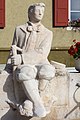
Schwarzbube (fountain)

Church and rectory in Oberkirch


Personalities
- Anton Hänggi (1917–1994), Roman Catholic bishop in the diocese of Basel , born in Nunningen
- Peter Hänggi (* 1942), Solothurn National and Government Councilor ( CVP ), born and living in Nunningen for his entire life
- Albin Fringeli (1899–1993), poet and author, honorary citizen of Nunningen

coat of arms
Split by black and white with two crossed lily sticks in alternating colors. The coat of arms is based on the coat of arms of the Vogtei Gilgenberg (Lilienberg), which goes back to the builders of the castle, the barons of Ramstein (cf. also with the coats of arms of Bretzwil , Brislach , Zullwil and Zwingen ).
literature
- Gottlieb Loertscher: The art monuments of the canton of Solothurn, Volume III: The districts of Thal, Thierstein, Dorneck. (= Art Monuments of Switzerland. Volume 38). Edited by the Society for Swiss Art History GSK. Bern 1957, DNB 750089342 .
Web links
- Official website of the municipality of Nunningen
- Lukas Schenker: Nunningen. In: Historical Lexicon of Switzerland .
Individual evidence
- ↑ Permanent and non-permanent resident population by year, canton, district, municipality, population type and gender (permanent resident population). In: bfs. admin.ch . Federal Statistical Office (FSO), August 31, 2019, accessed on December 22, 2019 .