Gmina Koluszki
| Gmina Koluszki | ||
|---|---|---|

|
|
|
| Basic data | ||
| State : | Poland | |
| Voivodeship : | Łódź | |
| Powiat : | Łódź East | |
| Geographic location : | 51 ° 45 ′ N , 19 ° 49 ′ E | |
| Residents : | s. Gmina | |
| Postal code : | 95-040 | |
| Telephone code : | (+48) 44 | |
| License plate : | ELW | |
| Economy and Transport | ||
| Street : | ( DK72 ) Rawa Mazowiecka - Łódź | |
| DW715 Brzeziny - Ujazd | ||
| DW716 Koluszki– Piotrków | ||
| Rail route : |
Warszawa – Piotrków (Warszawa – Łódź) |
|
| Łódź – Dębica | ||
| Next international airport : | Łódź | |
| Gmina | ||
| Gminatype: | Urban-and-rural parish | |
| Gmina structure: | 24 school offices | |
| Surface: | 157.2 km² | |
| Residents: | 23,367 (Jun. 30, 2019) |
|
| Population density : | 149 inhabitants / km² | |
| Community number ( GUS ): | 1006073 | |
| administration | ||
| Mayor : | Waldemar Chałat | |
| Address: | ul.Brzezińska 32 95-040 Koluszki |
|
| Website : | koluszki.pl | |
The Gmina Koluszki [ kɔˈluʃci ] is a town-and-country municipality in the powiat Łódzki wschodni (Łódź East) of the Łódź Voivodeship in Poland . Its seat is the city of the same name with about 13,000 inhabitants.
geography
The municipality is located in the eastern part of the voivodeship. The city boundary to the district and voivodeship capital Łódź is three kilometers to the west. Neighboring communities are Brzeziny , Rogów and Jeżów in the north, Żelechlinek in the east, Budziszewice and Ujazd in the southeast, Rokiciny in the south, Brójce in the southwest and Andrespol in the west.
The 97 km long Rawka rises east of the main town. Smaller rivers are Koluszkowianka, Mroga and Piasecznica. There are several smaller lakes and swamps in the municipality . The southern part of the municipality is very wooded, including the Gałków nature reserve in the southwest, with an area of 58 hectares . It was expelled in 1958 and, among other things, protects several dozen beech trees between 160 and 200 years old. The dendrological forest park between Kaletnik and Będzelin, on the other hand, is used for recreation and educational purposes. An area of 0.5 hectares shows different types of trees and shrubs.
The community has an area of 157.2 km², 51 percent of which is used for agriculture and 40 percent for forestry.
history
Interrupted by the German occupation in the Second World War from 1919 to 1975, today's municipal area belonged to the Powiat Brzeziński and to the Łódź Voivodeship with different layouts. Koluszki received city rights on April 1, 1949 by order of the Minister of Public Administration .
The rural community Koluszki was created on January 1, 1973 from different gromadas . From 1975 to 1998 the municipality was part of the Piotrków Voivodeship . The powiat was dissolved during this time. The urban and rural parish of Koluszki were merged into the urban and rural parish in 1990/1991. This came in 1999 to the Łódź Voivodeship and the newly formed Powiat Łódź East. The development of the city and the community has accelerated considerably in recent years, also through an economic zone.
structure
The city-and-rural municipality (gmina miejsko-wiejska) Koluszki with 23,367 inhabitants (as of June 30, 2019) includes the city itself and a number of villages with 24 school boards (sołectwa). The city is divided into nine settlements (Osiedla). The villages of Borowa and Gałków Mały each have two offices, other villages share one office. The school authorities are:
- Będzelin
- Borowa I
- Borowa II
- Długie – Turobowice
- Felicjanów
- Gałków Duży
- Gałków Mały Wschód
- Gałków Mały Zachód
- Gałkówek Parcela
- Jeziorko
- Katarzynów – Zygmuntów
- Kaletnik
- Kazimierzów
- Lisowice – Erazmów
- Nowy Redzeń
- Przanowice
- Regny
- Różyca – Żakowice
- Stamirowice – Leosin
- Stary Redzeń
- Stefanów
- Słotwiny
- Świny
- Wierzchy
Then there are the hamlets of Regny and Stare Chrusty.
traffic
The DW715 voivodeship road leads from Brzeziny to Ujazd . In Brzeziny, nine kilometers away, there is a connection to the national road DK72 from Rawa Mazowiecka to Łódź, Turek and Konin . The branching DW716 leads from Koluszki via Rokiciny to Piotrków Trybunalski (Petrikau) .
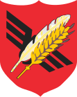
The place Koluszki is an important railway junction, the impeller is also part of the coat of arms of the city and municipality. The Koluszki long-distance train station is located on the Warsaw – Katowice railway (route number 1 of the PKP ) and on the Warsaw – Łódź connection (the end of the Łódź – Koluszki railway ). In the south of the municipality, the Łódź – Dębica railway crosses with another train station in Słotwiny. One stop was in Żakowice. There are also sidings for industry and the military.
The nearest international airport is Łódź .
Web links
- City and municipality website (Polish)
Individual evidence
- ↑ population. Size and Structure by Territorial Division. As of June 30, 2019. Główny Urząd Statystyczny (GUS) (PDF files; 0.99 MiB), accessed December 24, 2019 .
- ↑ koluszki.pl: Rezerwat leśny Gałków. (Polish, accessed May 30, 2020)
- ↑ koluszki.pl: Leśny Park Dendrologiczny. (Polish, accessed May 30, 2020)
- ↑ a b c d regioset.pl: data on the municipality (Polish, accessed May 30, 2020)
- ↑ a b koluszki.pl: Historia. (Polish, accessed May 30, 2020)
- ↑ koluszki.pl: Osiedla. (Polish, accessed May 30, 2020)
- ↑ koluszki.pl: Sołectwa. (Polish, accessed May 30, 2020)


