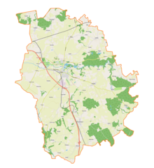
Gmina Pasłęk
| Gmina Pasłęk | ||
|---|---|---|

|
|
|
| Basic data | ||
| State : | Poland | |
| Voivodeship : | Warmia-Masuria | |
| Powiat : | Elbląski | |
| Geographic location : | 54 ° 4 ' N , 19 ° 39' E | |
| Residents : | s. Gmina | |
| Postal code : | 14-400 | |
| Telephone code : | (+48) 55 | |
| License plate : | NEB | |
| Economy and Transport | ||
| Street : | S7 Gdansk - Warsaw | |
| DW505 Frombork - Młynary –Pasłęk | ||
| DW513 Pasłęk– Orneta - Lidzbark Warmiński | ||
| Rail route : | Olsztyn - Elbląg | |
| Next international airport : | Danzig | |
| Gmina | ||
| Gminatype: | Urban-and-rural parish | |
| Gmina structure: | 39 school authorities | |
| Surface: | 264.39 km² | |
| Residents: | 19,337 (Jun. 30, 2019) |
|
| Population density : | 73 inhabitants / km² | |
| Community number ( GUS ): | 2804073 | |
| Administration (as of 2006) | ||
| Mayor : | Wiesław Śniecikowski | |
| Address: | pl. św. Wojciecha 5 14-400 Pasłęk |
|
| Website : | www.paslek.pl | |
The Gmina Pasłęk [ ˈpaswɛŋk ] is an urban-and-rural municipality in the powiat Elbląski of the Warmian-Masurian Voivodeship in Poland . Its seat is the city of the same name ( German Prussian Holland ) with about 12,150 inhabitants.
geography
The municipality is located in the northwest of the voivodeship. The seat of the Powiat, the independent city of Elbląg (Elbing) is ten kilometers to the northwest. Drulity (Draulitten) in the south of the municipality is only two kilometers from the Pomeranian Voivodeship . Neighboring communities are Elbląg in the northwest, Milejewo and Młynary in the north, Wilczęta in the northeast, Godkowo in the east, Morąg in the southeast, Małdyty in the south and Rychliki in the west.
The community has an area of 264.4 km², 74 percent of which is used for agriculture and 14 percent for forestry. The river Wąska (Weeske) runs through the municipality and its main town from east to west. The Oberland Canal ( Kanał Elbląski in Polish ) touches the southwest of the municipality.
history
The rural community was newly formed in 1973 from various gromadas . Urban and rural communities were merged to form urban and rural communities in 1990/1991. Your area belonged to the Olsztyn Voivodeship from 1946 to 1975 and then to the Elbląg Voivodeship until 1998 , the powiat was dissolved during this time. On January 1, 1999, the community came to the Warmian-Masurian Voivodeship and again to the Powiat Elbląski.
structure
The town and 39 villages (official German names until 1945) with school offices (sołectwa) belong to the town-and-country community (gmina miejsko-wiejska) Pasłęk :
- Anglity (Angnitten)
- Aniołowo (rapeseed village)
- Awajki (awakening)
- Bądy (Bunds)
- Borzynowo (Briensdorf)
- Brzeziny (Emilienhorst)
- Dargowo (Dargau)
- Drulity (Draulitten)
- Gołąbki (Spittels)
- Gulbity (Golbitten)
- Kopin (coupling)
- Krasin (Schönfeld)
- Kronin (Alt Krönau)
- Krosno (Krossen)
- Kupin (copy)
- Kwitajny (Quittainen)
- Leszczyna (Hasselbusch)
- Leżnice (Lägs)
- Łukszty (Luxethen)
- Majki (Mäken)
- Marianka (Marienfelde)
- Marzewo (Mahrau)
- Nowa Wieś (Neuendorf)
- Nowe Kusy (New Kussfeld)
- Nowy Cieszyn (New Teschen)
- Piniewo (Pinnau)
- Robity (Robitten)
- Robity Wieś
- Rogajny (Rogehnen)
- Rogowo (Rogau)
- Rydzówka (Kalthof)
- Rzeczna (Weeskenhof)
- Rzędy (border courtyards)
- Sakówko (Charlottenhof)
- Sałkowice (Zallenfelde)
- Stegny (Steegen)
- Surowe (Schönau)
- Zielonka Pasłęcka (Grünhagen)
- Zielony Grąd (Schönwiese)
Smaller villages, towns and hamlets are:
- Cierpkie (Friedheim)
- Dawidy (Davids)
- Gibity (Giebitten)
- Gryżyna (Greißings)
- Kajmy (Kaymen)
- Kalinowo
- Kalsk (Weeskenhof)
- Kawki (Koken)
- Kielminek (Koellming)
- Krosienko (Krossenfeld)
- Krosno-Młyn (Krossen Mill)
- Kudyny (Komthurhof)
- Kudyński Bór (Komthur Forest)
- Łączna (Wiesenhof)
- Malinowo (Amalienhof)
- Nowiny (Neufelde)
- Owczarnia (Freifelde)
- Pochylnia Kąty (Kanthen)
- Pochylnia Nowy Całun (Rodland)
- Pochylnia Oleśnica (Kodder shrub)
- Pólko (open field)
- Siódmak (Seven Hooves )
- Skolimowo (Skollmen)
- Sokółka (Sangershausen)
- Stare Kusy (Alt Kussfeld)
- Talpity (Talpitten)
- Tulno (Taulen)
- Wakarowo (Wackelsdorf)
- Wikrowo (Wickerau)
- Wójtowizna (Vogtshof)
- Zielno (Solainen)
traffic
The main road is the S7 expressway ( European route 77 ) from Gdansk to Warsaw . In addition, the voivodeship roads DW505 , DW513 , DW526 and DW527 meet in Pasłęk .
Long-distance trains on the Olsztyn – Bogaczewo – Elbląg line stop at Pasłęk station . - Passenger traffic on the Malbork – Braniewo railway with the Stegny stop was discontinued in 2004.
The nearest international airport is Gdansk .
Personalities
- Theodor Eggert (1864–1941), administrative lawyer and ministerial official; born in Weeskenhof
- Carl Rehs (1867–1945), author and beekeeper; born in Lägs
- Erich Kühn (1878–1938), writer, publicist and editor; born in Rogehnen.
- Gertrud Lerbs-Bernecker (1902–1968), graphic artist; born in Rogehnen.
Web links
- Official website of the city and municipality (Polish)
- territorial.de: City of Prussian Holland. (Rolf Jehke, 2005)
Footnotes
- ↑ population. Size and Structure by Territorial Division. As of June 30, 2019. Główny Urząd Statystyczny (GUS) (PDF files; 0.99 MiB), accessed December 24, 2019 .
- ↑ paslek.pl: Sołectwa na terenie Gminy Pasłęk. (Polish, accessed August 6, 2020)


