Persian Gulf
| Persian Gulf | ||
|---|---|---|
|
Satellite image of the Persian Gulf |
||
| Waters | Indian Ocean | |
| Land mass | Middle East | |
| Geographical location | 27 ° N , 52 ° E | |
|
|
||
| width | 200 to 300 km | |
| depth | approx. 1 000 km | |
| surface | 235,000 km² | |
| Greatest water depth | 110 m | |
| Medium water depth | 26 m | |
| Islands | Bubiyan , Failaka , al-Warba , Qeschm , Kish , Charg , Bahrain , al-Muharraq , Sitra , Umm Nasan , Hawar Islands , Das , Yas , Zirku , Halul | |
| Tributaries | Shatt al-Arab , Mand | |
|
The Persian Gulf |
||
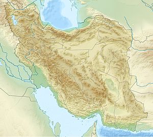
The Persian Gulf , in German only rarely called the Arabian Gulf , is an inland sea between the Iranian plateau and the Arabian Peninsula .
The Persian Gulf is about 1000 km long and 200 to 300 km wide, the area is about 235,000 km².
Geography and topography
The Persian Gulf is a relatively shallow body of water with a maximum depth of 110 m. Its volume is about 6000 km³, with an average depth of less than 26 meters. It is connected to the Gulf of Oman and the Arabian Sea and the Indian Ocean via the Strait of Hormuz . The confluence of the Tigris and Euphrates , the Shatt al-Arab, flows into the Persian Gulf . Due to the low inflow of fresh water and the high rate of evaporation, the salt content is above average at around 4%.
During the last glacial maximum , when the sea level was around 120 m lower worldwide , the bottom of the Persian Gulf was a flat valley through which the rivers Euphrates, Tigris and Karun found a common drain to the Strait of Hormuz. With the onset of the Flanders Transgression around 11,000 years ago, the level rose to around today's conditions.
politic and economy
Riparian states
The countries bordering the Persian Gulf are (from north to south along the coast):
-
 Iran
Iran
-
 Iraq
Iraq
-
 Kuwait
-
 Saudi Arabia
-
 Bahrain
-
 Qatar
Qatar
-
 United Arab Emirates (UAE)
 -
 Oman ( Musandam Governorate )
Of the eight countries bordering this body of water, seven are members of the Arab League , the eighth - and the one with the longest coastline - is Iran. With the exception of Iran and Iraq, the other six states form the Gulf Cooperation Council . Iran, Iraq, Kuwait and Saudi Arabia have been founding members of the Organization of Petroleum Exporting Countries (OPEC) since 1960 , while Qatar (1961) and the UAE (1967) also joined the organization a little later.
mineral oil and natural gas
The region around the Persian Gulf is of great geopolitical importance because of the wealth of oil and natural gas . According to the Federal Institute for Geosciences and Natural Resources (BGR), in 2007 Saudi Arabia (35.9 billion tons), Iran (18.8 billion tons), Iraq (15.6 billion tons), Kuwait (13.8 billion tons) and the UAE (13.3 billion tons) the five countries with the world's largest oil reserves . The recoverable reserves were estimated at 163.5 billion tons worldwide. Of this, 22.0% came from Saudi Arabia, 11.5% from Iran and 9.6% from Iraq. Iran (15.2 percent) and Qatar (14.0 percent) also have the largest global reserves of natural gas after Russia (26.1 percent) .
Due to its economic and geopolitical importance, the Persian Gulf was the scene of the three so-called Gulf Wars . In addition, border disputes between the neighboring countries have occurred and continue to occur .
Ship and freight transport

Freight traffic
According to information from the United States Energy Information Administration (EIA) , an average of 14 tankers with a total cargo of around 17 million barrels of crude oil pass the Strait of Hormuz every day . That is the equivalent of around 35% of the world's oil transported by sea and around 20% of the world's oil trade.
A special feature is the navigation around the Iranian Tunb Islands and through the Strait of Hormuz. There, ships are divided into incoming and outgoing traffic separation areas in order to reduce the risk of collisions along the Strait of Hormuz. The affected line is approx. 10 km wide and consists of two 3 km wide lanes, one inward and the other outward. The two tracks are separated from each other by a third, also approx. 3 km wide median track.
Accidents
One of the worst shipping accidents to date in the Persian Gulf occurred on April 8, 1961, when the British combination ship Dara went up in flames, burned out and sank off Dubai after an explosion on board. 238 passengers and crew members died.
Ports
see list of seaports (not complete)
Iranian seaports: Abadan , Bandar Abbas , Bushehr , Khorramshahr
History and culture
The coastal region of the Persian Gulf is considered a cradle of civilization. The great civilizations of Sumer , Elam , Akkad and Babylon , as well as the empires of the Persians, emerged here .
designation

Various names are used internationally for the Persian Gulf, the term "Persian Gulf" ( Persian خليج فارس Khalidsch-e fārs ) is mainly used. This has been in various Persian and Greek sources since pre-Christian times, and since the Islamic era also in Arabic ( Arabic الخليج الفارسي al-khalīdsch al-fārisī ) and European sources.
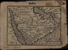
In the Arab (neighboring) states, however, the neologism “Arabian Gulf” ( Arabic الخليج العربي al-khalīdsch al-ʿarabī ) enforced; Since then, the term has appeared sporadically in Western media, as an alternative designation by the National Geographic Society and in printed works. Colloquially and also in the media, only the term “The Golf” is often used. In Germany, the term “Persian Gulf” was in use until the beginning of the 20th century. Before that, the name "Gulf of Bassora" ( Gulf of Basra ) was common, which is still in use today in Turkey ( Turkish Basra Körfezi ). On old German maps, the golf is sometimes called the “Green Sea”. In Persian, the term "Gulf of Jam" (named after Jamschid from Iranian mythology )was also used in the past. The former Akkadian name of the Persian Gulf was nar Marratû ("bitter stream"). The International Hydrographic Organization (IHO) has officially used the term "Gulf of Iran" since 1953.
The question of naming is a political issue in some countries and has repeatedly caused diplomatic disputes, especially between Iran and the Arab states. The United Nations also had to deal with this question several times. In 2006, one of its expert groups stated in this context that the United Nations internally adhered to the term “Persian Gulf”, but that “states cannot be forbidden to “ create and use ” exonyms ” for geographical names.
Individual evidence
- ↑ z. B. in Knaur's World Atlas 1988, map no.23
- ↑ a b History of the Persian Gulf in the Encyclopedia Iranica , March 23, 2005 (English).
- ↑ Robert Dinwiddie: Ocean: The World's Last Wilderness Revealed. Dorling Kindersley, London 2008, p. 452.
- ↑ Federal Institute for Geosciences and Raw Materials (Ed.): Reserves, Resources and Availability of Energy Raw Materials 2007 . Short study. 2008 ( online ( memento of March 6, 2009 in the Internet Archive ) [PDF; accessed on May 13, 2009]). Reserves, resources and availability of energy resources 2007 ( Memento from March 6, 2009 in the Internet Archive )
- ^ The Strait of Hormuz is the world's most important oil transit chokepoint , US Energy Information Administration.
- ↑ Handbook for Export and Shipping: Compact country and customs information .
- ↑ Touraj Daryaee, The Persian Gulf Trade in Late Antiquity , Journal of World History, Vol. 14, No. 1, March 2003, ( online ( Memento of March 4, 2004 in the Internet Archive )); 2007.
- ↑ z. B. in (1) Knaurs Weltatlas 1988, map No. 23; (2) The Brockhaus in 15 volumes , article: Persian Gulf ; (3) Meyers Lexikon - Article: online ( Memento from January 1, 2008 in the Internet Archive )
- ↑ Republic of Turkey Ministry of Culture and Tourism "İstanbul before the Roman Era" .
- ↑ z. E.g. in Gustav Droysen's general historical hand atlas in 96 maps with explanatory text (1886), see file: Arabische Eroberung 2.jpg
- ↑ Working paper with the arguments of the Iranian UNGEGN delegation, 2006 ( archived copy ( memento of January 8, 2010 in the Internet Archive )); 2007.
- ↑ Raymond P. Dougherty, The Sealand of Arabia. Journal of the American Oriental Society 50, 1930, 4.
- ↑ Limits of Oceans and Seas, 3rd edition (PDF; 994 kB) International Hydrographic Organization. 1953. Retrieved February 6, 2010.
- ↑ Omission of 'Persian Gulf' Name Angers Iran , worldpress.org
- ^ Louvre's 'Gulf' Move Draws Iranian Ire , Radio Free Europe, December 4, 2006.
- ↑ Omission of 'Persian Gulf' Name Angers Iran [1] [2] [3] ,
- ^ Report of the United Nations Group of Experts on Geographical Names on the work of its twenty-third session. Document E / 2006/57, Economic and Social Council, United Nations. New York, 2006 ( Memento of March 6, 2009 in the Internet Archive )
- ^ Report of the United Nations Group of Experts on Geographical Names on the work of its twenty-third session, Vienna, 2006, p. 21 ( Memento of March 6, 2009 in the Internet Archive ).
literature
- Hans Krech : From the dhow to the stealth frigate: On the history and current situation of the naval forces in the Persian Gulf , Köster, Berlin 2003, ISBN 3-89574-495-6 .
- Heinrich Lieser, Lukas Rölli-Alkemper: Arabian Gulf Economic Area: New Opportunities for German Companies in the Gulf States , 1995, ISBN 3-925925-74-0 .
- Michaela Wimmer, Stefan Braun, Hannes Enzmann: Focus on Golf: Backgrounds, History, Analyzes , Munich 1991, ISBN 3-453-05201-3 .
- Schliephake, Konrad (1993) Water - Crisis Element in the Arabian Gulf. The Earth Sciences; 11, 2; 42-49; doi : 10.2312 / geosciences . 1993.11.42 .
- Marc Perrenoud : Gulf States. In: Historical Lexicon of Switzerland . January 17, 2006 .


