Ostrownoi
| city
Ostrownoi
Ostrovna
|
||||||||||||||||||||||||||||||||||||||
|
||||||||||||||||||||||||||||||||||||||
|
||||||||||||||||||||||||||||||||||||||
| List of cities in Russia | ||||||||||||||||||||||||||||||||||||||
Ostrownoi ( Russian Островной ) is a small town in the Murmansk Oblast ( Russia ) with 2171 inhabitants (as of October 14, 2010).
geography
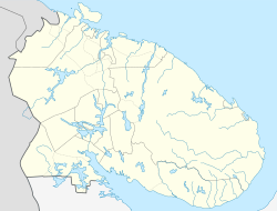
The city is located in the northeast of the Kola Peninsula about 280 kilometers as the crow flies southeast of the Oblast capital Murmansk on the Svyatonossky Bay of the Barents Sea .
Ostrownoi is administratively directly subordinate to the Oblast and is one of the Closed Cities of Russia.
The city cannot be reached by land.
history
A Sami settlement called Yokanga River (later Jokanga , Russian Йоканьга ; after the close opens river and the islands in the bay of the same name) was first mentioned in the 16th century. In 1938 the village was renamed Gremicha .
In 1951, Gulag prisoners began building the Kolaeisenbahn (official code name Bauwerk 509 ), the main line of which was to connect Apatity with Jokangabucht 300 kilometers away. After about 110 kilometers of track had been laid, construction ceased after Stalin's death in 1953. Part of the completed route still exists today as part of the connection to Rewda , but the place has remained without connection to the road or rail network of Russia to this day.
About three kilometers from Gremicha was a secret base of the Soviet Northern Fleet , u. a. built for nuclear submarines , with an associated housing estate and the code name Murmansk-140 . In 1981 Gremicha was incorporated into this settlement.
In 1992 the town charter was granted under its current name (derived from Russian ostrow for island ). With the crisis in the Russian Navy since the 1990s, the population dropped dramatically.
Population development
| year | Residents |
|---|---|
| 1939 | 632 |
| 1959 | 3,342 |
| 1970 | 6,956 |
| 1979 | 9,338 |
| 1996 | 14,000 |
| 2000 | 10,300 |
| 2002 | 5,032 |
| 2010 | 2,171 |
Note: except 1996-2000 census data
economy
The only industry is the supply of the fleet base.
Web links
- Ostrownoi on the Murmansk Oblast Government website (Russian)
- Ostrownoi on mojgorod.ru (Russian)
Individual evidence
- ↑ a b Itogi Vserossijskoj perepisi naselenija 2010 goda. Tom 1. Čislennostʹ i razmeščenie naselenija (Results of the All-Russian Census 2010. Volume 1. Number and distribution of the population). Tables 5 , pp. 12-209; 11 , pp. 312–979 (download from the website of the Federal Service for State Statistics of the Russian Federation)


