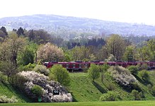
Vineyards (Starnberg)
|
Vineyards
City of Starnberg
Coordinates: 48 ° 1 ′ 28 ″ N , 11 ° 20 ′ 57 ″ E
|
|
|---|---|
|
Manor house in Rieden
|
Rieden is a hamlet belonging to the Upper Bavarian district town of Starnberg . The settlement consists of an estate, the corridors of which have been used as a golf course since 1991.
location
The listed manor house is at an altitude of 633 m above sea level. NHN on a plateau of the terminal moraine on the western high bank of the Würm . The estate's lands extend from there to the Mühlthal and Leutstettener Moos , a silting zone at the outflow of Lake Starnberg .
Rieden can be reached from Starnberg via a local road and via State Road 2063 running through the Mühlthal .
Belonging to the hamlet of corridors, in the conservation area Würmtal , parts of it in the nature reserve Leutstettener moss and other parts in the FFH area moors and forests of the terminal moraine near Starnberg .
history
The hamlet of Rieden is first mentioned in writing under the name "Riodun" - which can be traced back to clearing - in the traditions of the Hochstift Freising from the years 887 to 895. It is one of the oldest settlements in the Starnberg area. The Duke Surbar of 1280 shows that there were three farms there that were owned by the Wittelsbach family . After the death of Duke Ludwig the Strict , they fell as a widow's property to his third wife, who gave them to the Fürstenfeld monastery in 1297 . To round off the estates, on May 31, 1389, Fürstenfeld exchanged all of his property in Rieden for farms from the Schäftlarn monastery . From this, in the course of secularization in 1803, with a field size of 183 hectares , Rieden became the property of the Electorate of Bavaria .
From the records of the monastery about the Riedener Höfe it can be seen that there was an astonishing consistency there with regard to its fiefdoms . In the 19th century, however, there were frequent changes of ownership, which reduced the value of the farms. In addition, the cultivation of the fields was significantly impaired from 1854 by the construction of the Munich – Starnberg railway line . The route , which was later extended to Garmisch-Partenkirchen , interrupts the old paths and divides the corridors of the hamlet into two halves. The construction of a bridge over the railway line only partially solved the problem.
In 1904 Rieden came again into the possession of a member of the Wittelsbach dynasty. Prince Ludwig of Bavaria, later King Ludwig III. , had acquired the nearby Leutstetten Castle and made it his residence. Since his student days, he has been particularly interested in promoting agriculture. Due to the size of the existing land, he had the opportunity to build a model estate in which all the advances of his time were applied. In the newly purchased vineyards, the buildings of the old farms were demolished and a manor house built in the style of an Upper Bavarian farmhouse with a distant view of the Leutstettener Moos and Lake Starnberg. The newly built stables were exemplary in terms of TBC- free cattle breeding and high-yield dairy farming. At the Munich court society, which had little understanding for this, this earned him the disrespectful title “Millibauer” (High German: dairy farmer).
His descendants let Gut Rieden, as the hamlet was now called, farm until 1978. This was followed by the sale to a family who ran the estate for another ten years and then converted it into an 18-hole golf course . Since the autumn of 1991, the spacious corridors of the former model estate have been used by golf enthusiasts for sporting activities.
Attractions
St. Peter and Paul , the listed small church and its cemetery with graves of citizens of Riedens, members of the nobility and scientists.
literature
- Gerhard Schober: District Starnberg (= Bavarian State Office for Monument Preservation (Hrsg.): Monuments in Bavaria . Volume I.21). 2nd Edition. Schnell & Steiner, Munich 1991, ISBN 3-7954-1005-3 .
- Gerhard Schober: Castles in the Fünfseenland. Bavarian aristocratic residences around Lake Starnberg and Lake Ammersee. Oreos-Verlag, Waakirchen 2005, ISBN 3-923657-83-8 .
- Anton Brunner: The old field names. Kulturverlag Stadt Starnberg, 2007, ISBN 978-3-940115-00-3 .
Web links
- Homepage Gut Rieden.
- Sylvia Böhm-Haimerl: More farmer than king. In: Süddeutsche Zeitung . Online version September 16, 2018, accessed September 17, 2018.
Individual evidence
- ↑ Bavarian State Library Online. , accessed April 14, 2018.
- ↑ BayernAtlas Geographical Location of Rieden, accessed on April 14, 2018.
- ^ Protected planet Würmtal, accessed on April 14, 2018.
- ↑ Protected planet Leutstettener Moos, accessed on April 14, 2018.
- ↑ Protected planet moors and forests of the terminal moraine near Starnberg, accessed on April 14, 2018.
- ↑ A. Brunner: Die alten Flurnamen , p. 35.
- ^ Hans H. Schmidt: The county of Gilching . Self-published, Gauting 1999.
- ^ Bay. Main state archive , Rustikal and Dominikal tax cadastre of the tax district of Percha in the royal district courts. Rentamt Starnberg in the Isar district. Royal Bavarian Immediate Tax Cadastre Commission. 1812.
- ↑ G. Schober: Castles in the Fünfseenland. P. 70.
- ↑ G. Schober: Monuments in Bavaria. P. 348.


