
Haidelbach (Röthenbach)
| Haidelbach | ||
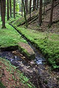
 Haidelbach at the Krämersweiher waterworks |
||
| Data | ||
| Water code | DE : 242284 | |
| location | Germany | |
| River system | Rhine | |
| Drain over | Röthenbach → Pegnitz → Regnitz → Main → Rhine → North Sea | |
| source | south of Entenberg in the Langes Ried forest section 49 ° 26 ′ 36 ″ N , 11 ° 21 ′ 58 ″ E |
|
| Source height | 541 m above sea level NHN | |
| muzzle | Northeast of Brunn Coordinates: 49 ° 26 ′ 51 ″ N , 11 ° 16 ′ 15 ″ E 49 ° 26 ′ 51 ″ N , 11 ° 16 ′ 15 ″ E |
|
| Mouth height | 339.8 m above sea level NHN | |
| Height difference | 201.2 m | |
| Bottom slope | approx. 20 ‰ | |
| length | approx. 9.8 km | |
| Catchment area | 34.03 km² | |
The Haidelbach is an approximately ten kilometer long right tributary of the Röthenbach in the municipality of Leinburg in the central Franconian district of Nürnberger Land .
geography
River course
The Haidelbach rises on the northern slope of 588 m above sea level. NHN high mountain Balcher in the Langes Ried forest south of the Leinburg district of Entenberg . From the headwaters, the brook flows in a northerly direction through the hillside forest to the southwestern outskirts of Entenberg, where, after changing direction to the west, two smaller brooks flow in from the right. Now it meanders through fields and meadows, another stream flows in from the right and finally the Kühbach flows from the left , the source of which is not far from the source of the Haidelbach. After crossing under the local connecting road called Talstrasse , the creek bed in Oberhaidelbach is almost canalised between two branches of the main road of the same name and passes under the state road 2404 at its western end .
Further westwards it goes again through open corridors until a few meters east of the hamlet of Pühlhof the Ettenbach flows from the right . From now on, the water is called Ettenbach up to the next mouth and runs southwest on the edge of the forest in the Heide forest . After a good 600 m, the Behlengraben flows from the right on the southern outskirts of Unterhaidelbach and now the name changes back to Haidelbach.
After crossing under the St 2240, it goes in a large arc to the west, then northwest on the northern edge and partly also in the area of the state forest of Leinburg , which also affects the nature reserve lichen-pine forests south of Leinburg (NSG-00570.01). Here the Berglesgraben flows from the left and two smaller bodies of water from the right. In the further course to the west, the area of the solitude of Heiligenmühle flows through, with a branch to an old mill. After a short distance through the state forest, it goes briefly north, then west again.
Again in the Leinburg area, the Haidelbach divides into two strands, both of which cross under the Leinburg- Brunn local road , the northern one runs through the wasteland of Fuchsmühle , the southern one past the Krämersweiher waterworks of the city of Nuremberg , to which the Ursprung flows from the left .
After leaving the municipality of Leinburg, the two branches reunite, the stream then takes on the Schmidgraben (Gänsebühlbach) from the right and then flows straight to 339.8 m above sea level. NHN in the community-free Brunner Staatsforst between the A 3 on the left and a sand pit on the right edge from the left into the Röthenbach .
Catchment area
The approximately 34 km² catchment area of Haidelbach lies in the Franconian Alb and is drained through it via the Röthenbach, Pegnitz , Regnitz , Main and Rhine to the North Sea.
It borders
- in the northeast to the catchment area of the Hammerbach , which flows into the Pegnitz
- in the southeast to that of the Raschbach , which drains over the Schwarzach and Rednitz into the Regnitz
- in the south and west to that of the Röthenbach
- and in the north to that of the Sandbach) , which flows into the Pegnitz.
The highest point is the Moritzberg with a height of 603.5 m above sea level. NHN in the north of the catchment area
The southern part of the catchment area is largely forested and the northern area is largely used for agriculture as meadows and arable land.
Tributaries
Selection. Lengths measured on the BayernAtlas, see the → web links .
- (Inflow), from the right from Entenberg, approx. 0.1 km
- (Inflow), from the right, with the upper course Neckargraben approx. 1.4 km
- Totengaßbach, from the right below Entenbach, approx. 1.0 km
- Kühbach, from the left on the eastern edge of Oberhaidelbach, approx. 1.0 km
- (Inflow), from the left in Oberhaidelbach, approx. 0.3 km
- Ettenbach, from the right at Pühlhof, approx. 1.9 km
- Behlengraben, from the right near Unterhaidelbach, with the left upper course from Moritzberg approx. 2.5 km
- Leingraben, from left to Unterhaidelbach, with a longer left upper course Berglesgraben approx. 4.5 km
- (Inflow), from the right of the Schimmelleite, approx. 0.4 km
- (Inflow), from the right in front of the Heiligenmühle from the Schimmelleite, approx. 0.5 km
- Urspringbach, from the left at the Fuchsmühle from the Ursprung valley gully , at least 1.8 km. Flows through a pond of over 2.0 hectares
- Schmidgraben, from the right with the upper course Gänsebühlbach approx. 2.5 km
Picture gallery
Valley of Origin
Speckweiher at the inflowing source

Haidelbach at the mouth of the river originates from the Krämersweiher waterworks

Haidelbach at the Krämersweiher waterworks

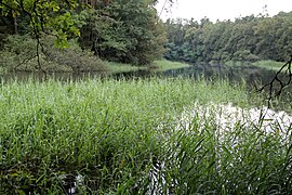
Röthenbach at the mouth of the Haidelbach


_n%C3%A4he_M%C3%BCndung_Haidelbach_2015-06-10_18.42.22.jpg)
See also
Individual evidence
- ↑ a b BayernAtlas of the Bavarian State Government ( notes )
- ↑ a b List of brook and river areas in Bavaria - Main river area, page 45 of the Bavarian State Office for the Environment, as of 2016 (PDF; 3.3 MB)
- ↑ Bavarian State Office for the Environment: Green List of Nature Reserves in Middle Franconia.Retrieved on June 8, 2015
- ↑ World Database on Protected Areas - NSG lichen-pine forests south of Leinburg (English)
- ↑ Origin of the Nuremberg drinking water ( memento from September 11, 2009 in the Internet Archive ) Website of the water supply association for the Franconian economic area . Retrieved June 8, 2015.
- ↑ Overview of the water supply in Nuremberg ( Memento from September 13, 2009 in the Internet Archive ) Map of the water supply association for the Franconian economic area . Retrieved June 8, 2015.
- ↑ OpenStreetMap: Urspringbach
- ↑ The Aeolian sand deposits in front of the stepped slope of the Northern Franconian Jura Announcements of the Franconian Geographical Society, Vol. 44, 1997, pp. 1-74, page 8, accessed on June 8, 2015
Web links
- Map of the course and catchment area of the Haidelbach on: BayernAtlas of the Bavarian State Government ( information )
- Map of the course and catchment area of the Haidelbach on: Map service water management, FGN Bavarian State Office for the Environment ( information )
- Bavarian State Office for the Environment: Basic data on flowing waters of Bavaria
- Map service system of the Bavarian State Office for the Environment (LfU)