Harlyberg
| Harlyberg | |
|---|---|
|
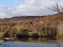
View from the south over Vienenburg with Vienenburger See |
|
| Highest peak | Harlyberg ( 256 m above sea level ) |
| location | Districts of Goslar and Wolfenbüttel ; Lower Saxony ( Germany ) |
| Coordinates | 51 ° 58 '2 " N , 10 ° 32' 34" E |
| Type | Narrow saddle |
| rock | Limestone, marl stones, loess |
| surface | 6.5 km² |
| particularities | - Harly Tower ( AT ) - Harliburg (Burgstall) - Herbal August Cave - former Hercynia potash mine |
The Harlyberg or Harly (also Harli and Harliberg ) is 256 m above sea level. NHN high and around 6.5 km² mountain range near Vienenburg in southeastern Lower Saxony . It is mainly located in the district of Goslar , its northwestern part protrudes into the district of Wolfenbüttel . Its forest cover is known as Harly Forest .
In addition to the highest elevation of the same name on the Harlyberg, there are other unnamed peaks. The Harly Tower observation tower is on the summit, and the Herb August Cave is located in the valley west of the summit . In addition, the Harliburg castle stable and the former potash mining in the Hercynia potash mine are located on the ridge .
Geography, geology and ecology
location
The Harlyberg rises in the northern Harz foreland . Its summit is 10.4 km north-east of the Goslar core city, 2.2 km north-west of Vienenburg , 550 m north-north-west of the Am Harlyberge settlement , 900 m north-north-east of the Wöltingerode monastery , 4.1 km east-north-east of Immenrode , 3.8 km east- south- east of Weddingen , 2.5 km southeast of Beuchte and 1.8 km south-southwest of Lengde . Beyond the Oker , which passes the Harlyberg in the south-east and comes from the Harz region from the south-west and bends north after passing the Vienenburger See , Wiedelah, 3 km away from the summit, is located at this Oker bend at the east-south-east end of the ridge . With the exception of Beuchte, a district of Schladen-Werla in the Wolfenbüttel district, all of the places mentioned belong to Goslar in the Goslar district. The 5.8 km long and 1.5 km wide ridge stretches like the nearby Harz in a west-northwest-east-southeast direction.
On the bank opposite the Harlyberg, the Oker takes on the Hurlebach and the Radau near Vienenburg and the Ecker near Wiedelah; Between Oker and Hurlebach, the gravel- rich stone field extends near the ridge . The Weddebach passes the ridge on the west side. The Ohebach rises on the northern slope of the Harlyberg , which flows between Beuchte and Lengde and flows into the Oker a few kilometers further.
Geology and ecology
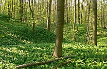
The Harlyberg was created by halokinesis . It is one of the narrow saddles, the structure is called the Vienenburger saddle. From an ecological point of view, the Harly Forest is a semi- natural hillside forest on dry, warm lime and silicate sites.
Natural allocation
The ridge forms in the natural environment feature unit group Northern harzvorland (no. 51) in the main unit resin edge recess (510) and in the sub unit Harzburger harzvorland (510 1 ) the natural environment Harliberg (510 1 02).
The Federal Agency for Nature Conservation assigns it to the natural area "51003 Harlyberg-Fallstein-Huyberg-Hakel-Blankenburger surveys".
Protected areas
On the Harlyberg are the landscape protection areas Harli ( CDDA no. 321387; designated 1966; 4.93 km²) in the district of Goslar and Harli (CDDA no. 321388; 1986; 1.37 km²) in the district of Wolfenbüttel. The fauna-flora-habitat area Harly, Ecker- and Okertal north of Vienenburg (FFH no. 3929-331; 6.8191 km²) extends to the summit . The Okertal nature reserve (CDDA no. 82281; 1982; 2.46 km²) meets the south to east slope foot .
history
The east-south-east part of the ridge is above the Oker valley. From its construction in 1203 until its destruction in 1291, it was the location of the Harliburg built by King Otto IV . Since after Otto's death the heirs of the castle were subordinated to having used its favorable location for raids and road robberies, it was besieged for several months in 1291 and then completely razed .
Harly Tower
On the top of the Harlybergs Harlyturm, also stands Napoleon tower called observation tower , which was handed over to the tourist use again after decades of neglect and after extensive restoration in the 1986th It is open when the flag is blowing on its roof. From its viewing platforms - there is a glazed and an open one - you can see the Harz rising to the south , the Elm to the north and the Huy rising to the east .
Attractions
In addition to the forest landscape, the Harlyberg's sights include the former Harliburg and the Harly Tower on the ridge. A remnant of former mining activities is the historic Hercynia potash mine with the former pits I, II and III. The former monastery of Wöltingerode is also worth seeing with its monastery distillery.
Traffic and walking
The Federal Highway 36 intersects with the 200 m long Okertalbrücke between the Harlyberg and Wiedelah to the Ostsüdostende of Höhenzugs because they are not on the former border at the time of establishment of the GDR could result. At their junction in Vienenburg , the federal highway 241, coming from the direction of the Goslar core city in the southeast and through Vienenburg, ends . Federal road 82 runs from Goslar to Schladen to the west of the ridge . The Harlyberg can be reached via the secondary roads that branch off from both federal roads - for example on state road 510, which connects the two federal roads between Weddingen and Vienenburg.
The Braunschweig – Bad Harzburg railway runs east to south-east past the Harlyberg . The ridge provided a natural barrier for this first railway line along the Okertal and led to Vienenburg being established as a junction.
Starting on the aforementioned main and secondary roads and at Vienenburg train station, the elevation can be hiked on forest and hiking trails - for example on the Kammweg. Harly circular hiking trail 3 runs on the southwest slope .
Others
Around 450 m west of the Harlyberg summit is the Herb August Cave, which is a natural monument , and Harliburg is just under 2 km east-southeast . From 1884 to 1930, potash salt was mined in shafts I to III of the Hercynia potash mine southeast to south of the elevation . The Harlyberg with the Harly Forest and the adjacent Vienenburger Lake is advertised as a tourist destination and a local recreation area.
Web links
- Map display Harly , on openstreetmap.org
- Harly: Slope forest with service tree trees (ecological and geological information), on region-braunschweig.de
Individual evidence
- ↑ State Office for Geoinformation and Land Surveying Lower Saxony: Top 50 - Topographic Map 1: 50,000 Lower Saxony / Bremen , as of 2000.
- ↑ The Harly. Goslar, accessed on July 10, 2017 .
- ↑ a b Landkreis Goslar: Landscape Protection Ordinance on the Harli Landscape Protection Area. , Goslar 1966.
- ↑ a b Map services of the Federal Agency for Nature Conservation ( information )
- ↑ Area information using the Measure distance function on Google Maps
- ^ Kurt Mohr: Collection of geological guides, Volume 70, Harz foreland - western part . Bornträger Brothers, Berlin 1982, ISBN 3443150292 .
- ↑ Fritz J. Krüger (Ed.): Walks in die Erdgeschichte, Volume 19, Braunschweiger Land , p. 54. Verlag Dr. Friedrich Pfeil, Munich 2006, ISBN 3-89937-066-X
- ↑ Jürgen Spönemann: Geographical Land Survey: The natural spatial units on sheet 100 Halberstadt. Federal Institute for Regional Studies, Bad Godesberg 1970. → Online map (PDF; 4.7 MB)
- ↑ Landscape profile 51003 Harlyberg-Fallstein-Huyberg-Hakel-Blankenburger surveys. (No longer available online.) Federal Agency for Nature Conservation, archived from the original on June 19, 2017 ; Retrieved July 10, 2017 . Info: The archive link was inserted automatically and has not yet been checked. Please check the original and archive link according to the instructions and then remove this notice.


