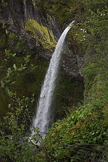
John B. Yeon State Scenic Corridor
|
John B. Yeon State Scenic Corridor
|
||
|
McCord Creek Falls |
||
| location | Multnomah County in Oregon (USA) | |
| surface | 88 ha | |
| Geographical location | 45 ° 37 ' N , 121 ° 59' W | |
|
|
||
| administration | Oregon Parks and Recreation Dept. | |
The John B. Yeon State Scenic Corridor is an 88 acre state park on the Historic Columbia River Highway in the US state of Oregon .
A gently sloping hiking trail begins in the park to two remote and less visited waterfalls of McCord Creek . The first falls, Elowah Falls , are one mile from the car park. The falls tumble over a basalt cliff and are 65 m high. The path continues to the higher 19 m high McCord Creek Falls .
The park also offers a good view of the Bonneville Dam .
The park area was acquired by the State of Oregon between 1935 and 1956. In 1935 the Civilian Conservation Corps built a bridge over McCord Creek and paved a footpath. The park was named after John B. Yeon , a leading architect and site manager in the construction of the Columbia River Highway. Use of the park is free of charge.
literature
- Jan Bannan: Oregon State Parks. A complete Recreation Guide. Seattle, Mountaineers Books, 2nd Edition 2002, ISBN 978-0-89886794-7
Web links
- Oregon State Parks: John B. Yeon State Scenic Corridor
- John B. Yeon State Scenic Corridor in the Geographic Names Information System of the United States Geological Survey
Individual evidence
- ^ World Waterfall Database: Elowah Falls. Retrieved August 17, 2011 .


