Sunset Bay State Park
|
Sunset Bay State Park
|
||
|
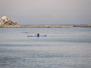
Kayakers in Sunset Bay |
||
| location | Coos County in Oregon (USA) | |
| surface | 164 hectares | |
| Geographical location | 43 ° 20 ′ N , 124 ° 22 ′ W | |
|
|
||
| Setup date | 1948 | |
| administration | Oregon Parks and Recreation Dept. | |
The Sunset Bay State Park is a State Park in Coos County US state of Oregon . The 164 hectare state park is located on the Cape Arago Highway 19 km southwest of Coos Bay .
geography
Sunset Bay is a bay enclosed by sandstone cliffs 4 km west of Charleston . The sandy beach, the sheltered location and the waist-deep water at this point allow you to step into the water, which is otherwise rather unusual in Oregon because of the currents and water temperature.
Cape Arago lighthouse
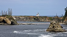
On an island off Sunset Bay, by the Native Americans Chief's Iceland is called, which is Cape Arago Lighthouse (Engl. Cape Arago Lighthouse ). In 1864 the construction of the first lighthouse for the port of Coos Bay began, which was completed in 1866. Storms and erosion forced the construction of a new lighthouse in 1909 and the construction of a third, still existing 13 m high tower in 1934. A nearly 400 m long wooden bridge leads to the island. In 1966 the lighthouse was automated. The lighthouse has not been in operation since 2006. The island is owned by Native Americans. The bridge to the island is locked and cannot be entered.
history
The sheltered bay used to serve as a mooring and shelter for fishing boats. According to local tradition, it also served as a pirate base. The bay got its name from a pioneer from Coos Bay. Around 1900 the area belonged to the property of the timber baron Louis J. Simpson , who sold the land to the state in 1942. Until 1984 the park was expanded to its present size through donations and purchases.
Tourist facilities
On the bay and in the meadows along the Big Creek, a small stream, the picnic area and the camping pitches extend with over 90 tent sites and almost 30 sites for mobile homes. A publicly accessible golf course borders the park. A hiking trail, which is also part of the Oregon Coast Trail , connects the park with the adjacent Shore Acres State Park and Cape Arago State Park to the south .
literature
- Jan Bannan: Oregon State Parks. A complete Recreation Guide. Seattle, Mountaineers Books, 2nd Edition 2002, ISBN 978-089886-794-7
Web links
- Oregon State Parks: Sunset Bay State Park
- Sunset Bay State Park on the United States Geological Survey's Geographic Names Information System
Individual evidence
- ↑ lighthousefriends.com: Cape Arago Lighthouse. Retrieved August 26, 2011 .
- ↑ Sunset Bay State Park ( December 5, 2003 memento in the Internet Archive )
- ↑ Sunset Bay Golf Course ( Memento from March 10, 2014 in the Internet Archive )


