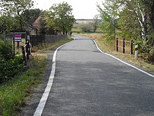
Kamenička (Bílá Voda)
| Kamenička | ||||
|---|---|---|---|---|
|
||||
| Basic data | ||||
| State : |
|
|||
| Region : | Olomoucký kraj | |||
| District : | Jeseník | |||
| Municipality : | Bílá Voda | |||
| Area : | 217 ha | |||
| Geographic location : | 50 ° 26 ' N , 16 ° 56' E | |||
| Height: | 307 m nm | |||
| Residents : | 63 (2011) | |||
| Postal code : | 790 54 | |||
| License plate : | M. | |||
| traffic | ||||
| Street: | Bílý Potok - Bílá Voda | |||
Kamenička (German Kamitz-Uberhar , Polish Kamieniczka ) is a district of the municipality Bílá Voda in the Czech Republic . It is located four kilometers east of Złoty Stok on the Polish border and belongs to the Okres Jeseník .
geography
The scattered settlement Kamenička is located between the Od Tří Lip / Kamienicka brook and a left tributary at the foot of the Reichensteiner Mountains ( Rychlebské hory ). The Na Střelnici (433 mnm) rises to the southwest.
Neighboring towns are Kamienica in the north, Paczków and Unikowice in the northeast, Gościce in the east, Horní Hoštice in the southeast, Travná in the south, Karlov and U Šišky ( pine cones ) in the southwest, Hundorf and Ves Bílá Voda in the west and Městys Bílá Voda in the northwest.
history
The settlement arose outside of the forest hoof village Kamitz as a local extension. With over crowd , sergeant or the additions remanentia agrorum , ager qui superabundat , excrescentia or superfluitas such field pieces were designated, which went at a Neuausmessung the hallways on the originally specified area measure and were used for new settlements.
The first written mention of the place took place in 1325 as property of the diocese of Breslau . At the end of the 15th century, the Principality of Neisse pledged the settlement to the town of Patschkau . Kamitz-Uberhar was then connected to the urban estate, which mainly consisted of Ober Gostitz .
When the principality of Neisse was divided, Kamitz-Uberar remained with Austria in 1742 after the preliminary peace of Breslau , while the city of Patschkau fell to Prussia . The settlement was since then directly on the border with Prussian Silesia. As a Patschkauer estate, it was listed as a “special property” in the Troppauer Landtafel . In the course of the secularization of the clerical principalities in Prussia, Kamitz-Übersar became the property of the town of Patschkau in 1810, and the administration was in the hands of Weißwasser .
In 1836 the village of Kamitz-Übersar consisted of 32 houses in which 216 German-speaking people lived. Some of the houses, including an inn, were an eighth of a mile away in a wedge that protruded right up to Kamitz in the Principality of Neisse. The main sources of income were flax spinning and daily wages. The parish and school location was Weißwasser. Until the middle of the 19th century, Kamitz-Übersar remained a knightly possession of the Patschkau combing.
After the abolition of patrimonial Kamitz Übersar formed from 1849 a district of the market town of Weißwasser in the judicial district of Jauernig . From 1869 Kamitz-Übersar belonged to the Freiwaldau district. At that time the village had 202 inhabitants and consisted of 32 houses. The Czech place name Kamenička was introduced at the end of the 19th century. In 1900 there were 159 people in Kamitz-Uberar , compared to 174 in 1910. In the 1921 census, 163 people, 124 of them Germans, lived in the 30 houses in the village.
In 1930 Kamitz-Übersar consisted of 30 houses and had 153 inhabitants, including 128 Germans, 22 foreigners and 3 Czechs. After the Munich Agreement , the village was assigned to the German Reich in 1938 and belonged to the Freiwaldau district until 1945 . After the end of the Second World War Kamenička came back to Czechoslovakia; most of the German-speaking residents were expelled in 1945/46 . The real estate of the city of Paczków, which at that time was already under Polish administration, was confiscated as German property by the Czechoslovak state despite Polish protests on the basis of the Beneš decrees .
In 1950 the village only had 91 inhabitants. In the course of the Polish-Czechoslovak border regulation of June 13, 1958, the wedge protruding into Polish territory with an area of 6 hectares was assigned to the municipality of Kamienica ; to Kamenička was added a hectare of land on the border between Městys Bílá Voda and Kamienica. This also made it possible to receive Czechoslovak television in Bílá Voda; the suitable location for a transmission mast was previously on Polish territory. During the territorial reform of 1960, the Okres Jeseník was abolished and Kamenička was incorporated into the Okres Šumperk . Since 1996 Kamenička has belonged to Okres Jeseník again. At the 2001 census, 60 people lived in the village's 15 houses.
Bílá Voda Municipal Office is located in Kamenička-u Bílé Vody.
Local division
The district Kamenička consists of the basic settlement units Kamenička and Kamenička-u Bílé Vody.
Kamenička forms the cadastral district Kamenička u Bílé Vody .
literature
- Historický lexikon obcí České republiky 1869–2005 , part 1, p. 650
Web links
Individual evidence
- ↑ Katastrální území Kamenička u Bílé Vody: podrobné informace , uir.cz
- ↑ Faustin Ens : The Oppaland or the Opava district, according to its historical, natural history, civic and local peculiarities. Volume 4: Description of the location of the principalities of Jägerndorf and Neisse, Austrian Antheils and the Moravian enclaves in the Troppauer district . Vienna 1837, p. 315
- ↑ Chytilův místopis ČSR, 2nd updated edition, 1929, p. 494 Kameničany - Kameň Modrý
- ↑ Základní sídelní jednotky , uir.cz


