
Cascades (ecoregion)


According to the United States Environmental Protection Agency (EPA) classification, the Cascades ecoregion is a Level III ecoregion in the US states of California , Oregon and Washington . Slightly smaller than the cascade range after which it is named, the ecoregion extends over 44,952 km² from Snoqualmie Pass near Seattle in the north to Hayden Pass near the border between Oregon and California in the south. It includes the peaks and western slopes of most of the high cascades. An exclave is around Mount Shasta in California.
The basement of the mountainous region consists of Cenozoic volcanic rock that has been shaped by alpine glaciers . The eastern part of the region contains active as well as dormant volcanoes known as the Cascades Volcanic Arc , rising up to 14,411 ft (4,392 m). The western cascades are older, flatter and cut through by numerous steep-walled stream valleys . The region has a humid temperate climate , which contributes to the growth of dense, highly productive temperate coniferous rainforests that are intensively used for forestry or recreational purposes. Subalpine meadows occur at higher altitudes.
Much of the region consists of publicly owned land administered by the federal government. These include the National Forests of Mount Baker-Snoqualmie , Wenatchee , Gifford Pinchot , Mount Hood , Willamette , Umpqua and Rogue Rivers, and the Columbia River Gorge National Scenic Area ; the wilderness areas Clearwater , Norse Peak , Tatoosh , William O. Douglas , Goat Rocks , Mount Adams , Indian Heaven , Trapper Creek , Salmon-Huckleberry , Mount Hood , Table Rock , Bull of the Woods , Opal Creek , Middle Santiam , Menagerie , Mount Jefferson , Mount Washington , Three Sisters , Diamond Peak , Boulder Creek , Mount Thielsen , Rogue-Umpqua Divide , Sky Lakes, and Mountain Lakes ; finally the national parks Mount Rainier and Crater Lake as well as the Mount St. Helens National Volcanic Monument .
The Cascade region borders the following ecoregions: in the north on the North Cascades , in the south on the Klamath Mountains , in the east on the Eastern Cascades Slopes and Foothills and in the west on the Willamette Valley and the Puget Lowland. It is divided into six Level IV ecoregions in Washington and Oregon, which are described below. Mapping of the Level IV regions in California is ongoing.
Detected species include black bears , deer , elk , lynx , pumas , coyotes , skunks , raccoons and chipmunks .
Level IV ecoregions

Western Cascades Lowlands and Valleys (4a)
The Western Cascades Lowlands and Valleys ecoregion comprises a network of steep mountain ridges and narrow valleys on the lower slopes of the Cascade Range. The altitudes vary between 600 ft (approx. 200 m) and 4,000 ft (approx. 1,200 m). The mild, humid climate leads to the growth of lush forests dominated by hemlocks and Douglas firs ; These are joined by the giant arborvitae , Oregon maple , red alder , grape-leaf maple , Shallon shamberry , rhododendron , common Oregon grape , huckleberry , white cinnamon-raspberry , West American sword fern , wood sorrel , hazel and blackberries . The soils are warmer than those in the higher elevations. The region is one of the most important wood producing areas in the Pacific Northwest. The steep, west-facing valleys contain high and moderate gradient rivers and streams that provide habitat for salmon fish , including the endangered king salmon , steelhead, and bull trout . Major Oregon river basins include those of the North Umpqua River , North Fork and Middle Fork Willamette Rivers , McKenzie River , North Santiam River , South Santiam River , Clackamas River , Salmon River, and Bull Run Rivers ; in Washington, those of the Lewis River , the Cowlitz River , the Nisqually River , the Puyallup River , the White River, and the Green River . Reservoirs store meltwater for irrigation and local water distribution systems in the Willamette Valley . The Westerns Cascades Lowlands and Valleys are the largest of the Cascades sub-regions. They cover 10,110 km² in Oregon and 6,208 km² in Washington.
Western Cascades Montane Highlands (4b)
The Western Cascades Montane Highlands ecoregion is characterized by mountains separated by steep valleys. It contains streams with steep to moderate gradients and glacial lakes in rock hollows. The altitudes vary between 3,000 ft (approx. 900 m) and 6,500 ft (approx. 2,000 m). The western cascades are older and more eroded than the volcanic plateau and the protruding snow-capped volcanic cones of the high cascades in the east. They are underlaid with dark basalt , in contrast to the gray andesites of the high cascades. The region has lower temperatures and larger amounts of snow in winter than the lowlands and valleys in the west. The soils are often frozen, and permafrost also occurs. The abundant rainfall provides growth conditions for forests dominated by Douglas firs and West American hemlocks, in which mountain hemlocks , noble firs , rocky mountain firs , coastal firs , purple firs , red alders and Pacific yews thrive, with an undergrowth of vine leaves - Maple, Rhododendron, Mahonia, Huckleberry and Blackberry. Nowadays the region is largely determined by forestry and recreational use. It is also an important source of water for cities, suburbs and agriculture . At 7,070 square kilometers in Oregon and 4,734 square kilometers in Washington, it is the second largest of the sub-regions of the Cascades.
Cascade Crest Montane Forest (4c)
The Cascade Crest Montane Forest ecoregion consists of an undulating plateau with isolated volcanic hardwoods and cones that reach a maximum height of 6,500 ft (1,981 m). The volcanism of the Pliocene exceeded the Miocene volcanoes of the Western Cascades Montane Highlands in height. Later, the glaciation in the Pleistocene left numerous lakes in rock hollows that are distributed over the entire plateau. Meandering streams with a moderate gradient traverse the terrain. The region is densely forested with mountain hemlocks, rocky mountain firs and purple firs along with some coastal firs, noble firs, Douglas firs, Engelmann spruces and coastal pines as well as an understory of vine-leaf maple, huckleberry, rhododendron, bear grass , Moss bells and " winter green ". Sedges , weed willows and turf kisses grow on mountain meadows . The region covers 4,940 km² in Oregon and 803 km² in Washington along the main ridge of the Cascades; an exclave of this region can be found on Newberry Volcano southeast of Bend .
Cascades Subalpine / Alpine (4d)
The Cascades Subalpine / Alpine ecoregion is an area of high, glaciated volcanic peaks above the subalpine meadows with raging glacial streams, glacier-shaped karen and cirque lakes . The Pleistocene glaciation shaped the mountains above 6,500 ft (approx. 2,000 m) and left moraines , glacial lakes and canyons with a U-shaped cross-section. Glaciers and permanent snowfields are still present at the highest peaks, but become rarer from north to south. The vegetation is adapted to the high altitudes, the low winter temperatures and short vegetation periods as well as to thick snow cover. It consists mainly of herbaceous plants, shrub-strewn sub-alpine meadows and scattered groups of mountain hemlocks, rocky mountain firs and white-stemmed pines near the tree line . Carex breweri ( English Brewer's sedge ), Carex heteroneura ( English Holm's sedge ), Carex nigricans ( English black alpine sedge ), turf sedge and alpine aster grow on moist meadows . Otherwise there is only bare rock. The region covers 1,000 km² in Washington and 860 km² in Oregon and contains many of the prominent volcanic mountains of the High Cascades such as Mount Rainier , Mount Adams , Mount Hood , Mount Jefferson , the Three Sisters , Mount Bachelor , Diamond Peak , Mount Scott and Mount McLoughlin .
High Southern Cascades Montane Forest (4e)
The High Southern Cascades Montane Forest ecoregion is an undulating, glaciated volcanic plateau with isolated hardwoods and volcanic cones. There are many glacial lakes. With altitudes between 4,000 ft (approx. 1,200 m) and 8,200 ft (approx. 2,500 m), it forms the transition zone between the South Cascades and the Subalpine / Alpine Zone. Mixed coniferous forests grow on permafrost and are dominated by mountain hemlocks, coastal pines and rocky mountain firs; the soils are colder than that of the southern cascades. Coast firs, Colorado firs, and magnificent firs also occur and become more common to the south and east. White-stemmed pines are found in the higher areas. The undergrowth consists of grove , winter love , lupins and Orthilia secunda ( English sidebells shinleaf ), a heather plant . In the highest areas there are open meadows with Eriogonum pyrolifolium ( English Shasta buckwheat ), the mountain knotweed Aconogonon davisiae ( English Newberry knotweed ) and Brewer's sedge. The region tends to experience less rainfall than the Cascade Crest Montane Forest, with a longer dry spell in summer and more temporary bodies of water. It covers 2,370 km² in southern Oregon and includes Crater Lake National Park in the lower elevations .
Southern Cascades (4f)
The Southern Cascades ecoregion is generally lower and less rugged than the surrounding regions. It is characterized by gently rising mountains and wide valleys. The altitudes range from 1,400 ft (approx. 400 m) to 5,300 ft (approx. 1,600 m). The climate is drier than other parts of the Cascade Range and the vegetation is adapted to the long dry summers. The runoff of the streams and rivers is significantly less than in the systems of the north. West American hemlocks and giant arborvitae, which are indicator species in the ecoregions of the West Cascades , decrease more and more in the South Cascades and are replaced by species from the Sierra Nevada such as frankincense cedar , Colorado fir, magnificent fir and sugar fir Pine replaced; the undergrowth consists of snowberries , moss bells, mahonia , rock pears , Chrysolepis species ( English golden chinkapin ) and forest foam spar . Douglas firs and yellow pines are predominant at lower altitudes . The region covers 3,660 km² in southern Oregon in the catchment areas of the South Umpqua River and Rogue River ; it is separated from the West Cascades by the Calapooya Mountains .
gallery
flora
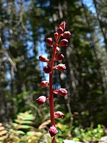
Wintergrün ( English Pink wintergreen ) in the William O. Douglas Wilderness


fauna

The Oregon worm salamander is found in forests with Oregon maple , giant arborvitae , and coastal Douglas fir .


Landscapes

Subalpine meadow in the Mount Baker-Snoqualmie National Forest
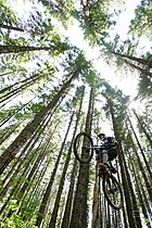
Tourist use is particularly intensive in the Mt. Hood National Forest .


See also
Individual evidence
- ↑ a b c d e f g h Thorson, SA Bryce, DA Lammers, et al .: Ecoregions of Oregon . USGS .
- ↑ a b c d e f g h D. Pater, SA Bryce, J. Kagan, et al .: Ecoregions of Western Washington and Oregon . USGS.