Khumjung
| Khumjung खुम्जुंग |
||
|---|---|---|
|
|
||
| Coordinates | 27 ° 49 ′ N , 86 ° 43 ′ E | |
| Basic data | ||
| Country | Nepal | |
| Province No. 1 | ||
| ISO 3166-2 | NP-P1 | |
| District | Solukhumbu | |
| height | 3780 m | |
| Residents | 1912 (2011) | |
|
Khumjung
|
||
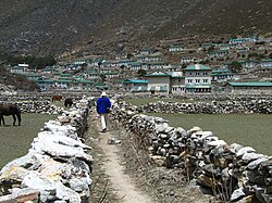
Khumjung ( Nepali खुम्जुंग ) is a village and Village Development Committee in the Khumbu region of Nepal within the Sagarmatha National Park .
The VDC Khumjung extends over the catchment area of the Dudhkoshi above the confluence of the Bhotekoshi . It thus also includes the side valley of Imja Khola and extends from Cho Oyu in the northwest to Mount Everest in the northeast. The Mount Everest Trek leads through the area.
The place Khumjung lies together with the directly adjacent village Khunde at an altitude of 3780 m in a basin, the Khumjung Valley at the foot of the Khumbi Yul Lha , the holy mountain of the Sherpas .
The Khumjung Valley lies between the well-known towns of Namche Bazar and Tengboche between 3800 and 4000 m altitude . Khumjung is in the eastern part of the valley and a little deeper than Khunde.
In the monastery of the village of the legendary is Yeti - scalp issued. The Hillary School, the only secondary school in the Khumbu region, is located in Khumjung. It is named after Sir Edmund Hillary , the first to climb Mount Everest, as is the small hospital in Khunde. Both institutions were established by the Hillary Foundation and are maintained to this day. This means that the Khumjung Valley has a good infrastructure in education and health care compared to other mountain regions in Nepal.
Residents
In 1991 the place had 1809 inhabitants. The VDC Khumjung had 1912 inhabitants (913 of them male) in 551 households at the 2011 census.
Villages and Hamlets
Khumjung consists of several villages and hamlets . The most important are:
- Dingboche ( 4340 m ⊙ )
- Gokyo ( 4860 m ⊙ )
- Gorak Shep or Gorakshep ( 5207 m ⊙ )
- Khumjung ( 3780 m ⊙ )
- Khunde ( 3860 m ⊙ )
- Lobuche ( 4930 m ⊙ )
- Machhermo ( 4380 m ⊙ )
- Pangboche ( 4020 m ⊙ )
- Pheriche ( 4250 m ⊙ )
- Phortse ( 3800 m ⊙ )
- Tashinga ( 3480 m ⊙ )
- Tengboche ( 3860 m ⊙ )
![]() Map with all coordinates of the section Villages and Hamlets : OSM
Map with all coordinates of the section Villages and Hamlets : OSM
- VDC Khumjung
literature
- Jamie McGuinness: Trekking in the Everest Region . Trailblazer Publications, 5th edition 2007, ISBN 1-873756-99-2 .
Web links
Individual evidence
- ^ National Geographic Information Infrastructure Program, Index of Geographical names of Nepal 2007 (p. 7, no. 226). ( Memento of the original from July 4, 2009 in the Internet Archive ) Info: The archive link was automatically inserted and not yet checked. Please check the original and archive link according to the instructions and then remove this notice. (PDF; 52 kB)
- ↑ National Population and Housing Census 2011 (PDF) Central Bureau of Statistics. Archived from the original on July 31, 2013.
- ^ District: Solukhumbu. List of Settlements (PDF) In: Index of Geographical names of Nepal . National Geographic Information Infrastructure Program. www.ngiip.gov.np. Archived from the original on January 9, 2016. Info: The archive link was inserted automatically and has not yet been checked. Please check the original and archive link according to the instructions and then remove this notice. Retrieved September 5, 2015.


