Blue (Danube)
| blue | ||
|
The Blautopf in Blaubeuren is the origin of the blue. |
||
| Data | ||
| Water code | EN : 1152 | |
| location |
Swabian Alb
|
|
| River system | Danube | |
| Drain over | Danube → Black Sea | |
| source | Karst spring pot Blautopf in Blaubeuren, on the southern edge of the Swabian Alb 48 ° 24 ′ 58.8 ″ N , 9 ° 47 ′ 1.8 ″ E |
|
| Source height | 511.9 m above sea level NHN | |
| Spring discharge |
NNQ (10/13/1991) MNQ 1952–2006 MQ 1952–2006 MHQ 1952–2006 HHQ (03/27/1988) |
251 l / s 616 l / s 2.35 m³ / s 14.5 m³ / s 32.7 m³ / s |
| muzzle | in Ulm from the left and roughly west into the Danube Coordinates: 48 ° 23 '42 " N , 9 ° 59' 32" E 48 ° 23 '42 " N , 9 ° 59' 32" E |
|
| Mouth height | 466 m above sea level NHN | |
| Height difference | 45.9 m | |
| Bottom slope | 2.1 ‰ | |
| length | 22.2 km | |
| Catchment area | 487.898 km² | |

The Blau is a 22 km long river on the southern edge of the Swabian Alb in the east of Baden-Württemberg , which flows into the upper Danube from the left and northwest in the city of Ulm .
Surname
The name blue does not come from the color of the water, it is rather a river name from pre-Germanic times ( idg. - Celt. Blava ), as this also applies to other tributaries of the Danube, such as the Nau , Drau and Sau ( Save ).
geography
Source Blautopf
The blue rises from the Blautopf in Blaubeuren in the Alb-Donau district , the karst spring with the second highest discharge (2300 l / s) in Germany. The source at the Blaubeuren monastery is fed from the blue cave and is located in a north loop of an old meandering valley of the original Danube .
Blue valley
Less than 300 meters after its origin in the Blautopf, the blue flows from the right from the upper, south-western section of the valley to the Ach , which is around ten kilometers long and also rises from a karst spring. Combined with this, it first flows through Blaubeuren and in a split course through its Gerhausen district . Then it enters the urban area of Blaustein in an east-northeast run and passes through the two districts of Arnegg on the right and Herrlingen on the left foot of the slope. The Kleine Lauter , which is also a large karst spring, flows there . The Klingenstein district is located in the right floodplain and on the slope there. Then the blue returns to the southeast and runs through Ehrenstein, which also extends to the slope opposite to Klingenstein. Shortly before the city limits of Ulm , the blue channel goes off to the right .


Branch and confluence
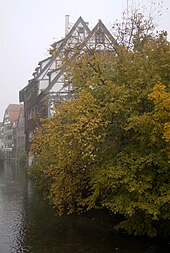
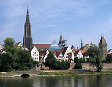
In Ulm , the blue flows past the former factory premises of the commercial vehicle manufacturers Magirus-Deutz and Kässbohrer , and the blue channel also runs back into this industrial area. In the Blaupark it then divides into two arms: Little Blue and Big Blue , both of which cross under the B 10 . Since the middle section of the Kleine Blau in the area of the main train station had to give way to the Citybahnhof project, it was led through a canal into the Große Blau , which then passes under the Ulm main station . After the main train station, the Kobelgraben branches off to the right from the Große Blau , which flows into the Danube next to the railway bridge. Small blue and large blue then branch out again and flow through the Ulm fishing district at a distance of a few meters . The Kleine Blau is finally triturated again and introduced into the Große Blau, which flows into the Danube on the left just a stone's throw from the northwest .
Catchment area
The catchment area of the Blau covers 488 km², of which the catchment areas of its two large tributaries Ach and Kleine Lauter each contribute over a third. It extends on the left in a north-westerly direction from the Ach – Blau water axis for about 20 kilometers to the Römerstein near Donnstetten . Measured by this, the valleys that flow from the Alb plateau on this side have very short bodies of water; they begin as dry valleys, if they do not even remain completely waterless up to the Ach-Blau valley axis. The right watershed, however, is nowhere even five kilometers away.
Competitors beyond the boundaries of the catchment area are the Neckar tributary Fils in the north ; here the watershed is therefore also part of the European main watershed ; in the northeast the Brenz running to the downstream Danube ; in the east and south the Danube itself: in the south-west the Schmiech moving towards the upward Danube ; in the north-west the Erms and (Lenninger) Lauter running back to the Neckar behind the main watershed .
Tributaries
The list is taken from the source to the estuary. As far as they are available, lengths and catchment areas have been given.
- Oh , from the right in Blaubeuren , 10.2 km and 168.3 km². The above-ground catchment area of the Blau itself has only 0.2 km² so far.
- Arnegger Talgraben , from the right at Blaustein - Arnegg , 4.9 km and 11.8 km².
- Kleine Lauter , from the left through Blaustein- Herrlingen across from Blaustein-Klingenstein, 5.9 km and 183.9 km².
- Weiherbach , from the left like the previous one, 0.9 km and 35.8 km².
- Lixgraben, from the right from Klingenstein, 0.8 km.
- → (exit of the blue channel), to the right below Klingenstein
- Wiesentalgraben, from the right in Ulm -Söflingen into the right Blue Canal, 4.1 km.
- Krautgartenbläule, from the right of the Blaukanal into the Blau opposite Ulm- Eselsberg , 0.7 km.
- Geiselstetter Bach, on the lower reaches of the Roter Bach , from the right in Söflingen into the Blue Canal, 2.3 km.
- ← (return of the blue channel), from the right, 4.3 km.
- → (Departure of the Little Blue), to the left, 2.1 km. From here on the blue itself is called Big Blue .
- → (exit of the Kobelgraben), to the right. After 0.6 km it flows into the Danube on the southwest edge of Ulm's old town.
- ← (Return of the Kleine Blau), from the left a few steps before the mouth of the Große Blau , 2.1 km. Big blue is hardly longer here.
River history
The valley of the Blau was formed by the original Danube. When the Swabian Alb rose in the course of the unfolding of the Alps , the original Danube initially dug deeper and deeper into the rock until it finally looked for a bed further south. The Hochstrasse was separated from the rest of the Alb. In the upward southern section of the valley, the Schmiech flows in the opposite direction to the Urdonau to Ehingen to the Danube.
Tourism
Sport climbing area
The Blautal offers good sport climbing opportunities and is one of the interesting climbing areas in the Swabian Alb. Routes are set up for almost all levels of difficulty. These routes and the rocks that have been approved for them are described in numerous publications. Nature conservation regulations limit climbing activities to certain months of the year.
water sports
The Blau is a delightful canoe and paddle boat water . From its confluence, it is a continuation of the Ach . From Blaubeuren to Klingenstein there is a traffic restriction for individual riders between March 1st and June 30th each year to protect the waterfowl, including Stand Up Paddling (SUP). These can obtain special permits from the nature conservation authority of the Alb-Donau district in Ulm. Official permission must be obtained all year round for organized trips, commercial rentals and all events.
Individual evidence
State Institute for the Environment Baden-Württemberg (LUBW)
Official online waterway map with a suitable section and the layers used here: Course and catchment area of the Blau
General introduction without default settings and layers: State Institute for the Environment Baden-Württemberg (LUBW) ( notes )
- ↑ Height according to the blue lettering on the background layer topographic map .
- ↑ a b Length according to the waterway network layer ( AWGN ) .
- ↑ Catchment area after the layer aggregated areas 04 .
- ↑ Catchment area according to the basic catchment area layer (AWGN) .
Other evidence
- ^ Hans Graul : Geographical land survey: The natural space units on sheet 179 Ulm. Federal Institute for Regional Studies, Bad Godesberg 1952. → Online map (PDF; 4.8 MB)
- ^ Deutsches Gewässerkundliches Jahrbuch Danube region 2006, Bavarian State Office for the Environment, p. 108, accessed on October 4, 2017, at: bestellen.bayern.de (PDF, German, 24.2 MB).
- ↑ Hans Bahlow: Germany's geographical world of names - Etymological lexicon of river and place names of old European origin.
- ↑ Laying of the small blue completed , in Südwest Presse , 2013.
- ↑ Ulm Paddler - Blue
- ↑ Paddling ( memento of December 24, 2013 in the Internet Archive ) at Naturschutz A – Z , Alb-Donau-Kreis
literature
- Topographic map 1: 25,000 Baden-Württemberg, as a single sheet:
- for the watercourse: No. 7524 Blaubeuren, No. 7525 Ulm Northwest, No. 7624 Schelklingen, No. 7625 Ulm Southwest
- For the rest of the catchment area: No. 7423 Wiesensteig, No. 7424 Deggingen, No. 7425 Lonsee, No. 7523 Münsingen, No. 7623 Mehrstetten
- Johannes Baier: About the tertiary education in the Ulm area. In: Documenta Naturae. 168, 1-32; Munich, 2008. ISBN 978-3-86544-168-3 .
- Johannes Baier: The geology of the Ulm area - Documenta Naturae, 173, 1–44; Munich, 2009. ISBN 978-3-86544-173-7 .
- Blautal - climbing in the Ach and Blautal around Blaubeuren, ed. by Andreas Buck, Albrecht Lonhardt and Walter Klein, Panico Alpinverlag, Köngen 2007, 7th edition, ISBN 978-3-926807-53-3 .

