
Koror (island)
| Koror | ||
|---|---|---|
 |
||
| Waters | Pacific Ocean | |
| Archipelago | Palau Islands | |
| Geographical location | 7 ° 20 '39 " N , 134 ° 28' 53" E | |
|
||
| length | 3.6 km | |
| width | 1.9 km | |
| surface | 7.8 km² | |
| Highest elevation | 100 m | |
| Residents | 13,000 (2000) 1667 inhabitants / km² |
|
| main place | Koror (city) | |
 |
||

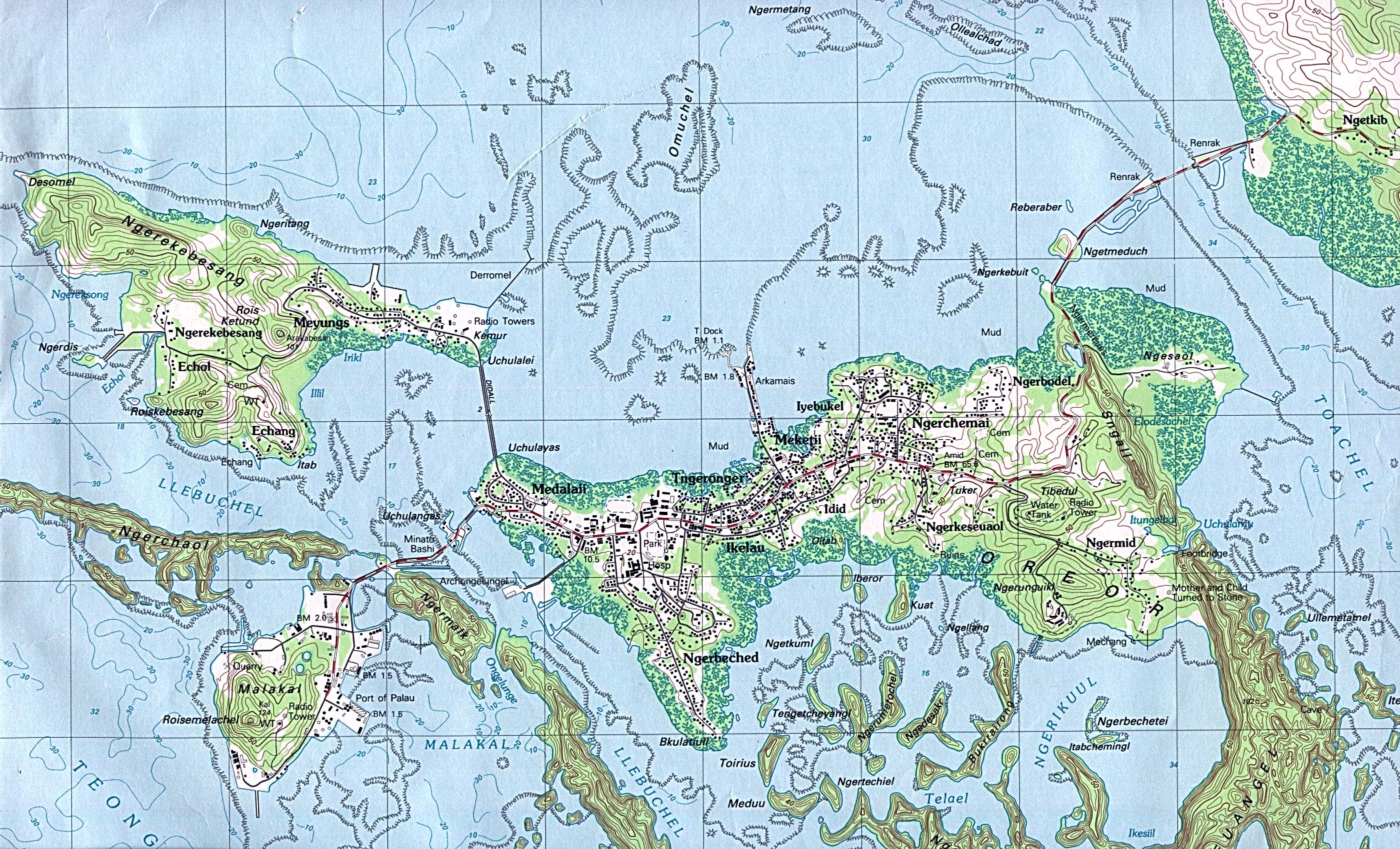
Koror , also called Oreor , is an island in the western Pacific Ocean ; geographically it belongs to the Palau Islands , politically to the island republic of Palau .
geography
The approximately 8 km² island is of volcanic origin and is located in the Palau state of the same name, Koror , about 7 kilometers southwest of Babeldaob . On the west coast is the city of Koror , the largest town on the island and the capital of Palau until 2006. This is now Ngerulmud , located on the east coast of the neighboring island of Babeldaob.
Koror is connected to the islands of Arakabesan , Malakal and Babeldaob by bridges.
tourism
In 2014, Koror was called at by cruise ships from time to time .
Web links
Islands: Angaur | Arakabesan | Babeldaob | Dmasech | Dongosaro | Express Malk | Fanna | Helen Island | Kayangel | Koror | Malacal | Merir | Ngercheu | Ngeriungs | Peleliu | Pulo Anna | Tobi | Ulebsechel
Archipelagos: Palau Islands | Chelbacheb | Iberor | Kayangel | Mecherchar | Ngemelis | Ngeroi | Ngerukeuid | Sonsorol | Ulebsechel | Ulong | Urukthapel | ( Southwest Islands ) | ( Helen Reef )