Ladeburg (Gommern)
|
Ladeburg
City of Gommern
|
|
|---|---|
| Coordinates: 52 ° 4 ′ 57 ″ N , 11 ° 56 ′ 13 ″ E | |
| Height : | 84 m above sea level NHN |
| Area : | 14.68 km² |
| Residents : | 249 (December 31, 2017) |
| Population density : | 17 inhabitants / km² |
| Incorporation : | January 1, 2005 |
| Postal code : | 39279 |
| Area code : | 039241 |
Location of Ladeburg in Saxony-Anhalt |
Ladeburg (with the postal addition "bei Zerbst") is a district of the city of Gommern in the district of Jerichower Land in Saxony-Anhalt , Germany.
geography
Ladeburg is about seven kilometers as the crow flies east of the city center of Gommern, a small town east of the state capital Magdeburg . Since there is no direct road connection, the real distance between the two places is eleven kilometers. Landstrasse 60 connects Ladeburg with its direct neighbors Leitzkau in the south (here connection to federal road 184 to Gommern) and Möckern in the north. The village, which is surrounded by agricultural land with above-average soil values for the area, is located on the western slope of the Fläming , which here still reaches heights between 70 and 80 meters.
In terms of natural space , the place belongs to the Zerbster Land , an arable, open cultural landscape and 536 km² main unit of the superordinate main unit group of the Fläming in the north German lowlands . The Zerbster Land forms the southwestern roof of the Fläming to the Elbe and belongs to the catchment area of this river.
history
The first documentary mention of Ladeburg happened in 1139 by Bishop Wigger of Brandenburg. In this document, he designated Ladeburg as a donation for the newly founded Premonstratensian monastery in Leitzkau, along with two other villages. A church as a branch of Leitzkau is first mentioned in 1187.
In 1564, Ladeburg became the property of the Hilmar von Münchhausen family , who also built a manor here. During the Thirty Years War , imperial troops under General Hatzfeld crossed the place and caused severe damage. Famine and plague subsequently led to a considerable decimation of the population.
In 1782, Ladeburg, now under Prussian rule, had 358 inhabitants. The main line of business was agriculture on over 290 hectares of arable and meadow land belonging to the place, which reached as far as the Elbe . In 1806 Ladeburg was occupied by Napoleon I's troops and had to pay high contributions for billeting.
When after the defeat of Napoleon Prussia in 1815 its district administration reformed, Ladeburg was assigned to the district of Jerichow I with the district town of Burg . In 1853 numerous houses and the church fell victim to a major fire. Since the newly built modern traffic routes did not directly touch the place, the industrialization of the 19th century had no influence. Only a connection to the small railway line Gommern - Groß Lübars took place in 1903. At that time Ladeburg had 487 inhabitants.
After the end of the Second World War , the manor was expropriated by the land reform ordered by the Soviet occupying power and his property was distributed among new farmers. With the GDR territorial reform, Ladeburg now became part of the Burg district, and from 1953 on, collective agriculture was introduced in the form of an LPG . The rail connection to Gommern was discontinued in 1960. In 1964, 562 inhabitants were registered in Ladeburg.
After the GDR era, the infrastructure in Ladeburg in particular was improved, and streets and sidewalks were paved with contemporary paving. The public buildings as well as the municipal administration and the church were renovated. On January 1, 2005, Ladeburg was incorporated into the city of Gommern.
politics
In addition to the city council of Gommern, the seven-member local council takes care of the special concerns of Ladeburg. Manfred Marwitz, who has been in charge of the town since 1989, is the honorary mayor of the town.
Attractions
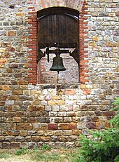
The village's sights include the Ladeburg village church within the village and the Ladeburg memorial stone to the battle at Möckern in 1813 just outside the village towards Vehlitz .
Individual evidence
- ^ City of Gommern - residents' registration office (ed.): Population figures for the unit municipality of Gommern - as of December 31, 2017 . January 28, 2019.
- ↑ Map services of the Federal Agency for Nature Conservation ( information )
- ↑ StBA: Changes in the municipalities in Germany, see 2005


