List of rivers in Niger
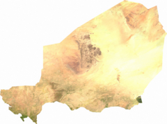
This is a list of the rivers in Niger . The state of Niger drains over two catchment areas: that of the Niger and that of Lake Chad . However, the state of Niger hardly contributes to either of the catchment areas. In large parts of the country, rainfall is less than 200 mm. Many river beds only carry water for a short time a year, if at all, and mostly do not reach Lake Chad or Niger.
The largest catchment area is that of the Azawagh with the Dallol Bosso as its estuary. It extends as a system of wadis across the Aïr mountains in Niger, Hoggar in Algeria and Adrar des Ifoghas in Mali as a border and drained the Ullemmeden basin at more humid times .
Niger
Dallol Bosso
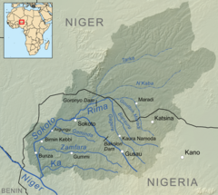
Sokoto (via Rima )
Further Niger tributaries
Lake Chad
Komadougou Yobé
Other Lake Chad tributaries
Catchment area distribution of the country in percent
| Catchment area | Square kilometre | Percent of the country's area |
|---|---|---|
| Niger | 563,939 | 44.5 |
| Lake Chad | 703.061 | 55.5 |
| total | 1,267,000 | 100 |
Individual evidence
- ^ The Niger River basin. FAO Land and Water Development Division, accessed July 3, 2019 .


