List of listed objects in Bernhardsthal
The list of listed objects in Bernhardsthal contains the 23 listed , immovable objects of the municipality of Bernhardsthal .
Monuments
| photo | monument | Location | description | Metadata |
|---|---|---|---|---|

|
Rectory ObjectID: 9301 |
Hauptstrasse 64 KG location : Bernhardsthal |
The rectory on the main street was originally surrounded by the cemetery wall. |
ObjectID: 9301 Status: § 2a Status of the BDA list: 2020-02-29 Name: Pfarrhof GstNr .: 291/1 Pfarrhof Bernhardsthal |

|
Shrine Object ID: 100243 |
diagonally across from Bernhardsthal 122 KG location : Bernhardsthal |
The late Gothic beveled pillar has a pyramid top from the first half of the 16th century. |
ObjectID : 100243 Status: § 2a Status of the BDA list: 2020-02-29 Name: Bildstock GstNr .: 3704/1 |

|
Shrine Object ID: 9306 |
at Hauptstrasse 282, KG location : Bernhardsthal |
The wayside shrine dates from the 18th century. |
ObjectID : 9306 Status: § 2a Status of the BDA list: 2020-02-29 Name: Bildstock GstNr .: 187/1 Bildstock Hauptstraße, Bernhardsthal |

|
Local desert of Ödenkirchen ObjectID : 129048 |
Ödenkirchen location KG: Bernhardsthal |
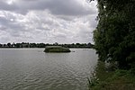
The Ortswüstung Ödenkirchen is under the waters of the Bernhard Thaler pond . The forecast has it that here the first church and the oldest district of Bernhardsthal have found. |
ObjectID : 129048 Status : Notification Status of the BDA list: 2020-02-29 Name: Ortswüstung Ödenkirchen GstNr .: 395 |

|
St. Martha Monastery ObjectID: 9304 |
Schulstrasse 60 KG location : Bernhardsthal |
The St. Martha monastery was built in 1925 and consecrated in 1926. |
ObjectID: 9304 Status: § 2a Status of the BDA list: 2020-02-29 Name: Kloster St. Martha GstNr .: 286 Kloster Sankt Martha (Bernhardsthal) |

|
Barrows Bernhardsthal ObjectID : 17887 |
Wehrlehen location KG: Bernhardsthal |
The three barrows date from the Hallstatt period (800 - 400 BC). In the northernmost hill there was a Slavic reburial around 800-900 AD . |
ObjectID : 17887 Status : Notification Status of the BDA list: 2020-02-29 Name: Hügelgräber Bernhardsthal GstNr .: 2028; 2031; 2032; 2035/2; 2035/3; 2036/1; 2036/2; 2036/3; 2039 Tumuli in Bernhardsthal |

|
Corridor / path chapel ObjectID : 100246 |
KG location : Bernhardsthal |
The chapel with an eight-sided floor plan was built around 1900. |
ObjectID : 100246 Status: § 2a Status of the BDA list: 2020-02-29 Name: Flur- / Wegkapelle GstNr .: 401 Wegkapelle, Bernhardsthal |

|
Figure shrine St. Johannes Nepomuk ObjectID: 9303 |
KG location : Bernhardsthal |
The statue from 1716 stands on the road to Reintal. |
ObjectID: 9303 Status: § 2a Status of the BDA list: 2020-02-29 Name: Figurine picture stick hl. Johannes Nepomuk GstNr .: 907 Statue John of Nepomuk, Bernhardsthal |

|
Figure shrine St. Johannes Nepomuk ObjectID: 9305 |
KG location : Bernhardsthal |
To the north of the church is a statue of John Nepomuk from 1729 . |
ObjectID: 9305 Status: § 2a Status of the BDA list: 2020-02-29 Name: Figurine picture stick hl. Johannes Nepomuk GstNr .: 295 Nepomuk Berhardsthal Church |

|
Catholic parish church hl. Aegydius with gate wall ObjectID: 9300 |
KG location : Bernhardsthal |
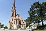
The oldest, Romanesque core includes the 12th century nave . The church, which was rebuilt and expanded several times, was given a baroque style in 1684 . Its late baroque furnishings were supplemented in the 19th century, for example the Aegydius altarpiece by Ludwig Mayer from 1856. |
ObjectID: 9300 Status: § 2a Status of the BDA list: 2020-02-29 Name: Catholic parish church hl. Aegydius with gate wall GstNr .: 295 Saint Giles Church (Bernhardsthal) |

|
Latène Age burial ground and prehistoric settlement Flur Kohlfahrt Weidl ObjektID : 130197 since 2014 |
KG location : Bernhardsthal |
On the Ried Kohlfahrt in the 1930s Richard Pittioni came across a grave from the Latène period while researching a Slavic burial ground (best known find: the "Bernhardsthaler Lead Cross") . Further finds from this era came to light in later excavations, including several skeletons, a children's grave and various grave goods. |
ObjektID : 130197 Status : Notification Status of the BDA list: 2020-02-29 Name: Laténe period burial ground and prehistoric settlement Flur Kohlfahrt Weidl GstNr .: 1606/2; 1606/4 |

|
Rectory including enclosure ObjektID : 9309 |
Hauptstrasse 73 KG location : Katzelsdorf |
The rectory built at the end of the 18th century was rebuilt by Karl Weinbrenner at the end of the 19th century . |
ObjectID : 9309 Status: § 2a Status of the BDA list: 2020-02-29 Name: Rectory including enclosure GstNr .: 154; 153/1; 153/2 Rectory in Katzelsdorf |

|
Catholic parish church hl. Bartholomäus ObjectID: 9308 |
Hauptstrasse 73a KG location : Katzelsdorf |
The neo-Romanesque - neo-Gothic church was built from 1905 to 1908 according to plans by the architect Karl Weinbrenner . |
ObjectID: 9308 Status: § 2a Status of the BDA list: 2020-02-29 Name: Catholic parish church hl. Bartholomäus GstNr .: 191/1 Parish Church Katzelsdorf |

|
Shrine Object ID: 100252 |
diagonally across from Hametweg 240 KG location : Katzelsdorf |
The pentagonal wayside shrine represents the fourteen helpers in need. |
ObjektID : 100252 Status: § 2a Status of the BDA list: 2020-02-29 Name: Bildstock GstNr .: 372/2 Bildstock Hametweg, Katzelsdorf (Bernhardsthal) |

|
Shrine Object ID: 100251 |
at house Marterberg 154, KG location : Katzelsdorf |
The pillar dates from the 16th or 17th century. Inside is a wooden group of figures from around 1870, depicting a merciful brother who shows a sick person the way to the hospital in Feldsberg . |
ObjectID : 100251 Status: § 2a Status of the BDA list: 2020-02-29 Name: Bildstock GstNr .: 3170/1 Bildstock Marterberg, Katzelsdorf (Bernhardsthal) |

|
Christian cemetery ObjectID : 107574 |
Marterberg 82 KG location : Katzelsdorf |
The cemetery was inaugurated on September 16, 1838. The laying out room was erected by Karl Weinbrenner in the first half of the 19th century, the cemetery cross in 1885 and the gate building, which was opened on four sides . |
ObjectID : 107574 Status: § 2a Status of the BDA list: 2020-02-29 Name: Friedhof christlich GstNr .: 2055/1; 2055/2 Katzelsdorf cemetery |

|
Wayside shrine ObjectID: 9310 |
Center of KG location : Katzelsdorf |
The late Gothic Floriani Column, which was renewed at the end of the 19th century , was erected according to the inscription on the base in 1296, which probably means 1496. |
ObjectID: 9310 Status: § 2a Status of the BDA list: 2020-02-29 Name: wayside shrine GstNr .: 3169/1 |

|
Wayside shrine eighth cross ObjectID : 100250 |
KG location : Katzelsdorf |
The pentagonal wayside shrine shows Pope Urban I (wine saint ) as well as the ice saints Pankraz, Servaz, Bonifaz and the Sopherl. It was built in the second half of the 18th century. |
ObjectID : 100250 Status: § 2a Status of the BDA list: 2020-02-29 Name: wayside shrine Achtelkreuz GstNr .: 3193/1 |

|
So-called. Rosary Park ObjectID : 107573 |
KG location : Katzelsdorf |
The Rosary Park was laid out and completed by Karl Weinbrenner in 1888 , and the opening took place in 1893. |
ObjectID : 107573 Status: § 2a Status of the BDA list: 2020-02-29 Name: Sog. Rosenkranzpark GstNr .: 191/2 Rosenkranzpark Katzelsdorf |

|
Figure shrine St. Johannes Nepomuk ObjectID : 9312 |
opposite Lundenburgerstrasse 251 KG location : Reinthal |
This sandstone statue was erected as a "Nepomuk" statue in the Pfarrgasse in front of the rectory. When a new statue was purchased in 1911, it was given its current location on the main street next to the old armory . During the renovation in 1993, the academic painter Albert Haller determined, based on the iconographic depiction, that the stone in his right hand was the stoning of St. Stephen acts. So St. Johannes Nepomuk to St. Stephen. In 2010, a request to Sister M. Imelda Ruf OSB, Nepomuk expert of the Archdiocese of Vienna, clearly stated that this is unmistakably St. Nepomuk acts, the only thing missing is the cross in his left hand, which was reconstructed in 1993.
The star wreath with the 5 stars is a clear indication that this is St. John of Nepomuk acts. |
ObjectID : 9312 Status: § 2a Status of the BDA list: 2020-02-29 Name: Figurine picture stick hl. Stephanus GstNr .: 2851/1 Statue of John of Nepomuk in Reintal |

|
Catholic Parish Church of the Most Holy Trinity and Cemetery ObjectID : 9311 |
Reintal 138a KG location : Reinthal |
The church was originally a plague chapel from 1689, which was rebuilt in 1728 and 1789/1790. In 1837 the presbytery was enlarged and raised . The cemetery adjoins the church to the northeast. |
ObjektID : 9311 Status: § 2a Status of the BDA list: 2020-02-29 Name: Catholic parish church of the Holy Trinity and Cemetery GstNr .: 349; 348 |

|
Wayside shrine ObjectID: 9313 |
north of Reintal KG location : Reinthal |
The Marterl on the Ackerberg was renovated in 2008. |
ObjectID: 9313 Status: § 2a Status of the BDA list: 2020-02-29 Name: Bildstock GstNr .: 1255/3 |

|
Figure shrine St. Johannes Nepomuk ObjectID : 100262 |
KG location : Reinthal |
According to the inscription, the wayside shrine was dedicated in 1911. |
ObjectID : 100262 Status: § 2a Status of the BDA list: 2020-02-29 Name: Figurine picture stick hl. Johannes Nepomuk GstNr .: 2851/1 |
literature
- DEHIO Lower Austria north of the Danube . Schroll, Vienna 1990, ISBN 3-7031-0652-2 .
Web links
Commons : Listed objects in Bernhardsthal - collection of images, videos and audio files
- Small monuments in Bernhardsthal. Retrieved February 8, 2013 .
- Small monuments in Katzelsdorf. Retrieved February 8, 2013 .
- Small monuments in Reintal. Retrieved February 8, 2013 .
Individual evidence
- ↑ a b Lower Austria - immovable and archaeological monuments under monument protection. (PDF), ( CSV ). Federal Monuments Office , as of February 14, 2020.
- ↑ Johannes-Wolfgang Neugebauer : Weir systems, ramparts, mansions and other fortifications and burial mounds from prehistoric times, the Middle Ages and the early modern times in the political district of Mistelbach . Austrian Working Group for Prehistory and Protohistory , Vienna 1979, DNB 945696132 , p. 14 .
- ↑ On the excavation in the large pond Bernhardsthal, Sept / Oct 2008
- ^ Monastery of Saint Martha. In: bernhardsthal.gv.at. Retrieved September 24, 2019 .
- ↑ Friedel Stratjel: Latène - grave yard at the bull meadow. (PDF; 1.2 MB) In: Contributions to the history of Bernhardsthal and the surrounding area. Museum Bernhardstal, 2013, accessed on March 24, 2020 .
- ↑ Spangl Kathi shrine (on Ackersberg). In: Hiking trails around Bernhardsthal. Dieter Friedl, accessed on February 22, 2014 .
- ↑ § 2a Monument Protection Act in the legal information system of the Republic of Austria .
