List of listed objects in Neuhofen an der Krems
The list of listed objects in Neuhofen an der Krems contains the 13 listed , immovable objects in the municipality of Neuhofen an der Krems in Upper Austria ( Linz-Land district ).
Monuments
| photo | monument | Location | description | Metadata |
|---|---|---|---|---|

|
Obermühle ObjectID : 98912 |
Piberbacher Austraße 1 KG location : fishing |
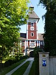
The historic mill has been a listed building since 2008. The well-preserved complex consists of the mill and residential wing, as well as a wooden barn and the weir system. |
ObjectID : 98912 Status : Notification Status of the BDA list: 2020-02-29 Name: Obermühle GstNr .: 7/1; 7/3; 596 |

|
Shrine Object ID: 98874 |
Steyrerstraße 22 KG location : Gries |
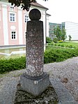
The wayside shrine in Steyrerstraße consists of a Tuscan column on a base with a square floor plan and a tabernacle top. The helmet of the tower carries a stone ball. In the picture niches are the pictures of St. Florian, Martin, Michael and probably St. Barbara. The wayside shrine dates from the first half of the 18th century. |
ObjectID : 98874 Status: § 2a Status of the BDA list: 2020-02-29 Name: Bildstock GstNr .: 11/2 Bildstock Steyrerstraße, Neuhofen an der Krems |

|
Memorial column to the peasant war of 1626 ObjectID : 98871 |
Steyrerstraße 24 KG location : Gries |
On August 17, 1626, there was a skirmish between rebellious peasants and the imperial troops. The pillar erected in 1976 commemorates the battle that was devastating for the farmers. |
ObjectID : 98871 Status: § 2a Status of the BDA list: 2020-02-29 Name: Memorial column to the peasant war of 1626 GstNr .: 1 |

|
State care and care center Schloss Gschwendt ObjectID : 59164 |
Steyrerstraße 24 KG location : Gries |
Only two mighty buildings are left of the former large moated castle of the 16th and 17th centuries. |
ObjectID : 59164 Status: § 2a Status of the BDA list: 2020-02-29 Name: State care and care center Schloss Gschwendt GstNr .: 1 Schloss Gschwendt |

|
Figure shrine St. Johannes Nepomuk ObjectID : 98899 |
KG location : Gries |
The figure shrine stands near the right abutment of the Krems Bridge. Stylistically, the sculpture can be classified in the middle to the third quarter of the 18th century. The current state of 2012 corresponds to a renovation in the middle of the 20th century. |
ObjectID : 98899 Status: § 2a Status of the BDA list: 2020-02-29 Name: Figurine picture stick hl. Johannes Nepomuk GstNr .: 99/2 |

|
Plague Column ObjectID : 98900 |
Hainbergstrasse location KG: Neuhofen an der Krems |
The Tuscan column stands on a pedestal with a square cross-section. In the niches of the tabernacle-shaped top, three saints and a view of the former citizens' hospital are painted on metal panels. The representation of the citizen hospital is marked with the year 1700. On the helmet there is a patriarchal cross with shamrock ends. |
ObjectID : 98900 Status: § 2a Status of the BDA list: 2020-02-29 Name: Plague column GstNr .: 77 |

|
Parsonage Object ID: 59163 |
Kirchenplatz 2 KG location : Neuhofen an der Krems |
The two-storey building with the appearance of the 17th century has windows with bezel frames and squared corners. In the divided gable above the entrance is a small niche with a statue of the Virgin Mary. |
ObjectID : 59163 Status: § 2a Status of the BDA list: 2020-02-29 Name: Pfarrhof GstNr .: .13 / 1 |

|
Fountain ObjectID : 98901 |
Marktplatz location KG: Neuhofen an der Krems |
In 1609 Georg von Diendorf had the market well with the four water pipes ("Röhrlbrunnen") built. The octagonal fountain has an octagonal central pillar crowned by a ball. |
ObjectID : 98901 Status: § 2a Status of the BDA list: 2020-02-29 Name: Brunnen GstNr .: 256/5 |

|
Marian column ObjectID : 98902 |
Marktplatz location KG: Neuhofen an der Krems |
The granite column with a figure of Maria Immaculata is surrounded by a stone balustrade. Gebhard Leopold Gapp had the monument built in 1713 as thanks for the extensive sparing of the market from the plague. |
ObjectID : 98902 Status: § 2a Status of the BDA list: 2020-02-29 Name: Mariensäule GstNr .: 256/5 |

|
Catholic parish church hl. Matthew ObjectID : 59162 |
KG location : Neuhofen an der Krems |
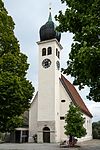
The small church with an older, presumably Romanesque single-nave nave with four bays and lancet barrel vaults. The retracted Gothic choir has two yokes with ribbed vaults and a five-eighth end. The tower with an onion helmet from 1658 stands west of the nave. In the north between the church and the rectory, a new parish church was built from 1968 to 1970, which is connected to the old church and the rectory. |
ObjectID : 59162 Status: § 2a Status of the BDA list: 2020-02-29 Name: Catholic parish church hl. Matthäus GstNr .: .14 Catholic parish church hl. Matthäus, Neuhofen an der Krems |

|
Cemetery including cemetery chapel ObjectID : 48855 |
KG location : Neuhofen an der Krems |
The cemetery was moved from the church to the northern outskirts as early as 1765. In the cemetery wall there are two entrances with partly expressive wrought iron gates. The cemetery chapel in the middle was only built in 1913. |
ObjectID : 48855 Status: § 2a Status of the BDA list: 2020-02-29 Name: Cemetery including cemetery chapel GstNr .: 76; 80/2; 80/3; 80/4; 85/2 Neuhofen an der Krems cemetery |

|
Weißenberg Castle ObjectID : 38406 |
Weißenberg 1 KG location : Weißenberg |
The first buildings were already in the 12th century. But around 1573 the castle was almost entirely rebuilt. It was then rebuilt several times by the beginning of the 21st century and in 1803 the fortifications were removed. The inner courtyard is shaped like an irregular pentagon. A walled-in Roman stone and a niche with a baroque wooden statue of St. Florian . |
ObjectID : 38406 Status : Notification Status of the BDA list: 2020-02-29 Name: Schloss Weißenberg GstNr .: .89 Schloss Weißenberg |

|
Volkersdorferkreuz ObjectID : 41295 |
KG location : Weißenberg |
A border or votive cross made of red marble, which today stands directly on federal highway 139. It was made towards the end of the 15th century. The inscription says: "The vol-geporn-Hasher-Volker-storff der-da.Kreuz-mach las." |
ObjectID : 41295 Status : Notification Status of the BDA list: 2020-02-29 Name: Volkersdorferkreuz GstNr .: 743 |
Individual evidence
- ↑ a b c d e f g h i Protected monuments in Neuhofen (PDF; 3.9 MB). Website of the market town of Neuhofen an der Krems. Official announcement: Gemeinde Info March / April 2009, page 14. Accessed March 7, 2012
- ^ A b Erwin Hainisch (edited by Kurt Woisetschläger): Dehio Upper Austria, Dehio-Handbuch, Die Kunstdenkmäler Österreichs. Upper Austria ; ed. from the Institute for Austrian Art Research of the Federal Monuments Office, 6th edition, Vienna 1977, page 210
- ^ Ada Paul: Steinkreuze and Kreuzsteine in Oberösterreich , in: Oberösterreichische Heimatblätter, 33rd year (1979), issue 1/2, page 97, online (PDF) in the forum OoeGeschichte.at
- ^ Upper Austria - immovable and archaeological monuments under monument protection. (PDF), ( CSV ). Federal Monuments Office , as of February 18, 2020.
- ↑ § 2a Monument Protection Act in the legal information system of the Republic of Austria .
Web links
Commons : Listed objects in Neuhofen an der Krems - collection of images, videos and audio files
