List of bridges in Hamburg / H
H
| photo | Name, brief description | use | (First) construction | District, location |
|---|---|---|---|---|

|
Hachmann Bridge leads over the Roßkanal in the course of Hachmannstrasse . Hachmannstrasse is named after the former mayor Gerhard Hachmann . The bridge is a listed building. |
Street |
Steinwerder ( 53 ° 31 ′ 14 ″ N, 9 ° 57 ′ 10 ″ E ) |
|

|
Neck bridge The Halskestrasse crosses the tidal channel over the Halskebrücke . It is named after the inventor and entrepreneur Johann Georg Halske . |
Street |
Billbrook ( 53 ° 31 ′ 34 ″ N, 10 ° 4 ′ 25 ″ E ) |
|

|
Hammer stone dam bridge The bridge leads the Hammer Steindamm over the tracks of the S-Bahn and the Hamburg-Lübeck railway line and also provides access to the Hasselbrook train station . |
Street | 1856 |
Eilbek ( 53 ° 33 ′ 54 ″ N, 10 ° 3 ′ 27 ″ E ) |

|
Hanover Bridge Hannoversche Straße is the connection between Harburg train station and the Süderelbe. It gave the Hanover Bridge its name. |
Street |
Harburg ( 53 ° 27 ′ 30 ″ N, 9 ° 59 ′ 23 ″ E ) |
|

|
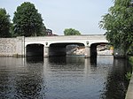
Hansabrücke The Dessauer Straße leads over the Hansabrücke over a branch canal between the Hansahafen - after which the bridge is named - and the Saale harbor. |
Street |
Kleiner Grasbrook ( 53 ° 31 ′ 28 ″ N, 10 ° 0 ′ 33 ″ E ) |
|
|
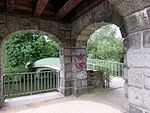
Hasenberg Bridge Bridge built by Hamburg's chief construction director Fritz Schumann, over which the “Am Hasenberge” road crosses the Alster. The bridge is a listed building. |
Street | 1913 |
Ohlsdorf ( 53 ° 37 ′ 22 ″ N, 10 ° 1 ′ 42 ″ E ) |
|
Hayn's Park Bridge This pedestrian bridge between the Alster and the Eppendorfer Mühlenteich connects Hayns Park with the park on the Meenkwiese. |
Footpath | 1956 |
Eppendorf ( 53 ° 35 ′ 48 ″ N, 9 ° 59 ′ 22 ″ E ) |

|
Hebebrand Bridge (H730) This bridge leads Hebebrandstraße over S-Bahn tracks in the Barmbek-Nord district . |
Street | 1973/74 |
Winterhude , Barmbek-Nord ( 53 ° 36 ′ 27 ″ N, 10 ° 1 ′ 57 ″ E ) |

|
Heerwegbrücke (H772) This bridge crosses the A25 between Holtenklinke and the Eschenhof settlement. |
Street |
Bergedorf , Curslack ( 53 ° 28 ′ 33 ″ N, 10 ° 14 ′ 24 ″ E ) |
|

|
Heiligengeist Bridge (H266) This bridge was designed and built by Franz Andreas Meyer and is a listed building. |
Street | 1883/1885 |
Hamburg-Altstadt , Neustadt ( 53 ° 32 ′ 56 ″ N, 9 ° 59 ′ 10 ″ E ) |

|
Heilwig Bridge Arched bridge built by Hamburg's chief construction director Fritz Schumacher, over which Heilwigstrasse crosses the Isebek Canal. |
Street | 1925-1926 |
Harvestehude ( 53 ° 35 ′ 5 ″ N, 9 ° 59 ′ 38 ″ E ) |

|
Heinrich Stubbe Bridge A reinforced concrete bridge that leads the Heinrich-Stubbe-Weg over the Neuengammer collecting ditch. |
Street | 1966 |
Neuengamme , Kirchwerder ( 53 ° 25 ′ 10 ″ N, 10 ° 12 ′ 8 ″ E ) |

|
Heinz-Gärtner-Bridge (H860) Pedestrian bridge that leads over the Osterbek Canal at Johannes-Prassek-Park . The bridge is named after the social democrat and resistance fighter Heinz Gärtner . |
Footpath | 2013 |
Hamburg-Winterhude , Barmbek-Süd ( 53 ° 35 ′ 0 ″ N, 10 ° 1 ′ 30 ″ E ) |

|
Hellbrookstrasse Bridge This bridge leads Hellbrookstrasse in the Hamburg district of Barmbek-Nord over the Barmbek branch canal. The bridge is a listed building. |
Street | 1913 |
Winterhude , Barmbek-Nord ( 53 ° 35 ′ 27 ″ N, 10 ° 2 ′ 2 ″ E ) |

|
Herbert Weichmann Bridge The bridge, like the road over it, is named after the Hamburg mayor Herbert Weichmann . It leads over the Uhlenhorster Canal . The bridge is a listed building. |
Street |
Uhlenhorst ( 53 ° 34 ′ 22 ″ N, 10 ° 0 ′ 48 ″ E ) |
|

|
Hermann Keesenberg Bridge (H827) With this bridge, Neuenfelder Straße crosses the railway tracks south of the Wilhelmsburg S-Bahn station. It is named after a Wilhelmsburg local historian. |
Street |
Wilhelmsburg ( 53 ° 29 ′ 49 ″ N, 10 ° 0 ′ 21 ″ E ) |
|

|
Herrengrabenbrücke This bridge is named after the street Herrengraben, whose name goes back to a ditch in which in the 16th century. Mayors and councilors had fishing rights. The bridge is a listed building. |
Street |
Neustadt ( 53 ° 32 ′ 54 ″ N, 9 ° 59 ′ 2 ″ E ) |
|

|
Hindenburgbrücke Over the Hindenburgbrücke - formerly "Borgwegbrücke" - the Hindenburgstrasse crosses the Alster between the Skagerrak Canal and the Braband Canal . |
Street |
Alsterdorf ( 53 ° 36 ′ 43 ″ N, 10 ° 0 ′ 35 ″ E ) |
|

|
Elevated road bridge This bridge leads the Hamburger Hochstrasse over the Pepermölenbek . |
Street |
Altona old town ( 53 ° 32 ′ 51 ″ N, 9 ° 57 ′ 14 ″ E ) |
|

|
Hofwegbrücke The bridge, classified as a cultural monument, is named after the Hofweg that leads over it. The Uhlenhorster Canal meets the Hofweg Canal under the Hofweg Bridge . |
Street |
Uhlenhorst ( 53 ° 34 ′ 23 ″ N, 10 ° 0 ′ 55 ″ E ) |
|

|
Hogrevestieg Bridge A pedestrian bridge over which the Hogrevestieg crosses the Wandse shortly after the Holzmühlenteich. |
Footpath |
Wandsbek ( 53 ° 34 ′ 40 ″ N, 10 ° 4 ′ 38 ″ E ) |
|

|
High Bridge (H539) The Hohe Brücke bridges the Nikolaifleet between Kajen and Bei dem Neuen Krahn. The bridge is a listed building. |
Street | since the 13th century |
Hamburg old town ( 53 ° 32 ′ 42 ″ N, 9 ° 59 ′ 15 ″ E ) |

|
Hoheluftbrücke The Hoheluftbrücke connects the districts of Grindel and Hoheluft. |
Street | first in 1884, today's bridge in 1962/63 |
Harvestehude ( 53 ° 34 ′ 43 ″ N, 9 ° 58 ′ 34 ″ E ) |

|
Hohenfeld Bridge This bridge leads the streets An der Alster and Mundsburger Damm over the Hohenfelder Bay. The bridge is a listed building. |
Street |
Hohenfelde ( 53 ° 33 ′ 47 ″ N, 10 ° 0 ′ 58 ″ E ) |
|

|
Dutch brookfleet bridge The bridge is named after the Dutch Brook Street. It leads over the Holländischbrookfleet. The bridge is a listed building. |
Street |
HafenCity ( 53 ° 32 ′ 43 ″ N, 9 ° 59 ′ 59 ″ E ) |
|

|
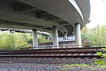
Holstenhofweg Bridge With this bridge, the Holstenhofweg crosses railway tracks in Jenfeld. |
Street |
Jenfeld , Tonndorf ( 53 ° 34 ′ 33 ″ N, 10 ° 6 ′ 13 ″ E ) |
|
|
Holstenkamp Bridge The bridge is named after the Holstenkamp and crosses train tracks north of the Diebsteich station. |
Street |
Stellingen ( 53 ° 34 ′ 25 ″ N, 9 ° 55 ′ 54 ″ E ) |
|

|
Holtenklinker Bridge In the vicinity of the Holtenklinke settlement, this bridge leads the Curslacker Heerweg over the Brookwetterung . |
Street |
Bergedorf , Curslack ( 53 ° 28 ′ 38 ″ N, 10 ° 14 ′ 27 ″ E ) |
|
|
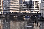
Wooden bridge (H606) A stone three-arch bridge that was built by Johann Hermann Maack after the great fire . The bridge leads over Nikolaifleet and is a listed building. |
Street | 1846/47 |
Hamburg Old Town ( 53 ° 32 ′ 48 ″ N, 9 ° 59 ′ 21 ″ E ) |

|
Holzhafen bascule bridge This bridge connects Konsul-Ritter-Straße and Lotsekai. The bridge is a listed building. |
Street | 1930 |
Heimfeld ( 53 ° 28 ′ 8 ″ N, 9 ° 58 ′ 51 ″ E ) |

|
Holzmühlenstrasse bridge This bridge runs between Walddörferstrasse and Wandsbeker Zollstrasse over the Wandse . |
Street |
Wandsbek ( 53 ° 34 ′ 43 ″ N, 10 ° 4 ′ 54 ″ E ) |
|

|
Hop cart bridge With this bridge the street crosses the Wandse at the Hopfenkarre . |
Street |
Wandsbek ( 53 ° 34 ′ 50 ″ N, 10 ° 5 ′ 42 ″ E ) |
|

|
Horner Wegbrücke A reinforced concrete bridge over the tracks of the freight bypass between Hamburg-Hamm and -Horn . |
Street |
Hamm , Horn ( 53 ° 33 ′ 20 ″ N, 10 ° 4 ′ 3 ″ E ) |
|
|
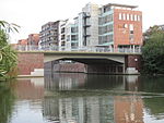
Hufnerstrasse Bridge This bridge is named after Hufnerstraße, which crosses the Osterbek Canal with this bridge . |
Street |
Barmbek-Süd , Barmbek-Nord ( 53 ° 35 ′ 6 ″ N, 10 ° 2 ′ 32 ″ E ) |
|

|
Humboldt Bridge A pedestrian bridge that extends south of Humboldtstrasse over Oberaltenallee and Hamburger Strasse to the Hamburger Meile shopping center. |
Footpath |
Uhlenhorst ( 53 ° 34 ′ 16 ″ N, 10 ° 1 ′ 45 ″ E ) |