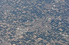
Lugo (Emilia-Romagna)
| Lugo | ||
|---|---|---|

|
|
|
| Country | Italy | |
| region | Emilia-Romagna | |
| province | Ravenna (RA) | |
| Local name | Lugh | |
| Coordinates | 44 ° 25 ′ N , 11 ° 55 ′ E | |
| height | 15 m slm | |
| surface | 116 km² | |
| Residents | 32,287 (Dec. 31, 2019) | |
| Population density | 278 inhabitants / km² | |
| Post Code | 48022 | |
| prefix | 0545 | |
| ISTAT number | 039012 | |
| Popular name | lughesi | |
| Patron saint | Sant'Illaro (May 15) | |
| Website | www.comune.lugo.ra.it | |
Lugo (formerly Lugo di Romagna) is a municipality in the province of Ravenna with 32,287 inhabitants (as of December 31, 2019) in the Italian region of Emilia-Romagna .
It is in the northwest of the fertile plain between the Santerno and Senio rivers that surrounds Ravenna .
The districts are: Ascensione, Belricetto, Bizzuno, Cà di Lugo, Campanile, Chiesanuova, Ciribella, Giovecca, Passogatto, San Bernardino, San Lorenzo, Santa Maria in Fabriago, San Potito, Villa San Martino, Viola, Voltana and Zagonara.
The neighboring municipalities are: Alfonsine , Bagnacavallo , Bagnara di Romagna , Conselice , Cotignola , Fusignano , Massa Lombarda , Mordano ( BO ) and Sant'Agata sul Santerno .
Lugo is a center of fruit growing.
history
Lugo was first mentioned in 782 by Pope Hadrian I to Charlemagne .
Events
Every Wednesday one of the largest markets in Italy with over 600 vendors takes place in the late 18th century Pavaglione and its surroundings.
sons and daughters of the town
- Francesco Bertazzoli (1754–1830), clergyman, bishop and cardinal
- Giuseppe Compagnoni (1754–1833), proposed today's Italian flag to the Cisalpine Parliament in 1797
- Giuseppe Decavanti (1779–1825), opera singer in Dresden
- Gregorio Ricci-Curbastro (1853–1925), mathematician
- Francesco Baracca (1888–1918), the most successful Italian fighter pilot of the First World War
- Fabio Taglioni (1920–2001), motorcycle designer
- Ermes Muccinelli (1927–1994), football player
- Teodoro Zeccoli (1929–2018), automobile racing driver
- Eugenio Dal Corso (* 1939), religious, bishop emeritus of Benguela and cardinal
- Angela Ricci Lucchi (1942–2018), documentary and experimental filmmaker
- Mario Lega (* 1949), motorcycle racer
- Paolo Ravaglia (* 1959), clarinetist
- Pierluigi Martini (* 1961), Formula 1 racing driver
- Cristian Gasperoni (* 1970), racing cyclist
- Mirko Valdifiori (* 1986), football player
Web links
Individual evidence
- ↑ Statistiche demografiche ISTAT. Monthly population statistics of the Istituto Nazionale di Statistica , as of December 31 of 2019.


