Madison Heights (Michigan)
| Madison Heights | ||
|---|---|---|
|
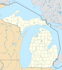
Location in Michigan
|
||
| Basic data | ||
| Foundation : | 1955 | |
| State : | United States | |
| State : | Michigan | |
| County : | Oakland County | |
| Coordinates : | 42 ° 29 ′ N , 83 ° 6 ′ W | |
| Time zone : | Eastern ( UTC − 5 / −4 ) | |
| Residents : | 31.101 (as of: 2000) | |
| Population density : | 1,681.1 inhabitants per km 2 | |
| Area : | 18.5 km 2 (about 7 mi 2 ) of which 18.5 km 2 (about 7 mi 2 ) is land |
|
| Height : | 193 m | |
| Postal code : | 48071 | |
| Area code : | +1 248 | |
| FIPS : | 26-50560 | |
| GNIS ID : | 0631311 | |
| Website : | www.madison-heights.org | |
| Mayor : | Edward C. Swanson | |
Madison Heights is a city in Oakland County in the US state of Michigan . The city is a suburb of Detroit . According to the 2000 census, the population was 31,101.
geography
According to the United States Census Bureau , the city has a land area of 18.5 square kilometers and no body of water.
history
Originally the city was part of Royal Oak . By a referendum on January 17, 1955, it was decided to register Madison Heights as an independent city. On December 6 of the same year, Madison Height became the tenth city in southern Oakland County.
At the time, the 18.6 square kilometer city was one of Detroit's largest suburban communities. The first town hall was located at 26305 John R Road, the location of the former community offices. On April 5, 1963, a new municipal building was erected at its present location at 300 West Thirteen Mile Road. The city lies in the corridor between I-696 and I-75 and has two elementary school districts, Lamphere and Madison, and an independent city council.
economy
Madison Heights is part of Oakland County Automation Alley. There are more than 1,300 commercial and industrial companies and services in the city. In addition to a majority of small companies, more than 100 large companies have settled within its borders, such as Best Buy, Coca Cola, Commercial Steel Treating Corporation, Costco, CVS Pharmacy, Henkel Technologies, Home Depot, Kmart, Meijer, Micro Center, Ogura Corporation, Sam's Club, Hungry Howie's, Target, and UPS. The city has 23 shopping centers, 11 hotels, more than 80,000 square meters of office space and seven industrial parks with an area of 900,000 square meters.
Demographic data
According to the 2000 census, the population was 31,101 people who lived in 13,299 households and 8,005 families in the city. The population density was 1,677.1 per square kilometer. There were 13,623 housing units, at an average density of 734.6 units per square kilometer.
In 26.9% of the 13,299 households there were children under the age of 18, 45.2% were married couples living together, 10.5% had a female head of the household without a husband and 39.8% were non-families. 33.8% of all households were single households and there were people living in 12.3% who were 65 years of age or older. The average household size was 2.33 and the average family size was 3.02 people.
The city population was 22.1% under the age of 18, 8.1% were 18 to 24, 35.4% were 25 to 44, 20.2% were 45 to 64, and 14.2% were 65 years or older older. The median age was 36 years. For every 100 females there were 95.8 males. For every 100 women aged 18 and over, there were 92.9 men.
The median income for a household in the city was 42,326 US dollars , and the median income for a family was 51,364 US dollars. Males had a median income of $ 41,478 compared to $ 29,345 for women. The city's per capita income was $ 21,429. Over 7% of families and 8.9% of the population were below the poverty line, including 10.8% under 18 years of age and 13% of the age group 65 years or older.
sons and daughters of the town
- Kendra Lust (* 1978), American porn actress of French-Canadian-Italian origin
