
Lindenhof (Mannheim)
|
Lindenhof
City of Mannheim
|
|
|---|---|
 |
|
| Area : | 2.34 km² |
| Residents : | 13,148 (Dec. 31, 2015) |
| Population density : | 5,619 inhabitants / km² |
| Postal code : | 68163 |
Lindenhof is an urban district and district of Mannheim in the Rhine-Neckar triangle located immediately south of the city center on the Rhine .
location

Lindenhof has an almost triangular shape. In the north and northeast, beyond the main train station and the railway line, the Mannheim city center and Schwetzingerstadt border, and in the south the Niederfeld and the Almenhof . The western border is formed by the Rhine with Ludwigshafen on the opposite bank.
history

In 1353 the construction of the Zollburg Eichelsheim began on the Rhine . This was expanded in the following years and also officially monitored the Rhine. Between 1416 and 1419 sat the antipope John XXIII. on Eichelsheim as a prisoner. In 1633 Eichelsheim was captured by the Swedes and then largely blown up. Five years later the castle was rebuilt. In 1688 the castle was completely destroyed as part of the Palatinate War of Succession. Today there is only a memorial stone at the point on the Rhine. The castle was located on today's Stephanienufer , which was named after Napoleon's adopted daughter and wife of Grand Duke Karl von Baden , Stéphanie de Beauharnais . As a resident of Mannheim Palace, she campaigned for the redesign of the palace gardens and the banks of the Rhine.
In the 18th and 19th centuries, agricultural goods with changing names were created south of the city near the Rhine, partly on the site of the former Eichelsheim Castle. The street names Rennershofstrasse and Gontardstrasse are a reminder of this. A little further from the Rhine and connected to the city via a direct route was the “Lindenhof”, which ultimately gave the district its name.
From 1870 Lindenhof experienced a strong industrial development. At the end of what is now Rennershofstrasse, a starch factory was operated near the Rhine. The chemical factory Lindenhof Weyl & Co. was located in the area of today's Meeräckerplatz. In 1879 the Lindenhof gas works went into operation. The “Aktiengesellschaft Mannheimer Ölfabrik”, later “Verein deutscher Oelfabriken” (VDO, today Bunge Germany ) on Bonadies Island, was located between the main train station and today's Gontardstrasse. In the east of the district, the agricultural machinery manufacturer Lanz established itself from 1888, which was taken over by John Deere in 1956 and is now the largest tractor factory in Europe.
Lindenhof soon developed into a middle-class residential area. After Johann Friedrich Engelhorn had acquired large estates in 1890, the streets on Gontard's estate began to be filled at the end of 1891. Lindenhof then got its structure. This also resulted in the only Rhine front in Mannheim, where the youth hostel is located today. The residential development progressed from north to south and reached today's Emil-Heckel-Strasse around 1906. The Käfertal – Gontardplatz tram line has also been extended to this point via Windeckstraße and Waldparkstraße. The development of the southern Lindenhof in the Meerfeld and Meeräcker tubs began in 1910.
After Heinrich Lanz's death , the Lanz family donated the Heinrich Lanz Hospital to the city of Mannheim , which was built on Meerfeldstrasse and opened in 1907. Part of it was the Lanz Chapel. This was to be demolished together with the hospital in 1998 according to a decision by the state of Baden-Württemberg. A community of interests was formed which, with the support of some companies, mined the historical substance, a total of 170 tons of sandstone, and rebuilt it in another location in Lanz-Park in 2001. The Lanz Chapel has now become a meeting place.
In the Second World War , the district was extensively, 80 percent, destroyed. After the reconstruction, the street scene in the northern part is characterized by multi-storey residential complexes.
In September 2010 Lindenhof gave itself a district coat of arms. Before that he did not have a coat of arms.
The historical Lindenhof educational trail provides interesting information on the history of the Lindenhof with five information signs and 33 themed signs at relevant locations.
politics

Lindenhof is one of the six inner city districts. According to the main statute of the city of Mannheim, each city district has a district advisory council, which includes 12 residents who are appointed by the local council according to the results of the local council election. They are to be heard on important matters that affect the municipality and advise the local administration and committees of the municipal council.
| Political party | 2019 | 2014 | 2009 | 2004 | 1999 | 1994 |
|---|---|---|---|---|---|---|
| CDU | 2 | 3 | 4th | 5 | 6th | 5 |
| SPD | 2 | 3 | 3 | 4th | 4th | 4th |
| GREEN | 4th | 2 | 3 | 2 | 1 | 2 |
| Mannheim list | 1 | 1 | 1 | 1 | 1 | 1 |
| FDP | 1 | 1 | 1 | 0 | 0 | 0 |
| left | 1 | 1 | 0 | 0 | 0 | 0 |
| AfD | 0 | 1 | 0 | 0 | 0 | 0 |
The citizens' interest group BIG Lindenhof represents the interests of the citizens, manages the Lanz Chapel and organizes social events such as the annual Lanzpark Festival.
Culture and sights
The Mannheim youth hostel is located on the banks of the Rhine . The Stephanienufer promenade runs along the Rhine. In the further course of the forest park and Reissinsel follow . Landmarks of the district are the three towers of the Johanniskirche , the St. Josefskirche and the former water tower called "Lanzturm" on the grounds of John Deere. In the immediate vicinity is also the John Deere Forum, which offers visitors the opportunity to see modern and historic agricultural machinery up close. The district along the southern bypass is more modern, where the " Glückstein-Quartier " is a new urban district with apartments, services and commercial space.
South of the main station is the Victoria Tower as the most striking and at 97.5 m tallest structure in the district.
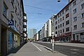
Meerfeldstrasse, in the background the Victoria Tower

John Deere water tower

Johanniskirche

St. Joseph Church


Club life is also very diverse. The largest Mannheim chess club is based here. The MFC 08 Lindenhof is the local football club. A canoe club, where, among other things, canoe polo is played, is also part of the Lindenhof district. Especially in summer, many Mannheimers come to the Rhine meadows to enjoy the sun and nature.
Economy and Infrastructure
The John Deere factory is located in the east of the district . The former Lanz plant houses the largest tractor factory in Europe as well as the company's headquarters for the region of Europe, Africa, the Near and Middle East. Since 2007, the John Deere Forum has also been a public exhibition hall on the northeast corner of the company premises.
RNV supplies local public transport with tram line 3 and a city bus line. The offer is supplemented by car sharing vehicles that are available at several car sharing stations in the district. There are connections to the RheinNeckar S-Bahn and long-distance trains to all of Europe via Mannheim's main train station in the north .
The new Glückstein Quarter is currently being built on the Südtangente ( B 36 ), an important main road that relieves the city center and connects the east of Mannheim with Ludwigshafen am Rhein . In this context, the southern bypass was relocated and has been running along the Deutsche Bahn AG tracks since 2013 . In addition, the connection to the southern bypass was redesigned to include the Neckarau crossing .
Separated from the city center by the railway, the district has been linked by a track underpass (Tunnelstrasse, popularly known as the Suez Canal ) since the 1870s . After a ramp was built between the main train station and the palace , the so-called "Beckebuckel" (after the then mayor Otto Beck ), the Lindenhof flyover was added in 1897. The southern ring road and the Neckarau crossing, which was last renewed in 2009, provide further connections to the north. The Lindenhof flyover was raised by 57 cm in 1956 to electrify the railway tracks below. In addition to the old overpass, a new structure was opened to road traffic in 1982 and the old bridge was removed in 1983. In 1995, when the tram B line was built, a second bridge for trams and road traffic towards the city center was built. Pedestrian traffic is also served by several underpasses and a transition over the eastern station tracks.

literature
- Wolf Engelen: Our Lindenhof . Mannheim 1996, ISBN 3-923003-75-7 .
Individual evidence
- ↑ City of Mannheim: Population 2015 in small-scale breakdown. (PDF 679 KB) Statistical data Mannheim № 1/2016. March 30, 2016, p. 5 ff. , Accessed on April 6, 2016 .
- ↑ First Mayor unveils the new Lindenhof district coat of arms , City of Mannheim, accessed September 14, 2010
- ↑ Experience history on site, the historical Lindenhof educational trail
- ^ Main statute of the city of Mannheim. (PDF 234 KB) VII. City districts and district councils, § 22. City of Mannheim, April 28, 2009, p. 10 , accessed on April 10, 2018 .
- ↑ SessionNet | City of Mannheim District Advisory Council Lindenhof. Retrieved November 5, 2019 .
- ^ City of Mannheim, Glücksteinquartier project: Südtangente released. (No longer available online.) December 13, 2012, archived from the original on December 18, 2014 ; accessed on May 22, 2014 . Info: The archive link was inserted automatically and has not yet been checked. Please check the original and archive link according to the instructions and then remove this notice.
Web links
- City of Mannheim: District life, Lindenhof. Retrieved October 27, 2014 .
- City of Mannheim: Statistical data 2015, Lindenhof. (PDF 204 KB) December 31, 2014, accessed on September 21, 2015 .
Almenhof | Caster field | Feudenheim | Franklin | Friedrichsfeld | Garden city | Herzogenried | Hochstätt | Downtown | Jungbusch | Käfertal-Mitte | Käfertal-Süd | Lindenhof | Luzenberg | Neckarau | Neckarstadt-Northeast | Neckarstadt-East | Neckarstadt-West | Neuhermsheim | Neuostheim | Niederfeld | Oststadt | Pfingstberg | Rheinau-Mitte | Rheinau-South | Sandhofen | Sandhofen-North | Schwetzingerstadt | Schönau-North | Schönau-Süd | Seckenheim | Sunshine | Speckweg area | Vogelstang | Waldhof-East | Waldhof-West | Wallstadt | Well situated