Bird rod
|
Bird rod
City of Mannheim
Coordinates: 49 ° 30 ′ 36 ″ N , 8 ° 32 ′ 22 ″ E
|
|
|---|---|
| Area : | 3.16 km² |
| Residents : | 12,728 (Dec. 31, 2015) |
| Population density : | 4,028 inhabitants / km² |
| Postal code : | 68309 |
| Area code : | 0621 |
Vogelstang is a district and at the same time an urban district of Mannheim . The large housing estate was laid out according to plan in the 1960s.
geography
Vogelstang is located in the eastern part of Mannheim. In the west the district borders on Käfertal , in the east the district borders on Wallstadt . In the south there is a former quarry pond that serves as a local recreation area. In the northeast is the Viernheimer Kreuz and the city of Viernheim ( Hessen ) with the Rhein-Neckar-Zentrum .
10,000 years ago, a loop of the Neckar ran south of today's residential development, roughly level with the lakes . The larger part of the area belonged to Wallstadt until it was incorporated, the smaller part to Käfertal. It was mostly managed by Käfertal farmers. Until the end they mainly grew special crops such as asparagus and tobacco.
history
Franconian graves were discovered as early as the 19th century . Later, when the Vogelstang settlement was being built, more than 5,000 objects from all historical periods since the Paleolithic were recovered.
From 1928 a small settlement was built that comprised around 40 houses by 1940. It was located in the north-west of today's district on the streets Auf der Vogelstang and Eberswalder Weg .
The starting point for planning the new district was the housing shortage that prevailed in Mannheim in the early 1960s. In 1964, more than 12,000 families and 2,000 individuals were considered to be looking for accommodation. From 1959 the city administration began to think about the creation of a new district. Mannheim's First Mayor Ludwig Ratzel was significantly involved in the planning and development of the Vogelstang. A large part of the project was implemented by GEWOG, a subsidiary of Neue Heimat , which put the total costs at 500 million Deutschmarks. The name "Vogelstang" was taken over from an old commercial or field name there .
The area between Käfertal and Wallstadt was developed on the basis of the very favorable location with a distance of 5 to 6 km to the city center , the simple connection to the infrastructure and no nuisance industry . It originally belonged to 400 property owners. The foundation stone was laid on September 10, 1964. Today the foundation stone is walled in in the skyscraper Geraer Ring 10. The loosened development ensured a comparatively low net housing density. The GFZ code is only half as large as in large housing estates built at the same time, such as Berlin-Gropiusstadt , Hamburg-Steilshoop and Heidelberg-Emmertsgrund . In addition, by creating social housing, condominiums and single-family houses, care was taken to ensure that the social mix corresponded to the conventional Mannheim districts.
The plan was to build 1,200 residential units per year, until after five years around 5,500 apartments could accommodate 20,000 people. At times the Vogelstang was considered the largest construction site in southern Germany. In the first construction phase, four-story buildings were built on Brandenburger Strasse and Auf der Vogelstang . On December 1, 1965, the first 76 families were able to move into their apartments. In 1968 the Neue Heimat invited to the Vogelstang topping-out ceremony. The mall opened a year later. At that time, 9,500 people were already living on the Vogelstang and the city districts of Friedrichsfeld and Wallstadt were outdated in terms of population. In December 1969, the tram route to the center of Mannheim was opened. In 1974 the city library branch and the indoor swimming pool were completed.
Because it was founded in the Mannheim district, the young district was never independent and therefore has no historical coat of arms. Following a suggestion from Neue Heimat and the Striffler architecture firm , the artist Emil Kiess designed an emblem with a stylized bird in 1969. It is used by the clubs and can be found on signs and flags.
Population development of the population entitled to live (including secondary residences):
| year | 1961 | 1969 | 1974 | 1989 | 1997 | 2006 |
|---|---|---|---|---|---|---|
| Residents | 215 | 9,500 | 18,000 | 14,650 | 13,864 | 13,554 |
Politics, administration
According to the main statute of the city of Mannheim, each city district has a district advisory council, which includes 12 residents who are appointed by the local council according to the results of the local council election. They are to be heard on important matters that affect the municipality and advise the local administration and committees of the municipal council.
| Political party | 2019 | 2014 | 2009 | 2004 | 1999 | 1994 |
|---|---|---|---|---|---|---|
| CDU | 3 | 5 | 5 | 6th | 7th | 4th |
| SPD | 3 | 5 | 5 | 5 | 5 | 6th |
| GREEN | 2 | 0 | 1 | 0 | 0 | 1 |
| Mannheim list | 1 | 1 | 1 | 1 | 1 | 0 |
| The left | 1 | 1 | - | - | - | - |
| Alternative for Germany | - | 1 | - | - | - | - |
As one of the eleven outer city districts, Vogelstang has a citizen service, in which city services such as vehicle registration, registration matters, parking permits, etc. are offered.
Culture and sights
Buildings
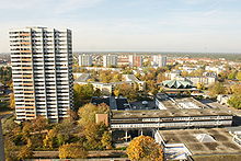
Of the 5,500 apartments, 15% were planned and built in low-rise buildings, 68% in medium-high buildings (four floors) and 16% in high-rise buildings. In the middle of the area, a shopping center was built according to a design by Helmut Striffler , around which he grouped three high-rise buildings, each with 198 apartments spread over 23 floors and a height of 70 meters. The Y-floor plan is characteristic of the four-story, medium-high buildings, which represent the focus of the development. With the help of landscape architects, generous open spaces and green spaces were created between the residential buildings.

Churches
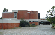
The Protestant and Catholic parishes initially used a wooden barrack as an emergency church from 1966 onwards. Two years later, Carlfried Mutschler completed the Protestant community center. The red clinkered, organic building deliberately stands out from the surrounding area and includes the parish and community center and kindergarten. The planned church and an old people's home were not realized for financial reasons.
The Catholic Twelve Apostles Church was built until 1969. In keeping with the times, an externally dominating bell tower was dispensed with. The church itself should be inviting to the people. The architecture contains ecclesiastical symbolism. The twelve- sided folding roof refers to the apostles . Seven portals lead into the church, which lead radially to the center of the altar. Inside, a 100 meter long twelve-apostle frieze spans the room.
leisure
The local recreation area provides the neighboring settlement areas Vogelstang, Wallstadt and Feudenheim with an interesting landscaped recreational area. The two Vogelstang lakes form the center of this area. The upper lake, about 1.70 m deep, is fed by a pump system from the lower lake. It is sealed by a layer of clay. The lower lake, about 5 m lower, is a former gravel pit and is considerably deeper. The lower lake is a groundwater lake. There is also a district sports facility, a riding stables, two allotment gardens and a tennis facility in this local recreation area. In addition, there is the SSV Vogelstang sports area in the immediate vicinity, with a soccer field and a beach volleyball facility.
Economy and Infrastructure
The shopping center is centrally located in the middle of the Vogelstang. A small commercial area is located east of the residential area.
traffic
The district center should be protected from through traffic, which is why main roads were built that are connected via peripheral roads. In addition, the access roads were structurally designed in the form of property driveways. The application to set the maximum speed at 30 km / h was rejected by the Karlsruhe Regional Council in 1969. Ten years later, some roads were regulated and a short time later 30 km / h zones were introduced across the board . In a nationwide comparison by the HUK Association in 1976, it was found that the number of accidents was only half as high as in settlements built at the same time.
In the west and east, bypass roads run past the Vogelstang. In the north, federal highway 38 leads into Mannheim city center on the one hand and establishes the motorway connection to the A 6 Frankfurt / Basel in the east .
The light rail line leading to Mannheim city center is operated by RNV .
education
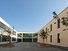
Initially, three elementary schools , an auxiliary school (later a special school) as well as a home economics school and a high school (later a secondary school and high school) were planned on the Vogelstang . Due to the influx of young families, rooms for elementary school students were first necessary, for which pavilions were set up. Following the educational reforms of the time, the city applied for the approval of an integrated comprehensive school . The Ministry of Education rejected this, but approved a cooperative comprehensive school . Today there is the Vogelstang elementary school, the school center of the Geschwister-Scholl-Schule, which includes the Hauptschule, Realschule and Gymnasium as well as a branch of the vocational Heinrich Lanz School. Parts of the film Parkour were shot at the Geschwister-Scholl-Schule .
Personalities
- Gerhard Widder (* 1940), politician (SPD), Lord Mayor of Mannheim from 1987 to 2003
- Uwe Ochsenknecht (* 1956 in Biblis, grew up in Mannheim), actor
- Oscar Ortega Sánchez (* 1962 in Lampertheim), actor
- Nina Kunzendorf (* 1971), actress
literature
- A new district for 20,000 people in the northeast of Mannheim: Vogelstang. Mannheim 1965.
- Heinz W. Krewinkel: Mannheim Vogelstang. Mannheim 1970.
- Non-profit citizens' association Mannheim-Vogelstang (Hrsg.): Mannheim-Vogelstang: a district chronicle. Mannheim 1993.
- Ludwig Ratzel, Walter Spannagel: Memories. Thorbecke, Sigmaringen 1993, ISBN 3-7995-0900-3 .
- Schwitalla, Johannes: Vogelstang. In: Werner Kallmeyer (Ed.): Communication in the city. Part 2: Ethnographies of Mannheim districts . Berlin, New York 1995, 189-343.
- Erich Gropengießer: A house plan from the urnfield time of Mannheim-Vogelstang. In: Preservation of monuments in Baden-Württemberg , 4th year 1975, issue 4, p. 167f. ( PDF; 8.7 MB )
Individual evidence
- ↑ City of Mannheim: Population 2015 in small-scale breakdown. (PDF 679 kB) Statistical data Mannheim № 1/2016. March 30, 2016, p. 5 ff. , Accessed on April 6, 2016 .
- ↑ Mannheimer Morgen, September 14, 1968
- ^ Dietmar Reinborn: Urban planning in the 19th and 20th centuries. Kohlhammer, Stuttgart 1996, ISBN 3-17-012547-8 .
- ↑ a b Main Statute of the City of Mannheim. (PDF 234 kB) VII. City districts and district councils, § 22. City of Mannheim, April 28, 2009, p. 10 , accessed on April 10, 2018 .
- ↑ SessionNet | City of Mannheim District Advisory Council Vogelstang. Retrieved November 6, 2019 .
- ↑ https://www.mannheim.de/de/service-bieten/buergerdienste/buergerservice/dienststellen-nach-stadtteil/vogelstang
- ↑ Twelve Apostles ( Memento of September 28, 2007 in the Internet Archive )
- ↑ Mannheimer Morgen of January 29, 1976
Web links
- City of Mannheim: District life, Vogelstang. Retrieved October 31, 2014 .
- City of Mannheim: Statistical data 2015, Vogelstang. (PDF 210 kB) December 31, 2014, accessed on September 21, 2015 .
- City of Mannheim: Vogelstang - past and present. (PDF 590 kB) City Points, Mannheim history on site. Retrieved May 19, 2018 .
- Abendschau - Vogelstang-Siedlung Mannheim (TV report from December 1, 1965) via ARD media library . Retrieved November 3, 2019.


