
Marbach LU
| LU is the abbreviation for the canton of Lucerne in Switzerland and is used to avoid confusion with other entries of the name Marbach . |
| Marbach | ||
|---|---|---|
 |
||
| State : |
|
|
| Canton : |
|
|
| Constituency : | Entlebuch | |
| Residential municipality : | Escholzmatt-Marbach | |
| Postal code : | 6196 | |
| former BFS no. : | 1006 | |
| Coordinates : | 635 185 / 189359 | |
| Height : | 871 m above sea level M. | |
| Area : | 45.10 km² | |
| Residents: | 1212 (December 31, 2012) | |
| Population density : | 27 inhabitants per km² | |
| Website: | www.marbach-lu.ch | |
| map | ||
|
||


Until December 31, 2012, Marbach was a political municipality in the Entlebuch district of the canton of Lucerne in Switzerland . On January 1, 2013, Escholzmatt merged with Marbach to form the new municipality of Escholzmatt-Marbach .
geography
The village of Marbach is located in southern Entlebuch in the Ilfis valley . The districts of Schärlig and Marbachegg also belong to the former municipality.
Marbach is the most south-westerly former municipality in the canton of Lucerne. The entire western and southern former municipal border is also the canton border between Lucerne and Bern.
The former community lies entirely in the hills and mountains and large areas are forested.
The southernmost point of the former community is at the Küblisbühl homestead. There the Bärselbach flows from the right into the Emme . The eastern border goes north along the Schrattenfluh ridge to Heidenloch ( 1936 m above sea level ). The highest peaks on this ridge are the Schybengütsch ( 2037 m above sea level ) and the Hengst ( 2092 m above sea level ). The source of the Ilfis is located a little to the north below the stallion . East of the Hexenschwand it unites with the Hilferenbach. At the Büfig homestead at the western end of the Hilferental, the Schonbach flows from the left into the Hilferen, which is called Ilfis again from this point on. At Wiggen the Ilfis turns from north to northwest and leaves the former community shortly before Kröschenbrunnen . The course of the Ilfis / Hilferen thus forms almost the entire eastern and northern border of the former municipality.
In addition to the mountains already mentioned above, the western foothills of this ridge are worth mentioning; the Lochsitenberg ( 1484 m above sea level ) near the Marbachegg district, the Hürndliegg ( 1597 m above sea level ) and the Steingrat between Marbach-Dorf and the Ilfis.
At the Wald farmstead in Schangnau, the Schonbach (formerly also called Marbach) rises south of the canton border, flows in a slightly northeastern direction and flows into the Ilfis. On its course, it crosses the village of Marbach, where the Steiglenbach flows into it from the right.
The highest elevations on the western former municipal boundary are the Rämisgummenhoger ( 1301 m above sea level ), the Pfyffer ( 1315 m above sea level ) and above all the Wachthubel ( 1415 m above sea level ). The Schärligbach rises on its northern slope, which - to the west of this - flows northwards parallel to the Ilfis. Before it joins the Ilfis west of Wiggen, it takes in the Kurzenbach.
Due to the rugged landscape, there are numerous districts, groups of houses and individual farms. The village of Marbach is five kilometers south of Wiggen on the Schallenbergstrasse (Luzern-Wiggen-Thun). The hamlets Moos (southwest) and Erlenmoos (northeast of the village) have now grown together with the village. With two exceptions, all of the larger settlements are located along Schallenbergstrasse. Only the districts of Marbachegg - which is on the same level and is connected to the village by a cable car - and Schärlig (on the Schärligbach ) are the exceptions. The hamlets of Färberhus and Schärligbad belong to Schärlig.
Of the entire community area, 47.4% is covered by forest and wood. 45.3% is used for agriculture, 4.7% is unproductive area and only 2.6% is settlement area.
Marbach bordered Escholzmatt in the north, Flühli in the east and the communities of Schangnau , Trub and Eggiwil in the canton of Bern in the south and west .
population
| Population development | |
|---|---|
| year | Residents |
| 1780 | 1,085 |
| 1798 | 1'524 |
| 1816 | 1,872 |
| 1837 | 2,004 |
| 1850 | 1,850 |
| 1860 | 1,673 |
| 1870 | 1,766 |
| 1900 | 1,491 |
| 1910 | 1'523 |
| 1980 | 1'160 |
| 2000 | 1,175 |
| 2004 | 1,227 |
| 2010 | 1,189 |
Between 1780 and 1837 the population almost doubled (1780–1837: +84.7%). After that, massive emigration began until 1980 (1837–1980: −42.1%). This development could only be stopped twice for a short time (1860/1870 and 1900/1910). Since 1980 the population has hovered around the 1,200 mark.
languages
The population uses a high Alemannic dialect as everyday language, which is more related to the neighboring Bernese dialects than to the dialect in the canton capital of Lucerne. In the last census in 2000, 97.79% said German, 0.60% Portuguese and 0.43% Serbo-Croatian as their main language.
religion
In earlier times all residents were members of the Roman Catholic Church. Strict adherence to "orthodoxy" was frequently checked by the ecclesiastical and secular authorities because of its proximity to the canton of Bern. Due to immigration, especially from the neighboring canton of Bern, the religious composition of the population has changed noticeably. Today (as of 2000) there are 73.11% Roman Catholic and 20.26% Evangelical Reformed Christians. In addition, there are still a few non-denominational people and Muslims (1.11 and 0.68%, respectively). Despite the large number of Reformed people, they have to use the Reformed church in Wiggen, as Marbach does not have a Protestant church. The chapel in Schärlig is also used by the Catholic community on special holidays.
Marbach is also a small place of pilgrimage , as the Mariengrotto is located here, which is dedicated to the grotto of the Blessed Virgin Mary of Lourdes . Numerous votive offerings testify to fulfilled wishes and there is also a clear source. There are also a few Muslims , Hindus and Sikhs living in the municipality of Marbach, but they have no religious institutions and have to use the mosques or temples in Lucerne or Bern .
Origin and nationality
Of the 1,204 inhabitants at the end of 2006, 1,190 were Swiss and only 14 (1.2%) were foreigners. At the last census, 97.11% (including dual citizens 97.62%) were Swiss citizens. The few foreigners come from Portugal, Serbia-Montenegro (Slavs), Sri Lanka, Macedonia, the Netherlands and Germany.
economy
The economy of Marbach is characterized by agriculture and alpine farming and increasingly also by tourism.
tourism
In Marbach there is a campsite, five restaurants with overnight accommodation and numerous holiday and second homes. The small skiing and hiking area includes a mountain railway and two ski lifts. Marbechegg is one of three places in Switzerland where grass skiing is still used. The Grass Ski World Championship was held in 2019 .
traffic
The place is not on any railway line. Marbach is connected to the Escholzmatt-Kemmeriboden post bus line. Escholzmatt has a train station on the Lucerne-Wolhusen-Bern line.
The former municipality is located on the road from Lucerne to Thun over the Schallenberg. All motorway connections are far away. The closest are Thun-Nord and Kiesen on the A6 .
history

Around 1290 Marbach came under the rule of the Habsburgs , while it had previously been owned by the Barons of Wolhusen. The lower jurisdiction exercised the Benedictine Abbey Trub for a long time . The village is first mentioned by name in the Habsburg land register in 1306 as Marpach . Because of the dependence on Habsburg bailiffs, the Entlebuch tried to buy itself out. The bailiff Peter von Thorberg in particular made himself unpopular with freedom-loving farmers. The Entlebuchers verburgrechted each other a first time in 1385 and a second time on March 13, 1396 with the city of Lucerne . With the exception of the communities of Escholzmatt and Marbach, the Entlebuch finally came under Lucerne rule in 1405. Marbach, Escholzmatt and Trub belonged to the Ranflüh district court. Since the city of Bern had acquired jurisdiction over the Ranflüh regional court in 1408, both Lucerne and Bern insisted on their right of ownership to Marbach. Both cities only settled their dispute with the Treaty of Complete Direction in 1470. Trub fell to Bern - Escholzmatt and Marbach to Entlebuch and thus to Lucerne. Until 1798, the latter communities formed the so-called upper Entlebuch. From 1798 to 1803 the community belonged to the district of Schüpfheim, since then to the then newly created Entlebuch office .
Attractions
In addition to the beautiful baroque church from the 18th century, the small center also has some beautiful houses in the typical pre-Alpine style. There is also a Way of the Cross that leads to a grotto of the Virgin Mary modeled on the holy site of Lourdes. The Marbachegg and the UNESCO - Biosphere Entlebuch - Schrattenfluh are attractive destinations.

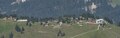
Marbach in Entlebuch

Church with rectory

Marbach's village center
Marbachegg from the Schrattenfluh


Personalities
- Albert Benz (1927–1988), composer and conductor
- Josef Haas (* 1937), cross-country skier
Web links
- Official website of the municipality of Escholzmatt-Marbach
- Community profile in the 2017 yearbook of the Canton of Lucerne (p. 364; PDF; 181 kB)
- Anton Kottmann: Marbach (LU). In: Historical Lexicon of Switzerland .
Individual evidence
- ↑ berbfex.ch: Marbachegg
- ↑ Braking is impossible at the Grasski World Championships on Marbachegg in Escholzmatt In: Luzerner Zeitung of August 10, 2019
Doppleschwand | Entlebuch | Escholzmatt-Marbach | Flühli | Hasle | Romoos | Schüpfheim | Werthenstein | Wolhusen
Former municipalities: Escholzmatt | Marbach | Chess | Wolhusen Market
Canton of Lucerne | Constituencies of the Canton of Lucerne | Municipalities of the Canton of Lucerne