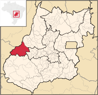
Northwest Goiás mesoregion
| Northwest Goiás mesoregion | |
|---|---|
| map | |
| Basic data | |
| State : |
|
| Administrative structure : | Midwest |
| State : |
|
| Mesoregion : | Northwest Goiás |
| Microregions : |
Aragarças |
| Number of municipalities: | 23 |
| Time zone : |
UTC -3 summer : UTC-2 |
| Area : | 55,841,200 km² |
| Residents : | 222,136 ( 2006 ) |
| Population density : | 4.0 inhabitants / km² |
| Telephone code : | +5562 |
Northwest Goiás ( port. : Norte Goiano ) was one of five as internal geostatistical mesoregions in the Brazilian state of Goiás from 1989 to 2017. She did not belong to the administrative units of Brazil and was in 2017 replaced by another regional division. It bordered in the west on the state of Mato Grosso , in the north on Tocantins and in Goiás on the mesoregions of North , Central and South Goiás and comprised 23 municipalities (port: municípios ), which were grouped in the three microregions :
The western border to the state of Mato Grosso was marked by the Rio Araguaia and from east to south by the Serra Dourada .


