Sao Miguel do Araguaia
| Sao Miguel do Araguaia | |
|---|---|
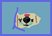
| coat of arms | flag |
| cards | |
| Basic data | |
| State : |
|
| Administrative structure : | Midwest |
| State : |
|
| Mesoregion : | Northwest Goiás |
| Microregion : | Sao Miguel do Araguaia |
| Geographic location : | 13 ° 17 ′ S , 50 ° 10 ′ W |
| Distance to Goiânia : | 486 km |
| Time zone : |
UTC −3 summer : UTC − 2 |
| Height : | 378 m above sea level NN |
| Area : | 6,144,380 km² |
| Residents : | 22,294 |
| Population density : | 3.6 inhabitants / km² |
| Telephone code : | +5562 |
| Post code ( CEP ): | 76590-000 |
| City administration address: | Av. José Pereira do Nascimento, 3851 |
| Official Website: | saomigueldoaraguaia.go.gov.br |
| E-mail address: | |
| Anniversary: | 14th November |
| Church planting: | 1958 |
| politics | |
| Mayor : | Ademir Cardoso dos Santos ( PP ), 2009–2012 |
| Vice Mayor: | Aderi Francisco Marques |
São Miguel do Araguaia is the northernmost political municipality in the Brazilian state of Goiás in the mesoregion of Northwest Goiás and in the microregion of the same name . It is located northwest of the Brazilian capital Brasília and almost 500 km north-northwest of the capital Goiânia .
The city got its name in honor of the Archangel Michael , the patron saint of the city and its location on the Rio Araguaia .
Economically significant in São Miguel do Araguaia are mainly cattle breeding , agriculture and, during the dry season (June, July), tourism in Luiz Alves along the banks of the Araguaia River (approx. 50 km west of São Miguel). During this time, the population of Luiz Alves increased from almost a thousand people to up to 30,000 and the low water level of the Rio Araguaia releases kilometers of white sandy beaches. Luiz Alvez has a natural runway for small aircraft and is the starting point of boats for visits to the downstream (north) Ilha do Bananal , the world's largest river island . At its northern end is the Parque Nacional do Araguaia and in the south a reserve for the Karajá and Javaés Indians.
About 15 km upstream from Luiz Alvez and south of the Crixás-Açu river is the Meandros do Rio Araguaia national nature reserve .
sons and daughters of the town
- Waldison Rodrigues de Souza (* 1984), football player
- Mahau Suguimati (* 1984), track and field athlete, Olympic hurdler
- Felipe Francisco Macedo (* 1994), football player
See also
Individual evidence
- ↑ SEPLAN: Road kilometers to Goiânia ( Memento from March 3, 2016 in the Internet Archive )
- ↑ Results of the 2010 census in Goiás (PDF; 29 kB), carried out by IBGE .


