Campestre de Goiás
| Campestre de Goiás | |
|---|---|
| coat of arms | flag |
| map | |
| Basic data | |
| State : |
|
| Administrative structure : | Midwest |
| State : |
|
| Mesoregion : | South Goiás (1989-2017) |
| Microregion : | Vale do Rio dos Bois (1989-2017) |
| Adjacent municipalities: | Santa Bárbara de Goiás , Trindade , Guapó , Palmeiras de Goiás |
| Distance to Goiânia : | 56 km |
| Geographic location : | 16 ° 46 ′ S , 49 ° 42 ′ W |
| Time zone : |
UTC -3 summer : UTC-2 |
| Height : | 651 m |
| Area : | 273.815 km² |
| Residents : | 3,387 (2010) |
| Population density : | 12.4 inhabitants / km² |
| Telephone code : | +55 62 |
| Post code (CEP): | 75385-000 |
| City administration address: | Pça. João Victor, s / n Setor Centro |
| Official Website: | |
| Anniversary: | October 29th |
| Church planting: | 1963 |
| politics | |
| Mayor : | Fabiano Queiroz Capuzzo ( PDT ), 2017–2020 |
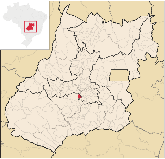
Campestre de Goiás , officially Portuguese Município de Campestre de Goiás , is a Brazilian political municipality in the state of Goiás . It is located southwest of the Brazilian capital Brasília and 54 km west of the capital Goiânia . The population was estimated on July 1, 2019 at 3630 inhabitants, who live in an area of 273.815 km².
Geographical location
Campestre de Goiás borders
- in the north to the municipalities of Santa Bárbara de Goiás
- to the east at Trindade
- to the south with Guapó
- to the west at Palmeiras de Goiás
economy
Agriculture and animal husbandry form the economic basis. Rice, corn, beans, cotton, okra pods and cassava are grown, as well as cattle and pigs. Bricks and tiles are also made.
Web links
- Citizen portal of the city prefecture
- City Council website
- História. In: gov.br. Prefeitura de Campestre de Goeás(Brazilian Portuguese).
Individual evidence
- ↑ SEPLAN: Road kilometers to Goiânia ( Memento from March 3, 2016 in the Internet Archive )
- ↑ a b Campestre de Goiás - Panorama. In: cidades.ibge.gov.br. IBGE , accessed September 17, 2019 (Brazilian Portuguese).
- ^ Fabiano Capuzzo 12 (Prefeito). In: todapolitica.com. Eleições 2016, accessed August 2, 2019 (Brazilian Portuguese).


