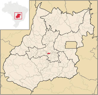
Caturaí
| Caturaí | |
|---|---|
| coat of arms | flag |
| map | |
| Basic data | |
| State : |
|
| Administrative structure : | Midwest |
| State : |
|
| Mesoregion : | Central Goiás (1987-2017) |
| Microregion : | Anápolis (1987-2017) |
| Adjacent municipalities: | Inhumas , Goianira , Trindade , Avelinópolis , Araçu |
| Distance to Goiânia : | 51 km |
| Geographic location : | 16 ° 27 ′ S , 49 ° 29 ′ W |
| Time zone : |
UTC –3 summer : UTC – 2 |
| Height : | 763 m |
| Area : | 207.154 km² |
| Residents : | 4686 (2010) |
| Population density : | 22.6 inhabitants / km² |
| Telephone code : | +5562 |
| Post code ( CEP ): | 75430-000 |
| City administration address: | Pça. 14 de November , 211 Setor Centro |
| Official Website: | caturai.go.gov.br |
| Anniversary: | 14th November |
| Church planting: | 1958 |
| politics | |
| Mayoress : | Divina Aparecida Zago ( PDT ), 2017-2020 |
| Vice Mayor: | |
Caturaí , officially Portuguese Município de Caturaí , is a small Brazilian political municipality in the state of Goiás . As of July 1, 2018, the population was estimated at 5038 inhabitants, who live in an area of around 205 km².
It is located west of the Brazilian capital Brasília and northwest of the capital Goiânia . Caturaí is 51 km away from the capital and belongs to the Goiânia metropolitan area .
Geographical location
Caturaí borders the municipalities:
- to the north at Inhumas
- from east to south on Goianira
- to the south at Trindade
- to the west with Avelinópolis
- to the northwest at Araçu
See also
- Municipalities in the microregion Anápolis (1987-2017)
- Mesoregions and microregions in Goiás (1987-2017)
Web links
- Website of the city prefecture , Prefeitura Municipal
Individual evidence
- ↑ Distances of the communities in Goiás to Goiânia ( Memento from March 3, 2016 in the Internet Archive )
- ↑ a b Caturaí - Panorama. In: cidades.ibge.gov.br. IBGE , accessed August 2, 2019 (Brazilian Portuguese).
- ↑ Caturaí - História. In: cidades.ibge.gov.br. IBGE , accessed August 2, 2019 (Brazilian Portuguese).
- ↑ Divina Zago 12 (Prefeita). In: todapolitica.com. Eleições 2016, accessed August 2, 2019 (Brazilian Portuguese).
- ↑ Região Metropolitana de Goiânia (Portuguese)


