Aruanã (Goiás)
| Aruanã | |||
|---|---|---|---|
| coat of arms | flag | ||
| There is no official flag | |||
| map | |||
|
|||
| Basic data | |||
| State : |
|
||
| Administrative structure : | Midwest | ||
| State : |
|
||
| Mesoregion : | Northwest Goiás | ||
| Microregion : | Río Vermelho (GO) | ||
| Geographic location : | 14 ° 56 ′ S , 51 ° 2 ′ W | ||
| Time zone : |
UTC -3 summer : UTC-2 |
||
| Height above d. M .: | 250 m above sea level NN | ||
| Area : | 3,050,303 km² | ||
| Residents : | 7.506 | ||
| Population density : | 2.5 inhabitants / km² | ||
| Telephone code : | +5562 | ||
| Post code ( CEP ): | 76270-000 | ||
| City administration address: | Prefeitura Pça. Couto Magalhães, 22 76710 - 000 Aruanã |
||
| Official Website: | www.aruana.go.gov.br | ||
| Anniversary day: | December 18th | ||
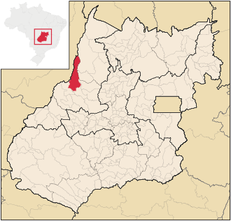
Aruanã , officially Município de Aruanã , is a small Brazilian political municipality in the state of Goiás in the mesoregion of Northwest Goiás and in the microregion of Rio Vermelho . It is located west-northwest of the Brazilian capital Brasília and northwest of the capital Goiânia .
Aruanã is located at the confluence of the Rio Vermelho into the Rio Araguaia . The name Aruanã refers to a fish characteristic of the region and a dance by the indigenous Karajá people , who still live on the banks of the Rio Araguaia today. In the mythology of the Tupi -Guarani Aruanã is the god of joy and protector of the Karajá.
Aruanã is a tourist place and an important producer of cattle .
See also
Web links
- IBGE Library: History of Aruanã (Portuguese; PDF; 10 kB)
- Brazil portal: Karajá
- Eco travel at uol.br (Portuguese)
- cidades.com.br (Portuguese)
Individual evidence
- ↑ First results of the 2010 census in Goiás (PDF; 30 kB), carried out by IBGE .


