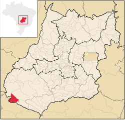
Chapadão do Céu
Chapadão do Céu is located 725 meters above sea level in the southwest of the Brazilian state of Goiás and is the closest access to the Emas National Park . Originally a small cattle breeding village, it now has 5,338 inhabitants (2006) on 2,354.8 km². Due to its proximity to the national park, it has meanwhile developed into a center of ecotourism . All households are connected to electricity, water and sewage.
Several waterfalls in front of and in the park (20–50 km away) attract tourists, the Salto do Rio Formoso , the Corredeira da Usina , the Cachoeira do Ivan Garcia , the Cachoeira da Prata , they offer opportunities for climbing and swimming. The 5 km long Canyon do Rio Sucuriu , also with waterfalls, is impressive .
Coordinates: 18 ° 24 ′ S , 52 ° 33 ′ W
