
Amaralina
| Município de Amaralina Amaralina |
|||
|---|---|---|---|
|
|||
| Coordinates | 13 ° 56 ′ S , 49 ° 18 ′ W | ||
 Location of Amaralina in the state of Goiás Location of Amaralina in the state of Goiás
|
|||
| founding | January 1, 1997 | ||
| Basic data | |||
| Country | Brazil | ||
| State | Goiás | ||
| ISO 3166-2 | BR-GO | ||
| Mesoregion | Norte Goiano (1989-2017) | ||
| Microregion | Porangatu (1989-2017) | ||
| structure | 1 multiple district | ||
| height | 55 m | ||
| surface | 1,343.2 km² | ||
| Residents | 3434 (2010) | ||
| density | 2.6 Ew. / km² | ||
| estimate | 3812 Ew. (July 1, 2019) | ||
| Parish code | IBGE : 5200829 | ||
| Time zone | UTC −3 | ||
| Website | amaralina.go (Brazilian Portuguese) | ||
| politics | |||
| City Prefect | Vandeilson Gonçalves Lima (2017-2020) | ||
| Political party | PSDB | ||
| economy | |||
| GDP | 51,044 thousand R $ 13,710 R $ per person (2016) |
||
| HDI | 0.609 (2013) | ||

Amaralina , officially Portuguese Município de Amaralina , is a small town in the north of the Brazilian state of Goiás . It is located in the ecoregion of the Cerrado . The distance to the capital Goiânia is 306 km.
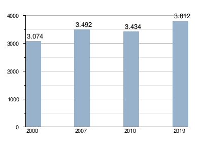
The municipality has an area of 1,343 km² according to the 2010 census 3434 inhabitants, the Amaralinese (Portuguese amaralinense ) are called. According to the IBGE's estimate on July 1, 2019, the population was 3812 Ew. increasingly appreciated. The population density is 2 to 3 people per km². It ranks 190th out of the 246 parishes of Goiás.
City administration
In the local elections in Brazil in 2016 , the previous city prefect (mayor) Vandeilson Gonçalves Lima from the Partido da Social Democracia Brasileira (PSDB) was re-elected for the term from 2017 to 2020 . The legislature lies with the Câmara Municipal, the city council.
Population development
Infrastructure and economy
With 18 other municipal cities , of which Niquelândia is the most important municipality in the neighborhood, Amaralina formed the statistical-geographical Microrregião de Porangatu (Microregion Porangatu) until 2017 . This microregion together with the Microrregião da Chapada dos Veadeiros formed the Mesorregião do Norte Goiano .
The GO-239 federal road runs from east to west , while the GO-151 runs north towards Porangatu .
The main occupations are agriculture and animal husbandry.
Web links
- City Prefecture website (Brazilian Portuguese)
Individual evidence
- ↑ a b c d IBGE : Cidades @ Goiás: Amaralina. Retrieved September 10, 2019 (Brazilian Portuguese).
- ^ Vandeilson 45 (Prefeito). In: com.br. Eleições 2016, accessed September 27, 2018 (Brazilian Portuguese).
Abadia de Goiás | Abadiânia | Acreúna | Adelândia | Água Fria de Goiás | Água Limpa | Águas Lindas de Goiás | Alexânia | Aloândia | Alto Horizonte | Alto Paraíso de Goiás | Alvorada do Norte | Amaralina | Americano do Brasil | Amorinópolis | Anápolis | Annexuera | Anicuns | Aparecida de Goiânia | Aparecida do Rio Doce | Aporé | Araçu | Aragarças | Aragoiânia | Araguapaz | Arenópolis | Aruanã | Aurilândia | Avelinópolis | Baliza | Barro Alto | Bela Vista de Goiás | Bom Jardim de Goiás | Bom Jesus de Goiás | Bonfinópolis | Bonópolis | Brazabrantes | Britânia | Buriti Alegre | Buriti de Goiás | Buritinópolis | Cabeceiras | Cachoeira Alta | Cachoeira de Goiás | Cachoeira Dourada | Caçu | Caiapônia | Caldas Novas | Caldazinha | Campestre de Goiás | Campinaçu | Campinorts | Campo Alegre de Goiás | Campo Limpo de Goiás | Campos Belos | Campos Verdes | Carmo do Rio Verde | Castelândia | Catalão | Caturaí | Cavalcante | Ceres | Cezarina | Chapadão do Céu | Cidade Ocidental | Cocalzinho de Goiás | Colinas do Sul | Córrego do Ouro | Corumbá de Goiás | Corumbaíba | Cristalina | Cristianópolis | Crixás | Cromínia | Cumari | Damianópolis | Damolândia | Davinópolis | Diorama | Divinópolis de Goiás | Doverlândia | Edealina | Edéia | Estrela do Norte | Faina | Fazenda Nova | Firminópolis | Flores de Goiás | Formosa | Gameleira de Goiás | Goianápolis | Goiandira | Goianésia | Goiânia | Goianira | Goiás Velho | Goiatuba | Gouvelândia | Guapó | Guaraíta | Guarani de Goiás | Guarinos | Heitoraí | Hidrolândia | Hidrolina | Iaciara | Inaciolândia | Indiara | Inhumas | Ipameri | Ipiranga de Goiás | Iporá | Israelândia | Itaberaí | Itaguari | Itaguaru | Itajá | Itapaci | Itapirapuã | Itapuranga | Itarumã | Itauçu | Itumbiara | Ivolândia | Jandaia | Jaraguá | Jataí | Jaupaci | Jesúpolis | Joviânia | Jussara | Lagoa Santa | Leopoldo de Bulhões | Luziânia | Mairipotaba | Mambaí | Mara Rosa | Marzagão | Matrinchã | Maurilândia | Mimoso de Goiás | Minaçu | Mineiros | Moiporá | Monte Alegre de Goiás | Montes Claros de Goiás | Montividiu | Montividiu do Norte | Morrinhos | Morro Agudo de Goiás | Mossâmedes | Mozarlândia | Mundo Novo | Mutunópolis | Nazario | Nerópolis | Niquelândia | Nova America | Nova Aurora | Nova Crixás | Nova Glória | Nova Iguaçu de Goiás | Nova Roma | Nova Veneza | Novo Brasil | Novo Gama | Novo Planalto | Orizona | Ouro Verde de Goiás | Ouvidor | Padre Bernardo | Palestina de Goiás | Palmeiras de Goiás | Palmelo | Palminópolis | Panamá | Paranaiguara | Paraúna | Perolândia | Petrolina de Goiás | Pilar de Goiás | Piracanjuba | Piranhas | Pirenópolis | Pires do Rio | Planaltina | Pontalina | Porangatu | Porteirão | Portelândia | Posse | Professor Jamil | Quirinópolis | Rialma | Rianápolis | Rio Quente | Rio Verde | Rubiataba | Sanclerlândia | Santa Bárbara de Goiás | Santa Cruz de Goiás | Santa Fe de Goiás | Santa Helena de Goiás | Santa Isabel | Santa Rita do Araguaia | Santa Rita do Novo Destino | Santa Rosa de Goiás | Santa Tereza de Goiás | Santa Terezinha de Goiás | Santo Antônio da Barra | Santo Antônio de Goiás | Santo Antônio do Descoberto | São Domingos | São Francisco de Goiás | São João d'Aliança | São João da Paraúna | São Luís de Montes Belos | São Luiz do Norte | São Miguel do Araguaia | São Miguel do Passa Quatro | São Patrício | São Simão | Senador Canedo | Serranópolis | Silvânia | Simolândia | Sítio d'Abadia | Taquaral de Goiás | Teresina de Goiás | Terezópolis de Goiás | Três Ranchos | Trindade | Trombas | Turvânia | Turvelândia | Uirapuru | Uruaçu | Uruana | Urutaí | Valparaíso de Goiás | Varjão | Vianópolis | Vicentinópolis | Vila Boa | Vila Propício