Santo Antonio do Descoberto
| Santo Antonio do Descoberto | |||
|---|---|---|---|
| coat of arms | flag | ||
| map | |||
|
|||
| Basic data | |||
| State : |
|
||
| Administrative structure : | Midwest | ||
| State : |
|
||
| Mesoregion : | East Goiás | ||
| Microregion : | Entorno de Brasília | ||
| Adjacent municipalities: | Águas Lindas de Goiás , Federal District , Novo Gama , Luziânia , Alexânia , Corumbá de Goiás , Cocalzinho de Goiás | ||
| Distance to Goiânia : | 179 km | ||
| Geographic location : | 15 ° 56 ′ S , 48 ° 15 ′ W | ||
| Time zone : |
UTC -3 summer : UTC-2 |
||
| Height : | 912 m above sea level NN | ||
| Area : | 938,309 km² | ||
| Residents : | 63.166 | ||
| Population density : | 67.3 inhabitants / km² | ||
| Telephone code : | +5561 | ||
| Post code ( CEP ): | 72900-000 | ||
| Address of the municipal administration: | |||
| Official Website: | |||
| E-mail address: | |||
| Anniversary: | |||
| Church planting: | |||
| politics | |||
| Mayor : | David Lei ( PR ), (2009–2012) | ||
| Vice Mayor: | |||
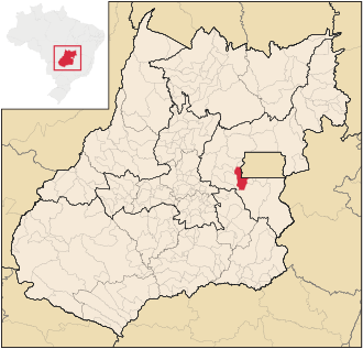
Santo Antônio do Descoberto is a Brazilian political community and city in the state of Goiás in the mesoregion East Goiás and in the micro-region Entorno de Brasília . It is located west of the Brazilian capital Brasília and northeast of the capital Goiânia .
Geographical location
Santo Antônio do Descoberto borders
- in the north at Águas Lindas de Goiás
- to the east to the federal district and Novo Gama
- in the south-east on Luziânia
- in the southwest at Alexânia
- to the west Corumbá de Goiás
- in the northwest at Cocalzinho de Goiás
The municipality is traversed by the Rio Descoberto from north to south. This flows into the southern border river Corumbá .
The distance to the capital Goiânia is 179 km.
economy
| GDP data 2007 | |
| Agriculture: | 7.128 |
| Industry: | 23,810 |
| Service: | 142,398 |
| Subtotal: | 173.337 |
| Taxes: | 9,063 |
| GDP total: | 182,400 |
| Rank in Goiás: | 53 |
| Population: | 55,621 |
| GDP per capita (R $): | 3,279 |
| Rank in Goiás: | 245 |
The table opposite shows the gross domestic product (GDP) in current prices for the three economic sectors , total GDP and rank in Goiás of Santo Antônio do Descoberto, population and GDP per capita for 2007 (in thousands of R $ ). Together with Áquas Lindas de Goiás, Santo Antônio do Descoberto had the lowest GDP per capita in Goiás in 2007.
See also
- Santo Antônio de Goiás
- Municipalities in the Entorno de Brasília microregion
- Mesoregions and micro-regions in Goiás
Web links
- Portal of Áquas Lindas de Goiás , (Portuguese)
Individual evidence
- ↑ SEPLAN: Road kilometers to Goiânia ( Memento of the original from February 5, 2009 in the Internet Archive ) Info: The archive link was inserted automatically and has not yet been checked. Please check the original and archive link according to the instructions and then remove this notice.
- ↑ Results of the 2010 census in Goiás (PDF; 30 kB), carried out by IBGE .
- ↑ Kilometers of road from Goiânia ( Memento of the original of February 5, 2009 in the Internet Archive ) Info: The archive link was automatically inserted and not yet checked. Please check the original and archive link according to the instructions and then remove this notice. (Portuguese)
- ↑ a b GDP per municipality in Goiás ( Memento of the original from March 29, 2016 in the Internet Archive ) Info: The archive link was inserted automatically and has not yet been checked. Please check the original and archive link according to the instructions and then remove this notice. Source: SEPLAN 2007


