
Mittagskogel (Karawanken)
| Mittagskogel (Kepa) | ||
|---|---|---|
 View from Villach to the Mittagskogel |
||
| height |
2145 m above sea level A. 2143 m. i. J. |
|
| location | Carinthia , Austria and Slovenia | |
| Mountains | Karawanken , Karawanken and Bacher Mountains | |
| Dominance | 9.5 km → Kukova špica | |
| Notch height | 706 m ↓ Maria-Elend-Saddle | |
| Coordinates | ||
|
||
| rock | Dachstein limestone and main dolomite | |
| Age of the rock | Norium | |

The Mittagskogel , Slovenian Kepa (Carinthian-Slovenian Jepa ), is at an altitude of 2145 m above sea level. A. one of the highest mountains in the western Karawanken . It lies on the Austrian - Slovenian border.
Location and structure
The mountain is located in the municipality of Finkenstein am Faaker See (Carinthia) and Kranjska Gora (Slovenia) between the villages of Latschach am Faaker See in the Klagenfurt basin and Dovje in the Sava Dolinka valley . The border runs over the summit along the Drau - Save -Wasserscheide and is marked at the highest point of the mountain with the boundary stone XXVI / 214 ( 2143 m ). The summit cross is a little to the north of it, directly at the highest point of the north face ( 2142 m , boundary stone XXVI / 215 ). The summit of the Mittagskogel is built up by a 600 to 700 meter thick layer of brittle main dolomite and thickly banked Dachstein limestone . At lower altitudes, this changes into chert limestone , Schlern dolomite and shell limestone , which form peaks in the neighboring mountains.
Origin of name
The name Mittagskogel, as a typical Zwölfer-Berg , is named from Schloss Rosegg ( Oberferlach is to the north ). In Slovene the mountain is called Kepa or Jepa , in dialect also Kum ( Ossiacher Tauern area ), the interpretation of which is unclear, could stand for kopa for " Schober ", 1650 Copan mons , or for a female first name Gëpa / Këpa , short form of Gebhild im Meaning "sleeping virgin".
The mountain is also occasionally referred to as Großer Mittagskogel , as a distinction to the two other mountains of the same name in the Karawanken, the Techantinger and Mallestiger Mittagskogel , or as a distinction to the western pre-summit known as the "Kleiner Mittagskogel".
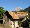
Paths and huts
The rock face, which slopes steeply to the north, gives the mountain its characteristic appearance. The only refuge is the Bertahütte located at 1527 m and owned by the OeAV . From there, the marked normal route leads over the northeast and east sides and finally over the southeast ridge to the summit.
Another ascent option is a climb from the former Annahütte over the northwest ridge, which follows the state border. The Kleiner Mittagskogel , in Slovenian Koroška Mala Kepa or Jepca ( ), also lies on this ridge . A climb over the northeast ridge leads to the summit with difficulty levels I-II .

View from Pörtschach / Poreče to the Mittagskogel
View from Altfinkenstein


literature
- Manfred Posch : The magic kingdom of Karawanken. The most beautiful tours. Kärntner Druckerei- und Verlagsgesellschaft mbH, Klagenfurt 1997, ISBN 3-85391-143-9 .
Cards:
- Geological map of the Republic of Austria 1: 50,000 sheets 201 Villach , 210 Assling ; Nikolaus Anderle, Franz K. Bauer, Christoph Hauser, Benno Plöchinger, Manfred E. Schmid, Hans Peter Schönlaub: Explanations for pages 201–210 Villach-Assling . Ed .: Christoph Hauser [compilation], Federal Geological Institute . Vienna 1982 ( geologie.ac.at [PDF]). ( Recording reports geologie.ac.at.)
- H. Seelmaier: Geological map Großer Mittagskogel - Großer Suchagraben . In: Austrian Geological Society (Hrsg.): Mitt.Geol. Ges. No. 33 . Vienna 1940, p. 1-10 .
Web links
Individual evidence
- ↑ austrianmap.at. Retrieved December 14, 2013 .
- ↑ Kagis. Retrieved December 14, 2013 .
- ^ Heinz Dieter Pohl : Mountain names. University of Klagenfurt, accessed in 2010 (→ 2. The names of the most famous Carinthian mountains , entry Mittagskogel ).
- ↑ Israel Holtz Worm: Map of Carinthia in 1611, Nachstich 1650
- ↑ Eberhard Kranzmayer : The mountain names of Austria . Vienna 1968. Quoted in Pohl: Bergnames
- ↑ Ref : Seelmaier: Geological map Big Mittagskogel - Big Suchagraben . 1940. FK Bauer: Explanations for pages 201–210 Villach-Assling . 7. Southern Alpine Permotrias of the West Karawanken , p. 20th f .