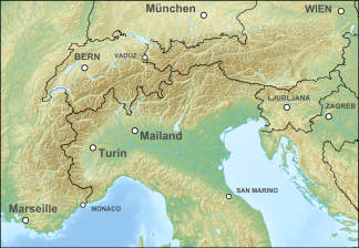
Karawanken and Bacher Mountains
| Karawanken and Bacher Mountains | ||
|---|---|---|
| Highest peak | High chair (Slov. Veliki Stol ) ( 2238 m above sea level ) | |
| location | Carinthia , Slovenia | |
| part of | Southern alps | |
| Classification according to | AVE 59 | |
|
|
||
| Coordinates | 46 ° 34 ' N , 14 ° 44' E | |
Karawanken and Bachergebirge is the name of a mountain group in the border area between Austria and Slovenia .
The mountain group consists, as the name suggests, of the Karawanken (Karavanke) in Carinthia and Upper Carniola (Gorenjska) together with the upstream Karawanken foothills and the area of the Jauntal , as well as the Bachergebirge (Pohorje) , the Strojna north between Karawanken and Bachergebirge, and some smaller marginal alpine groups in the Slovenian Lower Styria (Štajerska).
It is only for the AVE, and built to lodge catalogs of concern, the Karawanken among the Southern Limestone Alps , but the Pohorje geologically to the Central Alps , and (the Drava south) is now one of the only regional Geographically, Southern Alps expected.
The group (AVE No. 59) is defined as follows:
- in the extreme northwest of Gail from the confluence of the Gailitz north of Arnoldstein to the confluence with the Drau near Villach to the Gailtal Alps (56)
- in the northwest of the Drau to the confluence of the Gurk near Stein im Jauntal to the Gurktal Alps (46a)
- in the northeast Drau / Drava to Marburg / Maribor to the Lavanttal Alps (46b)
- in the southeast a line via Slovenska Bistrica ( Dravsko polje / Draufeld) , Zgornje Poljcane , Celje / Cilli to Velenje ( Velenjska kotlina / Wöllaner basin) - Paka (Dolina Paka / Paktal) to the confluence with the Savinja as the general south-eastern border of the Alps (see Note below)
- in the south (as an indentation) Savinja / Sann up to the junction of Jezera - Ručnik - Paulitschsattel / Pavličevo sedlo (1338 m) - Vellach / Bela upwards - Steinerbach - Seebergsattel / Jezerski vrh (1215 m) - Jezernica (Serniza valley) - Kokra to to the confluence with the Save at Kranj to the Steiner Alps (60)
- in the southeast of the Sava / Save upwards - Rateče / Valico di Fusine (Ratschacher Sattel, 850 m) - Rio Bianco / Weißenbach - Tarviso / Tarvis to the Julian Alps (58)
- in the west Slizza / Gailitz down to the confluence with the Gail and the Carnic main ridge (57a)
The southeast border over Poljcane and thus the saddle at Dolga Gora goes back to the division according to Moriggl (1924/28), and sees the Konjiška Gora (Gonobitzer Gora) as part of the Alps. The Celje - Vojnik - Velenje line excludes the Ložniško gričevje (Loschnice Hills). The border from the Paka to the mouth at Rečica ob Paki and the Savinja to the Ručnik mouth (above Solčava ) includes the Golte highlands and the Raduha massif . The former is often seen as a separate pre-alpine group, while the latter is included in the Kamniško-Savinjske Alpe (Steiner and Sanntaler Alps) , which in this respect does not correspond to the AVE term for the Steiner Alps . Moriggl had not yet taken the Pohorje (Bachern) into account and only listed the Karawanken as a group (No. 59). Today they are still part of the Predalpsko hribovje ( pre- alpine hill country) , which means that the Slovenian pre-Alps (Predalpske Slovenske) extend much further than in the AVE to the middle Sava and the Posavina . With the exception of the Bachern-Zug, these mountains no longer play a role in mountaineering.
Web links
Individual evidence
- ↑ a b Incorrectly reproduced as "Kucnik"; see Alpine division. bergalbum.de.
-
↑ a b Josef Moriggl: Guide for Alpine hikers in the Eastern Alps (with a list of refuges). 1924, 2nd edition 1928;
discussed and reproduced: Division des Alpes orientales d'après Josef Moriggl. ( Memento of the original from March 4, 2016 in the Internet Archive ) Info: The archive link was inserted automatically and has not yet been checked. Please check the original and archive link according to the instructions and then remove this notice. capleymar.com (and homoalpinus.com). - ↑ That roughly corresponds to the A1 motorway ; the exact line can be found, for example, for the Vitanjsko-Konjiške Karavanke / Weitensteiner and Gonobitzer Karawanken (Southeast Karawanken) in the classification Naravnogeografske regije in podregije Slovenije (natural geographic regions and subregions of Slovenia) according to Gams, Kladnik and Adamič.

