Ngerkeklau
| Ngerkeklau | ||
|---|---|---|
| Waters | Pacific Ocean | |
| Archipelago | Babeldaob | |
| Geographical location | 7 ° 44 '31 " N , 134 ° 37' 26" E | |
|
|
||
| length | 510 m | |
| width | 220 m | |
| surface | 9 ha | |
| Location of the Kayangel Islands | ||
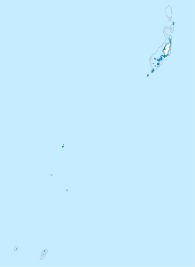
Ngerkeklau (also: Gasarao , Kaeakakurao-To , Karākakurao-tō , Ngarekeklau ) is an offshore island of around nine hectares in front of Ngarchelong , which is in the north of the Pacific island state of Palau , about 20 km north of the capital Melekeok .
geography
The island, together with the neighboring Ngerechur, forms the northern tip of Babeldaob . Administratively, the island belongs to the Palau state of Ngarchelong . It is part of the Ngerkelau and Ngerechur Islands Conservation Area . It is only about one kilometer to the northern tip of Babeldaob ( Arukoron Point ).
Individual evidence
literature
- Republic of Palau Adventure and Dive Guide. Guide to the undisputed Best Diving in the World. Franko Maps Ltd. 2016.

