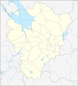
Nowy Nekous
| Village
Nowy Nekous
Новый Некоуз
|
||||||||||||||||||||||||||||||||||
|
||||||||||||||||||||||||||||||||||
|
||||||||||||||||||||||||||||||||||
Nowy Nekous ( Russian Но́вый Не́коуз ) is a village (selo) in the Yaroslavl Oblast in Russia with 3462 inhabitants (as of October 14, 2010).
geography

The place is about 110 km as the crow flies west-north-west of the Yaroslavl Oblast Administrative Center on the Ild river , which flows into the Volga about 20 km north-west from the left , there in the storage area of the Rybinsk reservoir .
Nowy Nekous is the administrative center of the Rajons Nekousski and seat of the rural community Nekousskoje selskoje posselenije. The municipality includes 163 other villages, of which only five have more than 100 inhabitants: Belovskaya (to the west), Nekous (4 km to the west), Novinskoje (15 km to the west), Parfenyevo (23 km to the west-northwest) and Stanilowo (17 km to the northwest) ; a further 43 places have at least 10 inhabitants, 68 have less than 10 inhabitants and 47 have no permanent residents (as of 2010).
history
The former village of Nikolo-Samoschje, which today forms the southern part of the place, has been known since the beginning of the 19th century at the latest, when the first church was built there; one more over the course of the century. In 1870 the Rybinsk - Bologoje railway was passed and the Charino station opened there. The village and station were in the extreme south of the Ujesds Mologa in the Yaroslavl governorate .
On January 14, 1929, a new Rajon based in the village of Nekous , 4 km west of the train station, was expelled and named after him. On August 18, 1931, the railway station was renamed Nekous after the name of the village and district , and on November 29, 1931 the district administration was moved to the settlement that had now developed around the station. As a result, the village was unofficially referred to as Stary Nekous ("Old Nekous") and the settlement at the train station as Nowy Nekous ("New Nekous"); the latter became official on December 15, 1952, while the original eponymous village is officially called Nekous to this day .
In 1975 Nowy Nekous received urban-type settlement status , but lost it again in 1993.
Population development
| year | Residents |
|---|---|
| 1939 | 708 |
| 1959 | 925 |
| 1970 | 1770 |
| 1979 | 3085 |
| 1989 | 3796 |
| 2002 | 3707 |
| 2010 | 3462 |
Note: census data
traffic
In Nowy Nekous, the Nekous station is at 48 km (from Rybinsk) on the Yaroslavl - Rybinsk - Bologoye railway line.
The place is on the regional road 78K-0009, which connects Uglich , which is almost 50 km southeast on the Volga, with the neighboring Rajon center Breitowo on the west bank of the Rybinsk Reservoir. The 78N-0377 branches off in a westerly direction, which follows the railway line to the border of Tver Oblast , there initially as 28N-1499 in the direction of Sonkowo - Beschezk .
Web links
Individual evidence
- ↑ a b Itogi Vserossijskoj perepisi naselenija 2010 goda. Tom 1. Čislennostʹ i razmeščenie naselenija (Results of the All-Russian Census 2010. Volume 1. Number and distribution of the population). Tables 5 , pp. 12-209; 11 , pp. 312–979 (download from the website of the Federal Service for State Statistics of the Russian Federation)

