Breitowo
| Village
Breitowo
Брейтово
|
||||||||||||||||||||||||||||||
|
||||||||||||||||||||||||||||||
|
||||||||||||||||||||||||||||||
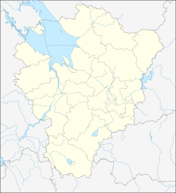
Breitowo ( Russian Бре́йтово ) is a village (selo) in the Yaroslavl Oblast in Russia with 3308 inhabitants (as of October 14, 2010).
geography
The place is about 140 km as the crow flies northwest of the Yaroslavl Oblast Administrative Center on the western bank of the Rybinsk Reservoir of the Volga , to the left of the river Sit which flows into it , the lower course of which is also in the reservoir area and is over 500 meters wide.
Breitowo is the administrative center of the Rajons Breitowski and seat of the rural community Breitowskoje selskoje posselenije. The municipality includes 75 other villages, of which only two have more than 100 inhabitants: Nowinka (5 km northwest) and Uljanicha (17 km south-southwest); another 30 places have at least 10 inhabitants, 23 have less than 10 inhabitants and 20 have no permanent residents (as of 2010).
history
The place was first mentioned in 1613. From 1777 he belonged to the Ujesd Mologa of the Yaroslavl governorship, from 1796 of the Yaroslavl governorate .
From February 3, 1921 to February 15, 1923, the Ujesd belonged to the short-lived Rybinsk Governorate . After dissolution of the governorates and Ujesde a Rajon was expelled based in Breitowo on 14 January 1929, which initially for Industrieoblast Ivanovo (to 1930 held by the okrugs belonged Yaroslavl) and came up with their distribution on March 11 in 1936, to Yaroslavl Oblast.
When the Rybinsk Reservoir was filled in the 1940s, the original location was partially flooded. Since then, the town center has been further west. From 1963 to 1964 the Rajon was temporarily dissolved. In 1986 Breitowo received the status of an urban-type settlement , but lost it again in 1991.
Population development
| year | Residents |
|---|---|
| 1897 | 808 |
| 1939 | 1736 |
| 1959 | 1544 |
| 1970 | 2058 |
| 1979 | 3052 |
| 1989 | 4015 |
| 2002 | 3710 |
| 2010 | 3308 |
Note: census data
traffic
Breitowo is the end point of the regional road 78K-0009, which comes from Uglich on the Volga via the neighboring district of Nowy Nekous to the south , continues along the west bank of the Rybinsk reservoir and crosses the Sit directly above Breitowo. Links of sit upstream south passes the regional road 78K-0022 to 78N-0377, the Novy Nekous with the border of the Tver towards Sonkowo - Bezhetsk connects. From Breitowo to the northwest, the 78N-0131 leads to Prosorowo, not far from the border with Tver Oblast, where there is further connection to Krasny Cholm or Vessyegonsk .
The nearest train stations are by road a good 60 km south of Nekous (in Nowy Nekous) and Schestichino on the Yaroslavl - Rybinsk - Bologoje route .
Web links
Individual evidence
- ↑ a b Itogi Vserossijskoj perepisi naselenija 2010 goda. Tom 1. Čislennostʹ i razmeščenie naselenija (Results of the All-Russian Census 2010. Volume 1. Number and distribution of the population). Tables 5 , pp. 12-209; 11 , pp. 312–979 (download from the website of the Federal Service for State Statistics of the Russian Federation)

