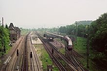
Upper Leinegraben
The Obere Leinegraben is a small basin landscape in the districts of Göttingen (NI), Eichsfeld (TH) and Werra-Meißner (HE) in Germany .
geography
location
The Obere Leinegraben is the southeastern extension of the Göttingen Leinegraben in the triangle of Hesse , Lower Saxony and Thuringia and, viewed clockwise, lies between Friedland in the north, Arenshausen in the east, Bornhagen in the south and Berge (Neu-Eichenberg) in the west. The nearest town, Witzenhausen, is about 3 kilometers from the southwestern edge and Göttingen is about 12 kilometers to the north.
Surveys
The altitudes of the basin range from 180 m on the Leine near Friedland to just over 300 m on the southern edge. The elevations in the Obere Leinegraben include:
- Göbelskopf (325 m), Eichsfeld district, north of Bornhagen (forest area of the old wood )
- Almas Höhe (305 m), Werra-Leine watershed southwest of Hohengander, Eichsfeld district ( Altes Holz )
- Horse mountain (approx. 300 m), border area of the districts of Göttingen and Eichsfeld, north of Kirchgandern
- Röneberg (278 m), Werra-Meißner district, north of Hebenshausen
- Hagen (262 m), district of Göttingen, south of Friedland
Natural structure
The Obere Leinegraben naturally belongs to the Lower Saxon mountainous region and is structured as follows:
-
(to 37 Weser-Leine-Bergland )
-
(to 372 Leine-Ilme-Senke )
- 372.7 Oberer Leinegraben
- 372.70 Eichenberg-Hohenganderner slopes and Keuperhügel (west wing)
- 372.71 Niederganderner Leineaue
- 372.72 Kirchganderner slopes (east wing)
- 372.7 Oberer Leinegraben
-
(to 372 Leine-Ilme-Senke )
The landscape is the southern extension of the Göttingen Leinegraben in the north and is delimited, clockwise, by the following ridges:
- Göttingen-Northeimer Wald (Steinkopf: 372.4 m) in the northeast
- Flowing in of the line from the Lower Eichsfeld in the east
- Upper Eichsfeld (Heuberg: 369 m) in the southeast
- Fretteröder Keupersenke as a south-eastern extension
- Höheberg ( Hanstein Castle : approx. 390 m) in the east south
- Neuseesen-Werleshäuser heights (Winterberg: 375 m) in the western south
- Sand forest (on the sharpness: 477.2 m) in the west
- Dransfeld plateaus , southern Solling foreland (Gieseberg: 371 m) in the north-west
The Thuringian State Institute for Environment and Geology uses its own, somewhat coarser structure that only exists nationwide, within which the area of the Upper Leine Ditch, as far as it is located in Thuringia, is completely part of the limestone landscapes of the Werrabergland-Hörselberge .
nature
The Obere Leinegraben is a fertile landscape along the Leine and is mainly used for agriculture. The NSG Rhöneberg near Marzhausen is located south of Friedland (identified in 1997 with 29.22 hectares). The inner German border and today's Green Belt of Germany ran through the middle of the landscape .
traffic
The intersections of old trade routes were already located here in the Middle Ages. Today the federal highways 80 and 27 cross here , as well as the Halle - Kassel and Göttingen-Bebra railways at the Eichenberg junction. Today runs in north-south and east-west direction. In 2006 the western section of the federal motorway 38 ( Göttingen - Leipzig ) was completed.
Worth seeing
Sights include:
- Homecoming memorial in Friedland
- Besenhausen manor in Niedergandern
- Arnstein Castle near Eichenberg
- former manor in Hebenshausen
- listed town center of Eichenberg (place)
literature
- F. Lotze: The southern part of the Göttingen Leinegraben and the Eichenberger Grabenknoten. Treatises of the Prussian Geological State Institute. New series 139 (1932), pp. 5-48
- David C. Tanner, Gernot Arp, Frithjof A. Bense, Gabriele Ertl: The structure of the Black Jurassic Keuper occurrence in the Eichenberger Grabenknoten near Hottenrode. In: Bernd Leiss: New studies on the geology of the Leinegraben structure: Building blocks for exploring the geothermal potential of the Göttingen region. Universitätsverlag Göttingen 2011, pp. 83–86
Individual evidence
- ↑ Map services of the Federal Agency for Nature Conservation ( information )
- ↑ Online map “Experience nature in Lower Saxony” ( Memento of the original from December 11, 2013 in the Internet Archive ) Info: The archive link was automatically inserted and not yet checked. Please check the original and archive link according to the instructions and then remove this notice. of the Lower Saxony Ministry for the Environment, Energy and Climate Protection, accessed on December 6, 2013
- ↑ Hans-Jürgen Klink: Geographical land survey: The natural space units on sheet 112 Kassel - Federal Institute for Regional Studies, Bad Godesberg 1969 → online map
-
^ Walter Hiekel, Frank Fritzlar, Andreas Nöllert and Werner Westhus: The natural spaces of Thuringia . Ed .: Thuringian State Institute for Environment and Geology (TLUG), Thuringian Ministry for Agriculture, Nature Conservation and Environment . 2004, ISSN 0863-2448 . → Natural area map of Thuringia (TLUG) - PDF; 260 kB → Maps by district (TLUG)


