
Oberrieden (Bad Sooden-Allendorf)
|
Oberrieden
City of Bad Sooden-Allendorf
Coordinates: 51 ° 18 ′ 33 " N , 9 ° 55 ′ 33" E
|
|
|---|---|
| Height : | 146 m above sea level NHN |
| Area : | 5.3 km² |
| Residents : | 512 (Jun. 30, 2016) |
| Population density : | 97 inhabitants / km² |
| Incorporation : | December 31, 1971 |
| Postal code : | 37242 |
| Area code : | 05542 |
 Aerial view
|
|
Oberrieden is the largest district of Bad Sooden-Allendorf in the Werra-Meißner district in northern Hesse .
Geographical location
Oberrieden is located near the border triangle of Hesse - Thuringia - Lower Saxony near the confluence of the Oberrieder Bach in the Werra . South of the village is the Soodener Bergland ( 482.4 m ) with the adjacent Hohem Meißner ( 753.6 m ), and northeast of the Schürzenberg ( 213.9 m ), which, like the village, are all in the Frau-Holle Geo-Naturpark Land (Werra valley, Meissner, Kaufunger forest) . Beyond the Werra, the Thuringian-Hessian Höheberg ( 511.7 m ) rises in the northeast .
history
timeline
| year | event |
|---|---|
| 1150 | First documentary mention: Count Gyso von Bilstein hands over his property in Rieden to the Fulda monastery |
| 1415 | Construction of Ludwigstein Castle by Landgrave Ludwig I of Hesse , later belonging to the Hessian office of Ludwigstein / Witzenhausen |
| 1447 | Hans von Dörnberg on Ludwigstein acquires patronage for the Oberrieden parish |
| 1747 | First mention of the name "Ober Rieden" to distinguish it from Unterrieden |
| 1870 | By 1875 construction of the Göttingen - Bebra railway line through the Oberrieden district with the Schürzenberg tunnel |
| 1945 | Blasting of the Oberrieden- Werleshausen railway bridge and the Werra bridge to Lindewerra by German troops; Occupation by American forces on April 6th |
| 1947 | by 1949 rebuilding of the railway bridge over the Werra |
| 1970 | Primary school closes |
| 1971 | As part of the regional reform in Hesse, incorporation as a district of Bad Sooden-Allendorf on December 31 |
| 1978 | Closure of the Oberriedener train station |
| 1987 | Until 1992, construction of the Schürzenberg tunnel to relieve the area of traffic from the B 27, which is a bypass road near the village |
| 1993 | Inclusion in the village renewal program |
| 1999 | Rededication of the bridge to Lindewerra |
| 2001 | Start of demolition of the through-town |
Population development
Source: Historical local dictionary
| • 1466: | 19 house seats |
| • 1543: | 31 house seats |
| • 1575/85: | 42 house seats |
| • 1681: | 48 house seats |
| • 1747: | 71 teams with 72 fireplaces |
| • 1961: | 596 Protestant (= 88.56%), 74 Catholic (= 11.00%) residents |
| Oberrieden: Population from 1834 to 1970 | ||||
|---|---|---|---|---|
| year | Residents | |||
| 1834 | 674 | |||
| 1840 | 677 | |||
| 1846 | 662 | |||
| 1852 | 610 | |||
| 1858 | 589 | |||
| 1864 | 592 | |||
| 1871 | 596 | |||
| 1875 | 693 | |||
| 1885 | 592 | |||
| 1895 | 521 | |||
| 1905 | 516 | |||
| 1910 | 511 | |||
| 1925 | 523 | |||
| 1939 | 477 | |||
| 1946 | 739 | |||
| 1950 | 756 | |||
| 1956 | 725 | |||
| 1961 | 673 | |||
| 1967 | 648 | |||
| 1970 | 652 | |||
| Data source: Historical municipality register for Hesse: The population of the municipalities from 1834 to 1967. Wiesbaden: Hessisches Statistisches Landesamt, 1968. Other sources: | ||||
politics
The Oberrieden local advisory board has seven members. The current mayor is Mario Babacz (SPD).
Attractions
- the nearby Ludwigstein Castle
- the nearby Teufelskanzel at Lindewerra
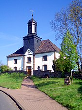
church

Cherry Blossom


traffic
In the Göttingen - Eschwege section, north-east past Oberrieden, the federal road 27 runs through the Schürzenberg tunnel (530 m long) near the village . Is located on this road at 12 km northern Friedland the junction Friedland of federal highway 38 (Göttingen-Friedland- Heiligenstadt - Hall ), on which one of the nearby motorway junction Drammetal ( A 7 can drive). The Göttingen – Bebra railway also runs northeast past the village through the Schürzenberg Tunnel (173 m) ; but there is no stop in the village.
literature
- Anniversary celebration 850 years Oberrieden . Printed by: Keitz + Fischer 2000.
- Wolfgang Koch : Oberrieden railway bridge . Verlag Vogt GmbH, Hess. Lichtenau 1989.
Individual evidence
- ↑ a b c Oberrieden, Werra-Meißner district. Historical local dictionary for Hessen. (As of May 24, 2018). In: Landesgeschichtliches Informationssystem Hessen (LAGIS).
- ↑ Budget 2017. (PDF; 7.71 MB) City of Bad Sooden-Allendorf, archived from the original ; accessed on June 21, 2018 .
- ^ Federal Statistical Office (ed.): Historical municipality directory for the Federal Republic of Germany. Name, border and key number changes in municipalities, counties and administrative districts from May 27, 1970 to December 31, 1982 . W. Kohlhammer GmbH, Stuttgart and Mainz 1983, ISBN 3-17-003263-1 , p. 410 .
Web links
- The districts on the website of the city of Bad Sooden-Allendorf.
- Oberrieden on the Werra. Pictures, information. In: www.oberrieden-werra.de. Private website
- Oberrieden, Werra-Meißner district. Historical local dictionary for Hessen. In: Landesgeschichtliches Informationssystem Hessen (LAGIS).
- Literature on Oberrieden in the Hessian Bibliography
Ahrenberg | Dudenrode | Ellershausen | Hilgershausen | Kammerbach | Kleinvach | Oberrieden | Orferode | Pastures