Oberrotweil
|
Oberrotweil
City of Vogtsburg in the Kaiserstuhl
|
|
|---|---|
| Coordinates: 48 ° 5 ′ 20 ″ N , 7 ° 37 ′ 50 ″ E | |
| Height : | 214 (180-557) m |
| Area : | 10.19 km² |
| Residents : | 1597 (Dec. 31, 2006) |
| Population density : | 157 inhabitants / km² |
| Incorporation : | 1st January 1975 |
| Postal code : | 79235 |
| Area code : | 07662 |
|
Location of Oberrotweil in the Kaiserstuhl. The upper and lower villages are shown in red.
|
|
|
Aerial view of Oberrotweil - in the background the Rhine and the Vosges
|
|
Oberrotweil (locally also Rotweil for short ) is a district of the town of Vogtsburg in the Kaiserstuhl in southern Baden. The village has about 1600 inhabitants and is mainly known as a wine village. Until 1975 Oberrotweil was an independent municipality, since then it has been one of seven localities in the town of Vogtsburg. Oberrotweil is the largest and centrally located district and houses the city administration.
The village of Oberrotweil consists of two districts: the eastern, larger and higher part is Oberrotweil , the other part is Niederrotweil . The local population only makes the distinction when it is necessary.
history
The district of Oberrotweil, which lies in a fertile valley ( Krottenbachtal ) and extends into the Rhine plain , was already settled in prehistoric times - in the Neolithic , Bronze Age and Iron Age .
There was a Roman settlement in Niederrotweil - remnants of Roman civilization were found on the fields of the so-called brick field .
The Alemannic settlement of the Krottenbachtal probably only began in the 7th century. In 1930 an Alemannic stone box grave was found in Niederrotweil, and an Alemannic row grave field was excavated at the lower entrance to Oberrotweil in 1925 . Only a few additions were found, which suggests that the dead were poor and / or already Christianized.
The place name Oberrotweil also points to the settlement by Alemanni: the Alemanni initially avoided the remains of Roman civilization, although these were mostly on good soil. They did not settle there until later. Sunny places were called Wila (after the Latin villa rustica ). The name Rotweil further indicates that something with a red color has been noticed - such as red (iron-rich) earth or red brick remains. The oldest known document with the name Rótuuila dates from the year 972.
The church of Niederrotweil is essentially early Romanesque and was first mentioned in documents around 1157. It was later redesigned in Gothic style.
For centuries, Oberrotweil was under the tenth rule of the St. Blasien monastery . In 1680 Johann Jakob von Dischinger (the mayor of Breisach ) bought the so-called Zehnthof. The von Gleichenstein family, still resident today, is one of his descendants and later tithe lords. Because of the viticulture, Oberrotweil was interesting for landlords from almost the entire Alemannic area. Landlords from the following localities have historically received benefits from Oberrotweil for a shorter or longer period of time:
- From Alsace : Ottmarsheim, Andlau
- From the Ortenau : Schüttersheim
- From the Breisgau : Waldkirch, Tennenbach, St. Peter, St. Ulrich, Adelhausen, St. Blasien
- From Switzerland : Muren, Einsiedeln
- From Lake Constance : Reichenau, Konstanz
In St. Gallen there are also two pilgrims from Oberrotweil ( Routvuilo, Routwil ) listed in the fraternity book (beginning of the 12th century); it is conceivable that they had to raise a contribution in kind in order to be included in the book - property assignments were common.
Oberrotweil had belonged to the House of Habsburg since 1330 as part of the Burkheim rulership , so it was part of Upper Austria . In 1806 Oberrotweil became part of the Grand Duchy of Baden .
Oberrotweil was not reformed. After the Thirty Years War , Catholics moved from other Alemannic areas, although the war-related population decline in Oberrotweil was not as pronounced as in other communities.
In 1906 the name Rothweil , which had established itself in official dealings from the 19th century, was changed to Oberrotweil by the grand ducal bureaucracy . Locals still speak of Rootwiil in the local Lower Alemannic dialect .
On January 1, 1973 Oberbergen was incorporated. On January 1, 1975, Achkarren , Bickensohl , Bischoffingen , Burkheim and Schelingen came to the city, whose name was changed on April 15, 1977 to Vogtsburg in the Kaiserstuhl.
Village and countryside
Settlement in the valley
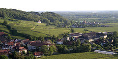
The place Oberrotweil is located in the bottom of the Krottenbach valley. The valley of the Krottenbach opens to the west towards the Rhine (5 km away) and Alsace . Because the village is wedged into the valley, it is long and narrow. The exit of the valley widens like a delta to the southwest; there Niederrotweil lies on the edge of a threshold that is raised about 20 meters above the Rhine plain. In the last few decades there have been new building areas with the names Firobe (= closing time , northwestern exit of the town), Mitteltal and in Niederrotweil the Ziegelfeld and Unter-dem-Holz .
In earlier times the valley floor and other low areas were planted with fruit trees and vegetables were even grown at the western entrance to the village and in the upstream Rhine plain. Due to the higher profitability, from the 1960s onwards, areas in the valley were also planted with vines - especially in the mouth of the valley in the southwest. The area planted with vines was unchanged between 1880 and 1930 at around 200 ha. Today, however, with 400 ha, it is twice as large.
Between Oberrotweil, Niederrotweil and the neighboring villages there are even larger areas without any buildings. So far, the inner Kaiserstuhl has been spared from the rampant urban sprawl in the greater Freiburg area . The population has changed very little since 1500. Industry is almost completely absent; a former quarry with production facilities for gravel extraction has been increasingly reclaimed by nature for decades. Almost all of the side valleys are uninhabited.
The Grottenbach (high German Krötenbach) is partly canalised, partly it still runs above ground (upper Bachstraße, Firobe and outside the village). It comes from the Äschigbächli (from Bickensohl) and is fed by the tiny Ellebuechbächli and has water all year round. Originally it flowed through Niederrotweil, but around 1930 it was diverted from the station to the west.
Mountains and vines
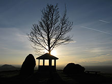
The town of Oberrotweil is bordered by mountains in the north and south. In the south the landscape rises more gently and in the north the ascent is quite steep. The highest point is the skull in the southeast - at 557 meters high, it is also the highest point in the Kaiserstuhl. The districts of Oberrotweil, Ihringen , Oberbergen and Bickensohl border one another here. In the northwest there is a viewpoint on the Mondhalde (370 m), from which one has a good overview of the Vosges and Alsace as well as the places Jechtingen , Bischoffingen , Burkheim , Oberbergen, Oberrotweil, Breisach and the southern Black Forest . When the weather is clear you can see the Swiss Jura in the south .
The mountain tops are almost all crowned by mixed forest. The slopes have been terraced especially for viticulture since at least the Middle Ages. In the south, the original terraces have been preserved, there you can also find old ravines with the names Roggenberggasse , Staffelgasse and Herrweg .
Land consolidation , in local parlance “reallocation”: In the north, the largest land consolidation of the Kaiserstuhl was carried out in the 1970s. The previous small-scale terrace landscape with many small valleys and hills was redesigned into large contiguous terraces with great mechanical use. These interventions on Badenberg and Mondhalde did not meet with complete approval at the time:
- Individual winegrowers who actually did not want to participate in this project but owned land in the affected areas were faced with a legal predicament, among other things: They could only sell or, if they did not participate, had to take the risk of bad land, as they did not have a say .
- The resulting new landscape was not received positively everywhere, but in some cases rejected as "artificial".
- The new vineyard sites are partly more at risk of frost due to the incline towards the slope, as so-called cold lakes, accumulations of cold air, can form.
- In the course of removing the small-scale structure, various biotopes were destroyed.
On the other hand:
- For viticulture, areas that can be processed more efficiently have emerged that can be processed more easily with the use of machines.
- The access to the properties through the new and paved path system has been made much easier. Before that, the work on individual steep slopes or the transport of the grape containers during the grape harvest on the medieval roads was life-threatening and very laborious.
- The grape harvest itself was made much easier because there were no steep areas. In the past, the removal from the rows of vines using a so-called bend was very tedious and exhausting. (A Bicke is a long, backpack-like container made of wood or later plastic that is carried on the back and weighs well over 50 kg when filled.)
- According to its proponents, the gigantic redesign is the main reason why there are still quite a few full-time vintners in Oberrotweil today who can make a living from viticulture.
Various landscape elements such as hollow alleys have been destroyed by the large and several medium-sized land consolidation measures. Certain earlier tubs and locations can no longer be distinguished today. In the area of the land-cleared Kunzebuck in the southeast, large stones have been set up in which the old tubs are carved with "official" and Alemannic names.
Culture
church
St. Michael
In the oldest church in Oberrotweil, St. Michael in the Niederrotweil district, wall paintings from the 14th century were uncovered in the choir. The altar comes from the 1620s by master HL , who also made the altar in the Breisach Stephansmünster . This masterpiece of Upper Rhine late Gothic was commissioned by the tithe, the monastery of St. Blasien . The carved altar with shrine and two wings has Mary in the center, who is framed by God and Jesus. Due to this very special altar, this church has a supra-regional significance.
St. Pantaleon
The small Pantaleons church - also in Niederrotweil ( Lage ) - is located on the edge of the valley directly adjacent to the vines and is the destination of a special pilgrimage that takes place annually on the Sunday after the commemoration of St. Pantaleon (Πανταλείμον). This church was completed in 1741. The associated pilgrimage is older, however.
The Pantaleon pilgrimage used to be of great importance, as it is one of the 14 helpers in need. In earlier times, pilgrims came from Alsace and more distant corners of the Breisgau. Allegedly, according to various testimonies from past centuries ( votive tablets ), the sick were healed in response to the “intercession of St. Pantaleon”. The custom of blessing horses on this occasion continues to this day. Since horses are no longer used in agriculture today, practically only riding horses can enjoy a blessing.
St. John Baptist
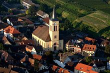
The parish church in Oberrotweil is the large St. John's Church in the upper part of the village. It was built in 1835; The architect was Hans Voss , a student of Friedrich Weinbrenner . Their painting in the Weinbrenner style receives national attention.
Club life
There is a rich club life in Oberrotweil. A large percentage of the population is organized in at least one association. The clubs contribute a lot to cultural life - especially the music and men's choirs, the church choir and others. An Alemannic play is regularly performed at the club's Christmas party - even at the sports club's celebration.
The clubs also play a crucial role in social, economic and political life. For example, the associations carried out voluntary projects for which the community could not spare any finances. In addition, the associations organize the spring wine festival that takes place every two years, which at the same time promotes wine sales.
The Oberrotweiler dialect
The local dialect has all the characteristics of Upper Rhine-Manish in common. The special features are:
- The Oberrotweiler dialect is strongly influenced by Alsace. This is where the palatalized forms Huüs, Fraü, Boi come from . The Oberrotweilerisch goes and stands is not a condemned German, but comes from Alsace. Common is otherwise im Breisgau goht and stoht .
- A highly Alemannic characteristic is the -ch in Birchedal (= Birkental). As in other Breisgau villages, it is called Kalch instead of Kalk and Wärchdig instead of working day.
- The noun ending -ig is only used for four words: Maria Ablesig (the name of a chapel where the pallbearers were replaced on the way to the cemetery in Niederrotweil); Noohaltig (fair for the deceased), Holzsteigerig (wood auction ) and Rächnig (invoice). Otherwise -ung is used: Zitung (newspaper).
- As the only village in the inner Kaiserstuhl Oberrotweil has -b- after l and r and received between vowel, which is why here Räbe Will Color, dälbe (üsgrabe) and even would (be) rather than as in the neighboring villages Räwe, färwe, dälwe, gää . The newer gää We have heard today already next to the elderly would be .
- Extended personal pronouns are also noticed in Oberrotweil: ihrini Miätere (her mothers, nominative / accusative), ihrene (dative plural), hers (dative singular): Si het ihrini Ränke her Suhn gabe (she gave her vines to her son).
The Oberrotweiler dialect is rarely used on official occasions. Club events are usually moderated in High German, even if more than 95% of the audience speak Alemannic in everyday life. Exceptions are the events of the Heimat- und Geschichtsverein Oberrotweil . Arno Landerer, who was the mayor of Oberrotweil in 2006, also speaks Alemannic through a microphone.
literature
- Rothweil - From the history of Nieder- and Oberrotweil. Edited by Emil Galli, Axel Killian, Harald Noth, Katja Schwab and Andreas Westen. Oberrotweil 2000.
- Hermann Ginker: The Niederrotweiler Altar. With 48 full-page illustrations. Langewiese library, Königstein im Taunus 1954.
- Dorothea Wenninger: Field names in the Kaiserstuhl. Frankfurt am Main 1997 (all winning names printed in italics are explained here).
Web links
- Local history and history association Oberrotweil
- About the St. Michalelis and St. Pantaleons Church
proof
- ^ Federal Statistical Office (ed.): Historical municipality directory for the Federal Republic of Germany. Name, border and key number changes in municipalities, counties and administrative districts from May 27, 1970 to December 31, 1982 . W. Kohlhammer, Stuttgart / Mainz 1983, ISBN 3-17-003263-1 , p. 496, 509 and 510 .
- ↑ A stone tablet on the facade gives this date, she. Baden walks ( Memento of the original from October 5, 2007 in the Internet Archive ) Info: The archive link has been inserted automatically and has not yet been checked. Please check the original and archive link according to the instructions and then remove this notice.


