Easter castle
|
Easter castle
Municipality of Osterienburger Land
|
|
|---|---|
| Coordinates: 51 ° 47 ′ 35 " N , 12 ° 1 ′ 52" E | |
| Height : | 74 m |
| Area : | 12.66 km² |
| Residents : | 1839 (December 31, 2016) |
| Population density : | 145 inhabitants / km² |
| Incorporation : | January 1, 2010 |
| Postal code : | 06386 |
| Area code : | 034973 |
|
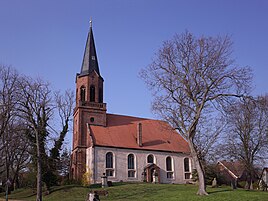
Protestant church
|
|
Osterienburg is a district of the municipality of Osternienburger Land in the Anhalt-Bitterfeld district in Saxony-Anhalt .
geography
Easterienburg lies between Dessau-Roßlau and Köthen (Anhalt) on the edge of the Middle Elbe Biosphere Reserve . The following districts of the former municipality were identified:
- Pißdorf
- Sibbesdorf
history
Osterienburg was first mentioned in a document in 1205. The village church was probably built at this time .
Lignite has been mined in the Wilhelm mine since 1875 . For this purpose, workers from West Prussia were recruited. 40 of these workers founded the St. Barbara Association on January 7, 1900 .
In 1898 Solvay GmbH put one of the first systems for chlor-alkali electrolysis into operation. The company also set up a workers' colony near the old farming village.
The Catholic Herz-Jesu-Kirche was founded in 1908.
On July 1, 1950, the previously independent communities Pißdorf and Sibbesdorf were incorporated.
On January 1, 2010, the previously independent communities Easterienburg, Chörau , Diebzig , Dornbock , Drosa , Elsnigk , Großpaschleben , Kleinpaschleben , Libbesdorf , Micheln , Zabitz , Reppichau , Trinum and Wulfen merged to form the single community Easterienburger Land. At the same time, the administrative community Osternienburg , to which these communities belonged, was dissolved.
Population development
| year | Residents |
|---|---|
| 1807 | 396 |
| 1867 | 554 |
| 1900 | 1550 |
| 1960 | 3500 |
| 1989 | 2600 |
| 2013 | 2169 |
| 2016 | 1839 |
Memorials
- Tombs on the local cemetery for three unknown and whose names are known Soviet citizens who during the Second World War deported to Germany and victims of forced labor were
- OdF memorial in Wilhelm-Feuerherdt-Strasse for the victims of fascism
- Memorial plaque from 1992 in Rudolf-Breitscheid-Strasse in memory of the dead in the war and the victims of tyranny
badges and flags
Blazon : "Divided and half-split, above in red a golden plow, below left in blue an eight-pointed golden star, below right a black miner's tooth."
The coat of arms was designed in 1996 by the Magdeburg municipal heraldist Jörg Mantzsch and included in the approval process. The star was taken from a historical image seal of the place; The plow as well as the mallet and iron symbolize the most important economic sectors.
The flag of the former municipality of Osternienburg is gold (yellow) blue with vertical stripes. The coat of arms is placed in the middle of the flag.
Culture and sights
Sports
Osterienburg is known as the "German hockey village". Despite the small number of inhabitants, the Osternienburger HC plays in the indoor hockey Bundesliga (men) and women. For years the club provided the bulk of the GDR's national hockey team .
There is also a football club in Osternienburg: “FC Hertha Osternienburg” currently plays in the district league of the Anhalt-Bitterfeld district.
Some members of the Easterienburg volunteer fire brigade are active in fire fighting . Together with firefighters from other locations, you will compete for the “ Fire Brigade Sports Team Klietzen”.
Economy and Infrastructure
The Wilhelminian industrial companies have been closed for decades.
traffic
The federal highway 187a from Zerbst / Anhalt to Köthen (Anhalt) runs directly through the district . South of the municipality, the federal highway 185 runs from Bernburg (Saale) via Köthen (Anhalt) to Dessau-Roßlau.
Osterienburg has a stop on the Dessau – Köthen railway line .
Web links
Individual evidence
- ↑ a b MZ: Osternienburger history - the changes of the last decades
- ^ The Polish Sankt-Barbara-Verein Osternienburg: Verein für Anhaltische Landeskunde , April 2006
- ^ Destatis: Changes in the municipalities in Germany , see 2010


