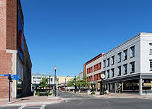
Plattsburgh (City, New York)
| Plattsburgh | |
|---|---|
| Nickname : "The Lake City" | |
 Saranac River and Thomas Macdonough Monument |
|
| Plattsburgh's county and county location in New York | |
| Basic data | |
| Foundation : | 1785 |
| State : | United States |
| State : | new York |
| County : | Clinton County |
| Coordinates : | 44 ° 42 ′ N , 73 ° 27 ′ W |
| Time zone : | Eastern ( UTC − 5 / −4 ) |
| Residents : | 19,989 (as of 2010) |
| Population density : | 1,537.6 inhabitants per km 2 |
| Area : | 17.0 km 2 (approx. 7 mi 2 ) of which 13.0 km 2 (approx. 5 mi 2 ) are land |
| Height : | 42 m |
| Postcodes : | 12901, 12903 |
| Area code : | +1 518 |
| FIPS : | 36-58574 |
| GNIS ID : | 979376 |
| Website : | www.cityofplattsburgh-ny.gov |
Plattsburgh is a city in the US state of New York . It is located on the west bank of Lake Champlain and is the administrative seat ( county seat ) of Clinton County . In 2010 the city had 19,989 inhabitants.
geography
Geographical location
Plattsburgh is located in the far northeast of the state, around 30 kilometers south of the border with Canada . The Saranac River , which rises in the Adirondack Mountains to the west , flows into Lake Champlain in the city center . About eight kilometers south of the lake is the island of Valcour Island .
Neighboring communities
All distances are given as straight lines between the official coordinates of the places from the 2010 census.
| Dannemora , 35.0 km | Beekmantown , 1.6 mi | North Hero, VT , 17.2 mi |
| Saranac , 32.9 km |

|
Grand Isle, VT , 14 mi |
| Schuyler Falls , 8.0 km | Peru , 6.2 km | South Hero, VT , 14.2 mi |
climate
| Plattsburgh City, New York | ||||||||||||||||||||||||||||||||||||||||||||||||
|---|---|---|---|---|---|---|---|---|---|---|---|---|---|---|---|---|---|---|---|---|---|---|---|---|---|---|---|---|---|---|---|---|---|---|---|---|---|---|---|---|---|---|---|---|---|---|---|---|
| Climate diagram | ||||||||||||||||||||||||||||||||||||||||||||||||
| ||||||||||||||||||||||||||||||||||||||||||||||||
|
Monthly average temperatures and rainfall for Plattsburgh City, New York
Source: www.weatherbase.com
|
|||||||||||||||||||||||||||||||||||||||||||||||||||||||||||||||||||||||||||||||||||||||||||||||||||||||||
The mean average temperature in Plattsburgh is between −7.9 ° C in January and 20.6 ° C in July. The snowfalls between October and April are up to 39.1 centimeters in January, the daily sunshine duration is at the lower end of the value spectrum in the USA.
history
Plattsburgh is named after the politician Zephaniah Platt , who founded the settlement in 1788. Due to its strategic location near a narrow passage in Lake Champlain, Plattsburgh was the scene of two armed conflicts: in 1776 with the Battle of Valcour in the War of Independence , in 1814 with the Battle of Plattsburgh in the British-American War . In 1815 Plattsburgh was given the status of a municipality and in 1902 that of a city. In 1948 the State University of New York opened a campus. From 1954 to 1994 the United States Air Force operated an air force base in Plattsburgh.
Population development
| Population development | |||
|---|---|---|---|
| Census | Residents | ± in% | |
| 1860 | 3032 | - | |
| 1870 | 5139 | 69.5% | |
| 1880 | 5245 | 2.1% | |
| 1890 | 7010 | 33.7% | |
| 1900 | 8434 | 20.3% | |
| 1910 | 11,138 | 32.1% | |
| 1920 | 10,909 | -2.1% | |
| 1930 | 13,349 | 22.4% | |
| 1940 | 16,351 | 22.5% | |
| 1950 | 17,738 | 8.5% | |
| 1960 | 20.172 | 13.7% | |
| 1970 | 18,715 | -7.2% | |
| 1980 | 21,057 | 12.5% | |
| 1990 | 21,255 | 0.9% | |
| 2000 | 18,816 | -11.5% | |
| 2010 | 19,989 | 6.2% | |
| 2016 estimate | 19,780 | -1 % | |
| US Decennial Census | |||
traffic
Major route is that of New York City in the direction of Montreal 's leading highway Interstate 87 . Amtrak trains run daily between these cities . The city of Burlington, Vermont can be reached by ferry across Lake Champlain. Plattsburgh International Airport is located on the site of the former air force base .
sons and daughters of the town
- Jean Arthur (1900–1991), actress
- Jon A. Lund (* 1928), lawyer and politician who Maine Attorney General was
- Glenn K. Otis (1929-2013), General
- Roger Hannay (1930–2006), composer and music teacher
- Douglas Lucia (* 1963), Roman Catholic Bishop of Syracuse
- Angelica Costello (* 1978), porn actress and actress
- Jerry Wong (* 1982), poker player
- Alissa Johnson (* 1987), ski jumper
Web links
Individual evidence
- ↑ Coordinates of the locations of the Census Authority 2010 ( page no longer available , search in web archives ) Info: The link was automatically marked as defective. Please check the link according to the instructions and then remove this notice.
- ↑ Climate data at www.City-Data.com (English)
- ↑ Population and Housing Unit Estimates ( English ) Retrieved on June 9 2017th
- ^ Census of Population and Housing ( English ) Census.gov. Retrieved June 4, 2015.

